
1954 Map of Dillingham C-2
USGS Topo · Published 1968About this map
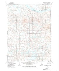
Stuyahok River defines the northern reaches of this Alaskan interior landscape, winding through a complex network of wetlands and tundra. The terrain is characterized by a high density of small lakes and ponds, typical of the Bristol Bay region's hydrologic patterns before extensive modern development. To the south of the river, the Stuyahok Hills rise above the surrounding lowland, providing a prominent topographic contrast in an area otherwise dominated by marshy flats. Mapped primarily from aerial photography taken in 1953 and 1955, the sheet reflects an era when vast portions of the Seward Meridian remained unsurveyed and unmarked on the ground, with land lines predetermined by the Bureau of Land Management rather than through physical field checking.
Find a feature on this map
2 named features on this map. Tap any name to fly to it.
Don’t see what you’re looking for? This feature index may not catch every label — zoom into the map to look around manually.
Map Details
Editions of this 1954 Dillingham C-2 Map
2 editions found
Other maps of this area

1951 · Dillingham
USGS Topo · 1:250,000

1954 · Dillingham
USGS Topo · 1:250,000

1954 · Dillingham C-3
USGS Topo · 1:63,360

1954 · Dillingham D-2
USGS Topo · 1:63,360

1954 · Dillingham C-1
USGS Topo · 1:63,360
1954 · Dillingham B-2
USGS Topo · 1:63,360

1954 · Dillingham B-3
USGS Topo · 1:63,360

1954 · Dillingham D-3
USGS Topo · 1:63,360

1954 · Dillingham D-1
USGS Topo · 1:63,360
1954 · Dillingham B-1
USGS Topo · 1:63,360