
1954 Map of Dillingham B-3
USGS Topo · Published 1968About this map
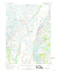
Kukluk Creek winds through this interior Alaskan wilderness, serving as a primary hydrological feature in an area otherwise dominated by an intricate network of unnamed lakes and wetlands. Surveyed in the early 1950s, the map reveals a landscape defined by thousands of small water bodies and complex drainage patterns, likely reflecting the post-glacial topography of the Bristol Bay region. The absence of roads, trails, or permanent settlements underscores the isolation of the area at the time of this 1954 field annotation. While human infrastructure is absent, the precise contouring and water-level notations provide a meticulous record of the terrain as it existed before contemporary environmental changes. This survey by the Army Map Service captures a raw, undeveloped expanse of the subarctic, where water and permafrost features are the only landmarks.
Find a feature on this map
1 named feature on this map. Tap any name to fly to it.
Don’t see what you’re looking for? This feature index may not catch every label — zoom into the map to look around manually.
Map Details
Editions of this 1954 Dillingham B-3 Map
This is the sole edition of this map. No revisions or reprints were ever made.
Other maps of this area

1951 · Dillingham
USGS Topo · 1:250,000

1952 · Dillingham A-2
USGS Topo · 1:63,360

1952 · Dillingham A-4
USGS Topo · 1:63,360

1952 · Dillingham A-3
USGS Topo · 1:63,360

1954 · Dillingham
USGS Topo · 1:250,000

1954 · Dillingham B-4
USGS Topo · 1:63,360

1954 · Dillingham C-3
USGS Topo · 1:63,360
1954 · Dillingham B-2
USGS Topo · 1:63,360

1954 · Dillingham C-2
USGS Topo · 1:63,360

1954 · Dillingham C-4
USGS Topo · 1:63,360