
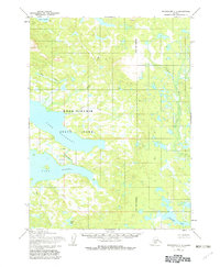
1954 Map of Dillingham C-7
USGS Topo · Published 1968About this map
Lake Beverley and Lake Nerka dominate this remote Alaskan landscape, connected by the short, powerful reach of the Agulukpak R. This 1954 survey shows a wilderness defined by water and terrain, where travel was dictated by the drainage patterns of Moose Creek, Spider Creek, and Hope Creek. A solitary Cabin stands on the northern shore of Lake Nerka, representing one of the few signs of human infrastructure in this vast hydrographic network. To the south and east, the map details numerous smaller bodies of water like Stovall Lake and Okstukuk Lake, while Lake Kulik borders the northern edge. The mapping, based on aerial photography from the mid-1950s, meticulously records the elevation contours and intricate shorelines that characterize the Wood-Tikchik region during this era of post-war exploration and survey.
Find a feature on this map
12 named features on this map. Tap any name to fly to it.
Don’t see what you’re looking for? This feature index may not catch every label — zoom into the map to look around manually.
Map Details
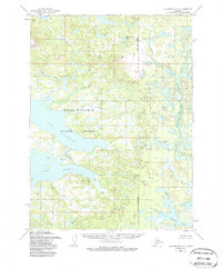
Editions of this 1954 Dillingham C-7 Map
3 editions found
Other maps of this area

1951 · Dillingham
USGS Topo · 1:250,000

1954 · Dillingham
USGS Topo · 1:250,000

1954 · Dillingham C-6
USGS Topo · 1:63,360

1954 · Dillingham D-6
USGS Topo · 1:63,360

1954 · Dillingham D-7
USGS Topo · 1:63,360

1954 · Dillingham B-7
USGS Topo · 1:63,360

1954 · Dillingham B-8
USGS Topo · 1:63,360

1954 · Dillingham B-6
USGS Topo · 1:63,360

1954 · Dillingham D-8
USGS Topo · 1:63,360

1954 · Dillingham C-8
USGS Topo · 1:63,360