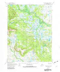
1954 Map of Dillingham B-6
USGS Topo · Published 1982About this map
The Muklung Hills dominate the southwestern quadrant of this Alaskan landscape, rising above a complex network of waterways and marshlands. Mapped in the mid-1950s, the terrain is defined by the winding course of the Kokwok River in the north and the Muklung River to the south. This area is characterized by an intricate drainage pattern where Kenakuchuk Creek and Koklung Creek feed into larger river systems through a series of unnamed lakes and wetlands. A single Cabin near the northern boundary represents the only named structure, reflecting the isolated nature of the region during this period. The landscape showcases the characteristic Alaskan tundra and muskeg transition, where topography is dictated by the subtle elevation changes between the many tributaries like Nameless Creek and the high ground of the interior hills.
Find a feature on this map
7 named features on this map. Tap any name to fly to it.
Don’t see what you’re looking for? This feature index may not catch every label — zoom into the map to look around manually.
Map Details
Editions of this 1954 Dillingham B-6 Map
2 editions found
Other maps of this area

1951 · Dillingham
USGS Topo · 1:250,000

1952 · Dillingham A-5
USGS Topo · 1:63,360

1952 · Dillingham A-6
USGS Topo · 1:63,360

1952 · Dillingham A-7
USGS Topo · 1:63,360

1954 · Dillingham
USGS Topo · 1:250,000

1954 · Dillingham C-6
USGS Topo · 1:63,360

1954 · Dillingham B-7
USGS Topo · 1:63,360

1954 · Dillingham B-6
USGS Topo · 1:63,360
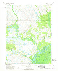
1954 · Dillingham B-5
USGS Topo · 1:63,360

1954 · Dillingham C-7
USGS Topo · 1:63,360