Old Maps of Biorka, Alaska for Metal Detecting
Plan your next treasure hunt with 3 historic maps of Biorka. Find old homesites, ghost towns, trails, and gathering spots that may be lost to time — perfect for identifying promising metal detecting locations.
- Locate forgotten sites: Uncover places like long-lost settlements, abandoned rail lines, or gathering spots.
- Plan better hunts: Use map overlays combined with LiDAR or satellite views to narrow in on historically rich areas.
- Made for detectorists: Thousands of hobbyists use these maps to discover relics, coins, and hidden history.
Use these historic maps to boost your research and find new opportunities beneath the surface of Biorka.
Biorka, AK maps
(3)- 1951 Map of Unalaska, 1952 Print
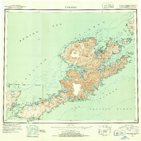 1951 Unalaska1952 Print · USGSThe Fox Islands are shown during the strategic post-war period when military installations still guarded the Aleutian chain. Genealogists and historians can trace the locations of Makushin and Kashega alongside the footprints of Fort Mears and Fort Glenn.10 unique versions available
 - 1989 Map of Unalaska C-1
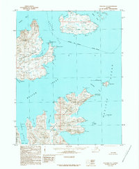 1989 Unalaska C-11989 Print · USGSUnalaska and its neighboring islands are documented in the late 1980s, showcasing a landscape of complex straits and volcanic shorelines. Researchers can trace maritime points of interest like Fishermans Point, the Baby Islands, and Inner Signal across Beaver Inlet.
 - 2021 Map of Unalaska C-1 SW, 2021 Print
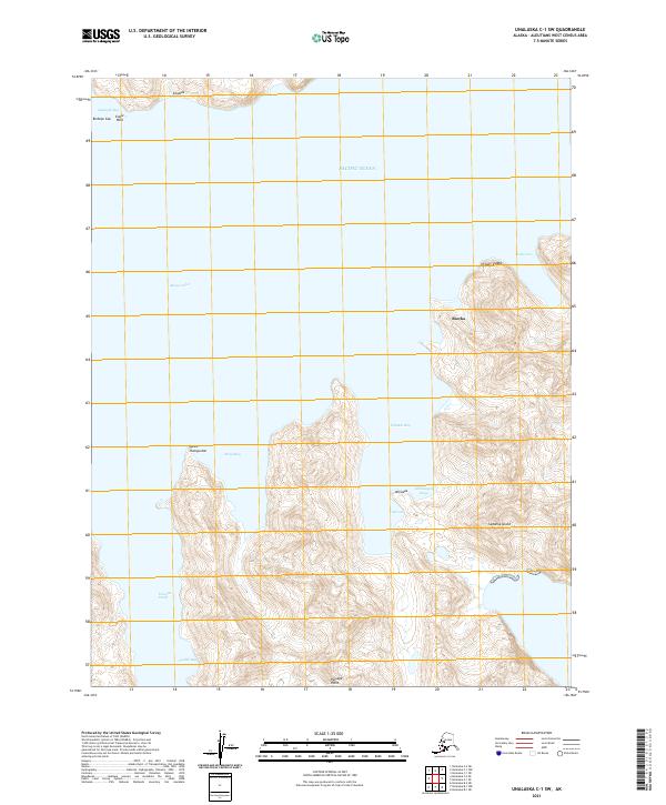 2021 Unalaska C-1 SW2021 Print · USGSSedanka Island and the surrounding waters of the Aleutians are documented here in the early twenty-first century. Researchers can trace the coastal settlement of Biorka and map the rugged maritime terrain of Udamat Bay and Udaga Strait.
End of results
Showing maps 1-3 of 3
Top cities near Biorka
Frequently asked questions
- What are the different types of historical maps available for Biorka?
- What is the oldest map of Biorka?
- Where can I purchase historical maps of Biorka for my home or office?
- Where can I download high-res historical maps of Biorka?
- Are there historical topographic maps available for Biorka?
- Is there historical aerial imagery available for Biorka?
- Where are historical maps of Biorka sourced from?