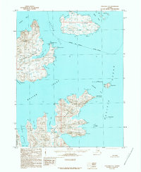
1989 Map of Unalaska C-1
USGS Topo · Published 1989About this map
Unalaska Island and Sedanka Island dominate this late-twentieth-century maritime survey of the Aleutian chain. The landscape is defined by its dramatic coastal indentations, notably Beaver Inlet and Udagak Strait, which separate these landmasses. The map details the intricate waterways used for navigation between the Bering Sea and the Pacific Ocean, including the treacherous Unalaska Pass and the narrow Baby Pass near the Baby Islands. Named coastal landmarks such as Erskine Point, Fishermans Point, and Brundage Head provide essential orientation points along the rocky shorelines. On Unalga Island, the terrain rises toward peaks like Malga Bay's surrounding heights, while Sedanka Island features prominent signals at Inner Signal and Outer Signal, likely indicating its importance for regional maritime safety and communication in the 1980s.
Find a feature on this map
49 named features on this map. Tap any name to fly to it.
Don’t see what you’re looking for? This feature index may not catch every label — zoom into the map to look around manually.
Map Details
Editions of this 1989 Unalaska C-1 Map
This is the sole edition of this map. No revisions or reprints were ever made.
Other maps of this area

1951 · Unalaska
USGS Topo · 1:250,000

1951 · Unimak
USGS Topo · 1:250,000

1958 · Unimak
USGS Topo · 1:250,000
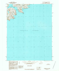
1989 · Unalaska B-1
USGS Topo · 1:63,360

1989 · Unimak A-6
USGS Topo · 1:63,360
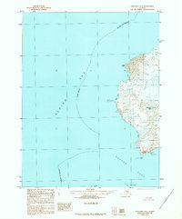
1989 · Unalaska D-1
USGS Topo · 1:63,360
1989 · Unalaska D-2
USGS Topo · 1:63,360

1989 · Unalaska B-2
USGS Topo · 1:63,360

1990 · Unalaska C-2
USGS Topo · 1:63,360
2020 · Unalaska D-1 SW
USGS Topo · 1:25,000