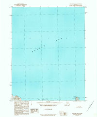
1989 Map of Unalaska D-2
USGS Topo · Published 1989About this map
Bering Sea waters dominate this late-twentieth-century maritime survey, focusing on the northern entrance to one of the most vital natural harbors in the Aleutian chain. The chart highlights the approach to Unalaska Bay along the rugged northern coast of Unalaska Island. Key navigational aids and landforms for mariners include the Priest Rock Light and the prominent headland at Cape Kalekta, which anchors the eastern edge of the bay entrance. While most of the map area covers open ocean, the terrestrial portions reveal the complex shoreline of the Unalaska Island coastline, including the distinctively named coastal feature The Dry Dock. This provisional map, compiled from 1983 aerial photography, captures the remote character of the island’s northern reaches before later modern development or coastal changes altered these historic landmarks.
Find a feature on this map
7 named features on this map. Tap any name to fly to it.
Don’t see what you’re looking for? This feature index may not catch every label — zoom into the map to look around manually.
Map Details
Editions of this 1989 Unalaska D-2 Map
This is the sole edition of this map. No revisions or reprints were ever made.
Other maps of this area

1951 · Unalaska
USGS Topo · 1:250,000

1989 · Unalaska C-3
USGS Topo · 1:63,360
1989 · Unalaska D-1
USGS Topo · 1:63,360
1989 · Unalaska D-3
USGS Topo · 1:63,360
1989 · Unalaska C-1
USGS Topo · 1:63,360

1990 · Unalaska C-2
USGS Topo · 1:63,360
2020 · Unalaska D-1 SW
USGS Topo · 1:25,000
2020 · Unalaska D-2 SW
USGS Topo · 1:25,000
2020 · Unalaska C-1 NW
USGS Topo · 1:25,000
2020 · Unalaska D-2 SE
USGS Topo · 1:25,000