Old Maps of Chalkyitsik, Alaska for Hiking & Exploration
Hike through history with 5 historic maps of Chalkyitsik. Explore old trails, ghost towns, and forgotten backroads — perfect for outdoor adventurers and local explorers.
- Rediscover forgotten places: Map out old mining camps, roads, and footpaths that no longer exist on modern maps.
- Layer with modern tools: Combine with LiDAR or satellite views to plan hikes through historical terrain.
- Made for exploration: Popular among hikers, overlanders, and local history lovers.
Use these maps to find adventure and explore the hidden past of Chalkyitsik.
Chalkyitsik, AK maps
(5)- 1951 Map of Black River
 1951 Black River1951 Print · USGSAlaska's northern interior at the mid-century reveals a landscape of sprawling river systems and isolated outposts. Researchers can trace the path of the Arctic Circle and locate historic sites like Chalkyitsik, Joe Ward Camp, and Shuman House.
 - 1956 Map of Black River C-6, 1959 Print
 1956 Black River C-61959 Print · USGSThe interior Alaskan wilderness near the Black River is shown in the mid-fifties, centered on the settlement of Chalkyitsik. Researchers can trace the winding Chalkyitsik Slough, the remote Tractor Trail, and numerous landmarks like Red Bluff.3 unique versions available
 - 1956 Map of Black River, 1960 Print
 1956 Black River1960 Print · USGSUpper Alaska near the Canadian border during the mid-fifties remains a wilderness dominated by river networks and high peaks. Researchers can locate remote outposts like John Herberts Village, follow the Arctic Circle, or trace the path of an old Tractor Trail.9 unique versions available
 - 1964 Map of Black River
 1964 Black River1964 Print · USGSNortheastern Alaska's river systems and mountain peaks are captured here in the mid-1960s, showing the remote lifestyle of the Yukon-Koyukuk region. Researchers can locate specific outposts like John Roberts Cabin, Salmon Village, and the Chalkyitsik Landing Area.
 - 2018 Map of Black River C-6 NE, 2018 Print
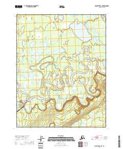 2018 Black River C-6 NE2018 Print · USGSThe Yukon-Koyukuk wilderness in the late twenty-teens is defined by the winding Draanjik River and its vast wetlands. Researchers can trace the landing strip at Chalkyitsik Airport or locate remote landmarks like Red Bluff and Chahalie Lake.
End of results
Showing maps 1-5 of 5
Frequently asked questions
- What are the different types of historical maps available for Chalkyitsik?
- What is the oldest map of Chalkyitsik?
- Where can I purchase historical maps of Chalkyitsik for my home or office?
- Where can I download high-res historical maps of Chalkyitsik?
- Are there historical topographic maps available for Chalkyitsik?
- Is there historical aerial imagery available for Chalkyitsik?
- Where are historical maps of Chalkyitsik sourced from?