Old Maps of Clark's Point, Alaska for Academic Research
Study the evolution of Clark's Point with 6 high-resolution historic maps. Whether you're teaching, researching, or modeling changes in land use, these maps provide essential visual documentation of urban, environmental, and geographic change.
- Analyze long-term change: Track patterns in development, transportation, and natural features.
- Ideal for environmental or urban studies: Support academic projects with primary historical map data.
- Use in the classroom or lab: Educators and researchers rely on these maps to bring historical context to life.
These maps are a powerful tool for teaching, research, and visualizing how Clark's Point has changed over the decades.
Clark's Point, AK maps
(6)- 1945 Map of Nushagak Bay, 1954 Print
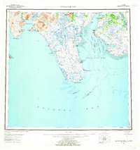
 1945 Nushagak Bay1954 Print · USGSNushagak Bay and the sprawling Alaskan coastline are captured in the mid-1940s, highlighting a landscape defined by salmon fishing and tidal waters. Researchers can locate remote outposts like Old Saltery, the busy Nushagak Cannery, and the coastal settlement of Clarks Point.
 - 1949 Map of Nushagak Bay
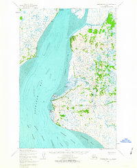
 1949 Nushagak Bay1949 Print · USGSCoastal Alaska at the height of the mid-century salmon industry reveals a landscape of isolated canneries and subsistence camps. You can trace the shorelines to find sites like Nushagak Cannery, the Old Saltery, and the remote Igushik Cannery along the river.2 unique versions available
 - 1951 Map of Nushagak Bay, 1955 Print
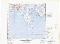
 1951 Nushagak Bay1955 Print · USGSBristol Bay's eastern coastline is captured here in the early fifties, highlighting the salmon fishing and canning hubs of the era. Genealogists and historians can trace coastal settlements like Ekuk and Nushagak or locate the Igushik (Site).7 unique versions available
 - 1952 Map of Nushagak Bay D-2, 1963 Print
 1952 Nushagak Bay D-21963 Print · USGSNushagak Bay in the early fifties shows a remote Alaskan coastline defined by maritime commerce and government outposts. Genealogists and historians can trace coastal settlements like Ekuk, the Santa Claus Ch, and the Kanakanak US Govt Hosp.2 unique versions available
 - 1964 Map of Nushagak Bay
 1964 Nushagak Bay1964 Print · USGSNushagak Bay and the Bristol Bay coastline appear in mid-century detail, capturing the seasonal fishing hubs and maritime hazards of the era. Researchers can trace historic cannery sites, coastal settlements like Ekuk, and the shifting sands of Ship Channel or Etolin Pt.
 - 2019 Map of Nushagak Bay D-2 SW, 2019 Print
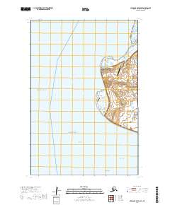 2019 Nushagak Bay D-2 SW2019 Print · USGSCoastal life in the Dillingham Census Area is captured here during the late 2010s, focused on the eastern edge of Nushagak Bay. Researchers can trace the local connections between Clarks Point and Ekuk, alongside features like Ekuk Cape and the Ship Channel.
End of results
Showing maps 1-6 of 6
Top cities near Clark's Point
Top neighborhoods of Clark's Point
Frequently asked questions
- What are the different types of historical maps available for Clark's Point?
- What is the oldest map of Clark's Point?
- Where can I purchase historical maps of Clark's Point for my home or office?
- Where can I download high-res historical maps of Clark's Point?
- Are there historical topographic maps available for Clark's Point?
- Is there historical aerial imagery available for Clark's Point?
- Where are historical maps of Clark's Point sourced from?