Old Maps of Latouche, Alaska for Genealogy
Trace your family roots with 8 historic maps of Latouche. These high-res maps reveal old neighborhoods, homesites, landmarks, and streets — helping you uncover where your ancestors lived and how the area evolved over time.
- Explore historic neighborhoods: Identify where your relatives may have lived in the 1800s or 1900s.
- Compare maps over time: Trace the changes in streets, buildings, and landmarks for multi-generational research.
- Perfect for genealogy & ancestry research: Used by family historians and researchers to map out lineage and migration.
These maps are an incredible resource for exploring your personal connection to Latouche's past.
Latouche, AK maps
(8)- 1951 Map of Seward
 1951 Seward1951 Print · USGSThe Kenai Peninsula and Prince William Sound come to life in the early 1950s as the rail and maritime networks linked remote coastal outposts. Genealogists and historians can trace the Alaska Railroad corridor through Seward, find the Jesse Lee Indian School, and locate isolated camps like Latouche and Chenega.4 unique versions available
 - 1951 Map of Seward A-3, 1965 Print
 1951 Seward A-31965 Print · USGSPrince William Sound's islands and waterways are documented here during the early fifties, showing a region defined by maritime industry and mining. Researchers can trace the heritage of San Juan Cannery and identify the locations of the Beatson Mine (Aband) and the LIGHTHOUSE RESERVE.3 unique versions available
 - 1952 Map of Seward A-3, 1954 Print
 1952 Seward A-31954 Print · USGSCoastal life in the 1950s centered on the fishing and mining outposts of the Prince of Wales Passage. Genealogists and historians can trace the foundations of Latouche, the San Juan Cannery, and several abandoned sites like the Blackbird Mine (Aband).2 unique versions available
 - 1953 Map of Seward, 1956 Print
 1953 Seward1956 Print · USGSThe Kenai Peninsula and Prince William Sound are documented in the early 1950s as the rail and road networks expanded. Trace the route of the Alaska Railroad and find early settlements like Seward, Moose Pass, and Latouche.12 unique versions available
 - 1959 Map of Seward
 1959 Seward1959 Print · USGSThe Kenai Peninsula and Prince William Sound are captured here during the mid-century, showing the vital transit corridor between Seward and the interior. Researchers can trace the Alaska Railroad through Whittier and locate historic coastal settlements like Chenega and Latouche.
 - 2000 Map of Seward A-3, 2002 Print
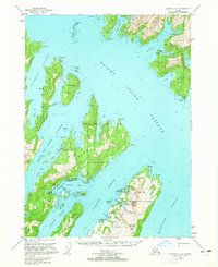
 2000 Seward A-32002 Print · USGSThe islands of Prince William Sound appear here in the late twentieth century, showing a landscape shaped by maritime industry and mining. Researchers can trace the heritage of Port Ashton, locate the Beatson Mine, and find historical locations like Chenega (Site).
 - 2018 Map of Seward A-3 SE, 2018 Print
 2018 Seward A-3 SE2018 Print · USGSCovers Latouche, including Unorganized Borough, United States, and other nearby areas
 - 2023 Map of Seward A-3 SE, 2023 Print
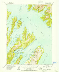
 2023 Seward A-3 SE2023 Print · USGSLatouche Island and the surrounding waters of Prince William Sound appear here in modern detail. Researchers can trace the coastal settlements of Chenega and Latouche or locate landmarks like the Glory Hole and Mt Beatson.
End of results
Showing maps 1-8 of 8
Frequently asked questions
- What are the different types of historical maps available for Latouche?
- What is the oldest map of Latouche?
- Where can I purchase historical maps of Latouche for my home or office?
- Where can I download high-res historical maps of Latouche?
- Are there historical topographic maps available for Latouche?
- Is there historical aerial imagery available for Latouche?
- Where are historical maps of Latouche sourced from?