Old Maps of McGrath, Alaska for Hiking & Exploration
Hike through history with 7 historic maps of McGrath. Explore old trails, ghost towns, and forgotten backroads — perfect for outdoor adventurers and local explorers.
- Rediscover forgotten places: Map out old mining camps, roads, and footpaths that no longer exist on modern maps.
- Layer with modern tools: Combine with LiDAR or satellite views to plan hikes through historical terrain.
- Made for exploration: Popular among hikers, overlanders, and local history lovers.
Use these maps to find adventure and explore the hidden past of McGrath.
McGrath, AK maps
(7)- 1949 Map of McGrath, 1955 Print
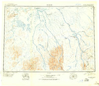 1949 McGrath1955 Print · USGSThe Alaskan interior at mid-century comes to life through this survey of the river valleys and mountain passes near McGrath. Trace old-world wilderness routes via the Winter Trail and remote stops like the Big River Roadhouse or the Rohn Roadhouse.
 - 1950 Map of McGrath
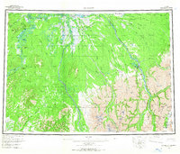
 1950 McGrath1950 Print · USGSThe Kuskokwim River valley and the Alaska Range foothills appear here at the dawn of the fifties. Trace the old interior supply routes through McGrath and Nikolai, or locate remote landmarks like Farewell Mtn Roadhouse and Rainy Pass.
 - 1953 Map of McGrath D-5, 1958 Print
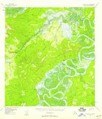
 1953 McGrath D-51958 Print · USGSThe Kuskokwim River meanders through the Alaska interior during the mid-1950s, revealing a landscape of shifting oxbows and remote outposts. Researchers can locate seasonal Cabins and trace the winding course of Stewart Bend and Blackwater Creek.2 unique versions available
 - 1954 Map of McGrath D-6, 1958 Print
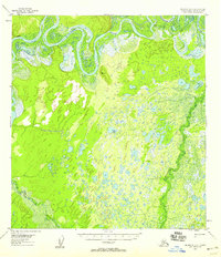
 1954 McGrath D-61958 Print · USGSThe mid-century Alaskan interior comes alive through this record of river-bound life and mining. Genealogists and researchers can locate Old McGrath (Aband), the Candle Placer mine, and remote cabins along the Kuskokwim River.4 unique versions available
 - 1958 Map of McGrath, 1967 Print
 1958 McGrath1967 Print · USGSThe Alaskan interior at the end of the fifties reveals a landscape of river-braids and remote outposts centered on the confluence at McGrath. Researchers can trace the legacy of bush travel through sites like the Big River Roadhouse, Sterling Landing, and the high gateway at Rainy Pass.3 unique versions available
 - 2019 Map of McGrath D-5 NW, 2019 Print
 2019 McGrath D-5 NW2019 Print · USGSThe community of McGrath and its vital riverside location are documented here in the early twenty-first century. Researchers can trace the local road network including Vanderpool Road and identify riparian features like Stewart Bend along the Kuskokwim River.
 - 2019 Map of McGrath D-6 NE, 2019 Print
 2019 McGrath D-6 NE2019 Print · USGSMcGrath and its vital river junctions are mapped here in the late 2010s, showing the town's position at the confluence of the Takotna River and Kuskokwim River. Local researchers can trace modern street layouts and regional access roads like Dodg's Haul Road and the Sterling Landing-Takotna Ophir Road.
End of results
Showing maps 1-7 of 7
Frequently asked questions
- What are the different types of historical maps available for McGrath?
- What is the oldest map of McGrath?
- Where can I purchase historical maps of McGrath for my home or office?
- Where can I download high-res historical maps of McGrath?
- Are there historical topographic maps available for McGrath?
- Is there historical aerial imagery available for McGrath?
- Where are historical maps of McGrath sourced from?