Old Maps of Owl Village, Alaska for Academic Research
Study the evolution of Owl Village with 4 high-resolution historic maps. Whether you're teaching, researching, or modeling changes in land use, these maps provide essential visual documentation of urban, environmental, and geographic change.
- Analyze long-term change: Track patterns in development, transportation, and natural features.
- Ideal for environmental or urban studies: Support academic projects with primary historical map data.
- Use in the classroom or lab: Educators and researchers rely on these maps to bring historical context to life.
These maps are a powerful tool for teaching, research, and visualizing how Owl Village has changed over the decades.
Owl Village, AK maps
(4)- 1951 Map of Marshall
 1951 Marshall1951 Print · USGSThe Yukon River corridor and its surrounding delta wetlands are documented here in the early fifties, showcasing the vital riverine economy of the day. Researchers can trace remote settlements and points of interest like Pilot Station, Marshall, and Owl Village.
 - 1952 Map of Marshall D-6, 1964 Print
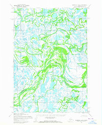 1952 Marshall D-61964 Print · USGSThe Seward Meridian region in the early fifties reveals a labyrinth of tundra waterways and remote settlements. Researchers can trace the winding course of the Kashunuk River and locate the isolated site of Owl Village.2 unique versions available
 - 1954 Map of Marshall, 1966 Print
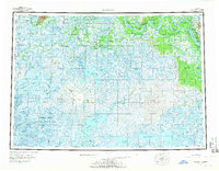 1954 Marshall1966 Print · USGSThe Yukon Delta and lower river system appear in intricate detail during the mid-fifties, showing the essential water routes and riverfront settlements of the era. Genealogists and researchers can locate Marshall (Fortuna Ledge PO), Pilot Station, and the seasonal Winter Trail crossing the frozen landscape.3 unique versions available
 - 2020 Map of Marshall D-6 SW, 2020 Print
 2020 Marshall D-6 SW2020 Print · USGSThe Kusilvak Census Area's delta landscape is captured in this recent survey of the intricate Kashunuk River system. Researchers can trace the winding paths of the Kipungolak River and Nunagatak River across this wetland terrain.
End of results
Showing maps 1-4 of 4
Frequently asked questions
- What are the different types of historical maps available for Owl Village?
- What is the oldest map of Owl Village?
- Where can I purchase historical maps of Owl Village for my home or office?
- Where can I download high-res historical maps of Owl Village?
- Are there historical topographic maps available for Owl Village?
- Is there historical aerial imagery available for Owl Village?
- Where are historical maps of Owl Village sourced from?