Old Maps of St. George, Alaska for Academic Research
Study the evolution of St. George with 12 high-resolution historic maps. Whether you're teaching, researching, or modeling changes in land use, these maps provide essential visual documentation of urban, environmental, and geographic change.
- Analyze long-term change: Track patterns in development, transportation, and natural features.
- Ideal for environmental or urban studies: Support academic projects with primary historical map data.
- Use in the classroom or lab: Educators and researchers rely on these maps to bring historical context to life.
These maps are a powerful tool for teaching, research, and visualizing how St. George has changed over the decades.
St. George, AK maps
(12)- 1948 Map of Pribilof Islands, 1955 Print
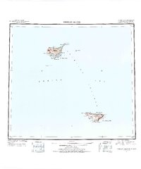 1948 Pribilof Islands1955 Print · USGSThe remote Pribilof Islands are documented here just after the war, showing the essential settlements and coastal geography of this Bering Sea archipelago. Researchers can trace the landing sites and terrain at St Paul, St. George, Village Cove, and Garden Cove.4 unique versions available
 - 1949 Map of Pribilof Islands
 1949 Pribilof Islands1949 Print · USGSThe Bering Sea islands of St. Paul and St. George are shown in the late 1940s during a pivotal era for Alaska’s maritime territory. Researchers can trace remote coastal points and settlements like St Paul and St. George, or locate landmarks such as Walrus Island and Village Cove.2 unique versions available
 - 1958 Map of Pribilof Islands
 1958 Pribilof Islands1958 Print · USGSThe isolated Pribilof archipelago appears here in the late fifties, detailing the rugged coasts of St. Paul Island and St. George Island. Researchers can locate the primary settlements of St Paul and St. George alongside remote landmarks like Rush Hill and Walrus Island.
 - 1969 Map of Pribilof Islands
 1969 Pribilof Islands1969 Print · USGSThe remote Pribilof archipelago appears during the late sixties, centered on the vital maritime outposts of St Paul and St. George. Researchers can trace the volcanic topography from Rush Hill to coastal features like Village Cove and English Bay.
 - 2001 Map of Saint George Island West, 2002 Print
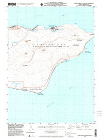
 2001 Saint George Island West2002 Print · USGSSaint George Island in the Pribilof chain appears here at the turn of the millennium, featuring dual Unangam Tunuu and English nomenclature. Researchers can trace land use near the Airport and coastal features like Zapadni Bay and the Zapadni Rookery.
 - 2001 Map of Saint George Island East, 2002 Print
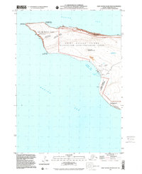
 2001 Saint George Island East2002 Print · USGSSaint George Island at the turn of the millennium shows a landscape where indigenous Aleut heritage and federal conservation meet. Trace the village at St George, the high peak of Ulakaia Hill, and the Cem overlooking the Bering Sea.
 - 2020 Map of Pribilof Islands A-2 NW, 2020 Print
 2020 Pribilof Islands A-2 NW2020 Print · USGSSaint George Island in the Bering Sea is documented here in the early twenty-first century, showing the settlement and its critical island infrastructure. Trace local landmarks like St. George and St George Airport, or coastal features such as First Bluff and Garden Cove.
 - 2020 Map of Pribilof Islands A-2 SW, 2020 Print
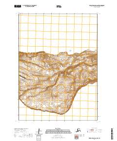
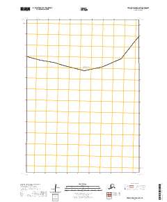 2020 Pribilof Islands A-2 SW2020 Print · USGSThe northern waters of the Bering Sea are documented here in the Aleutians West Census Area during the early twenty-first century. Researchers can trace the exact alignment of maritime survey boundaries and the grid coordinates of T42s R130w and T42s R129w.
 - 2020 Map of Pribilof Islands A-3 SE, 2020 Print
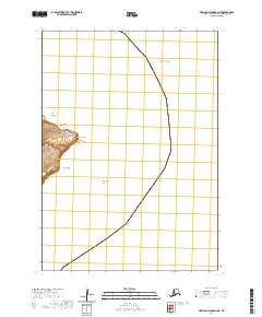
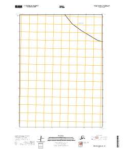 2020 Pribilof Islands A-3 SE2020 Print · USGSThe open waters of the North Pacific define this maritime survey of the Aleutians West region during the early twenty-first century. Researchers can trace the cadastral boundary of T42S R130W as it intersects the Bering Sea.
 - 2020 Map of Pribilof Islands A-2 SE, 2020 Print
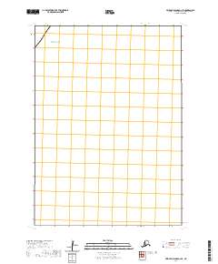 2020 Pribilof Islands A-2 SE2020 Print · USGSNavigate the open waters of the Pribilof Islands during the early twenty-first century. This specialized maritime chart identifies the vast expanse of the Bering Sea within the bounds of T42S R129W.
 - 2020 Map of Pribilof Islands A-3 NE, 2020 Print
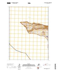 2020 Pribilof Islands A-3 NE2020 Print · USGSSt. George Island in the Bering Sea remains a critical Alaskan maritime outpost in the early twenty-first century. Researchers can trace the rugged coastal geography from Dalnoi Point to Zapadni Bay and locate the community of St. George near its modern airfield.
 - 2020 Map of Pribilof Islands A-2 NE, 2020 Print
 2020 Pribilof Islands A-2 NE2020 Print · USGSThe Pribilof Islands' coastline is captured in detail here during the early twenty-first century, showing the remote geography of the Aleutians. Researchers can trace traditional Aleut place names and coastal landmarks like Tolstoi Point, Sealion Neck, and North Sealion Hill.
End of results
Showing maps 1-12 of 12
Top neighborhoods of St. George
Frequently asked questions
- What are the different types of historical maps available for St. George?
- What is the oldest map of St. George?
- Where can I purchase historical maps of St. George for my home or office?
- Where can I download high-res historical maps of St. George?
- Are there historical topographic maps available for St. George?
- Is there historical aerial imagery available for St. George?
- Where are historical maps of St. George sourced from?