Old Maps of Twin Hills, Alaska for Academic Research
Study the evolution of Twin Hills with 4 high-resolution historic maps. Whether you're teaching, researching, or modeling changes in land use, these maps provide essential visual documentation of urban, environmental, and geographic change.
- Analyze long-term change: Track patterns in development, transportation, and natural features.
- Ideal for environmental or urban studies: Support academic projects with primary historical map data.
- Use in the classroom or lab: Educators and researchers rely on these maps to bring historical context to life.
These maps are a powerful tool for teaching, research, and visualizing how Twin Hills has changed over the decades.
Twin Hills, AK maps
(4)- 1951 Map of Goodnews, 1953 Print
 1951 Goodnews1953 Print · USGSSouthwest Alaska’s coastal bays and mountain lakes are captured here just after the war, showing the area's shifting settlement patterns. Trace the coastline from Kwinhagak to Goodnews, or locate interior landmarks like the Placer Mine and Nuyakuk Lake.6 unique versions available
 - 1954 Map of Goodnews A-4, 1968 Print
 1954 Goodnews A-41968 Print · USGSTogiak Bay and its surrounding river deltas are captured here in the early fifties, showing a landscape defined by water and isolation. Researchers can trace the coastal settlement at Togiak, the Landing Field, and remote landmarks like Eklik 932.2 unique versions available
 - 1979 Map of Goodnews Bay
 1979 Goodnews Bay1979 Print · USGSCoastal villages and massive mountain ranges define the southwestern Alaska wilderness during the late seventies. Researchers can trace remote routes like the Winter Trail and locate isolated outposts at Platinum and Goodnews Bay near Cape Newenham.2 unique versions available
 - 2020 Map of Goodnews Bay A-4 SE, 2020 Print
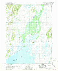
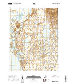 2020 Goodnews Bay A-4 SE2020 Print · USGSNear the shores of Bristol Bay, the community of Twin Hills is documented in this recent survey. Researchers can trace the local infrastructure including Airport Road, the Twin Hills Airport, and the meandering Negukthlik River.
End of results
Showing maps 1-4 of 4
Top cities near Twin Hills
Frequently asked questions
- What are the different types of historical maps available for Twin Hills?
- What is the oldest map of Twin Hills?
- Where can I purchase historical maps of Twin Hills for my home or office?
- Where can I download high-res historical maps of Twin Hills?
- Are there historical topographic maps available for Twin Hills?
- Is there historical aerial imagery available for Twin Hills?
- Where are historical maps of Twin Hills sourced from?