Old Maps of Venetie, Alaska for Metal Detecting
Plan your next treasure hunt with 4 historic maps of Venetie. Find old homesites, ghost towns, trails, and gathering spots that may be lost to time — perfect for identifying promising metal detecting locations.
- Locate forgotten sites: Uncover places like long-lost settlements, abandoned rail lines, or gathering spots.
- Plan better hunts: Use map overlays combined with LiDAR or satellite views to narrow in on historically rich areas.
- Made for detectorists: Thousands of hobbyists use these maps to discover relics, coins, and hidden history.
Use these historic maps to boost your research and find new opportunities beneath the surface of Venetie.
Venetie, AK maps
(4)- 1951 Map of Christian, 1952 Print
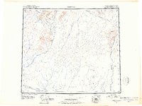 1951 Christian1952 Print · USGSInterior Alaska during the early postwar years reveals a landscape of massive river systems and essential overland routes. Genealogists and historians can trace the early layout of Venetie, follow the Winter Trail, or locate the remote settlement of Christian.2 unique versions available
 - 1956 Map of Christian, 1959 Print
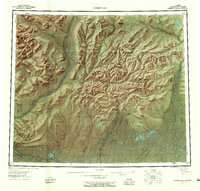 1956 Christian1959 Print · USGSInterior Alaska in the mid-fifties remains a world of remote rivers and seasonal routes through the Venetie Indian Reservation. Researchers can trace the Sled Trail connecting Venetie to the Christian Landing Area and locate many isolated Cabins along the Koness River.7 unique versions available
 - 1990 Map of Christian A-5
 1990 Christian A-51990 Print · USGSThe riverside settlement of Venetie and its surrounding wetlands are captured here as they appeared in 1990. Researchers can trace local landmarks like the Landing Strip, the village Cem, and seasonal routes such as the Winter Trail.
 - 2018 Map of Christian A-5 SW, 2018 Print
 2018 Christian A-5 SW2018 Print · USGSThe settlement of Venetie and the Teedriinjik River are documented in this 2018 survey of the Alaskan interior. Trace local travel and subsistence routes like the Fort Yukon Trail, Well House Trail, and Big Lake Road.
End of results
Showing maps 1-4 of 4
Frequently asked questions
- What are the different types of historical maps available for Venetie?
- What is the oldest map of Venetie?
- Where can I purchase historical maps of Venetie for my home or office?
- Where can I download high-res historical maps of Venetie?
- Are there historical topographic maps available for Venetie?
- Is there historical aerial imagery available for Venetie?
- Where are historical maps of Venetie sourced from?