Old Maps of Bisbee, Arizona for Hiking & Exploration
Hike through history with 23 historic maps of Bisbee. Explore old trails, ghost towns, and forgotten backroads — perfect for outdoor adventurers and local explorers.
- Rediscover forgotten places: Map out old mining camps, roads, and footpaths that no longer exist on modern maps.
- Layer with modern tools: Combine with LiDAR or satellite views to plan hikes through historical terrain.
- Made for exploration: Popular among hikers, overlanders, and local history lovers.
Use these maps to find adventure and explore the hidden past of Bisbee.
Bisbee, AZ maps
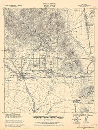
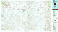
(23)- 1902 Map of Bisbee
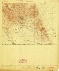 1902 Bisbee1902 Print · USGSCochise County mining and ranching culture are shown here at the turn of the century as the local economy centered on copper and the border trade. You can trace the early footprints of Bisbee and Don Luis or locate old homesteads like Fike's Ranch and the Glance Mine.2 unique versions available
 - 1910 Map of Bisbee
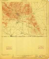 1910 Bisbee1910 Print · USGSMining and ranching define this Cochise County landscape in the early 1900s as Bisbee booms in the Mule Mountains. Researchers can trace the El Paso and Southwestern RR past Don Luis to the border at Naco, identifying family ranch sites like Browns Ranch and Forrests Ranch along the way.2 unique versions available
 - 1916 Map of Douglas
 1916 Douglas1916 Print · USGSThe Arizona-Mexico border comes alive in the mid-1910s, showcasing the height of the copper mining era around Bisbee and Douglas. Genealogists and historians can trace family land like Forrests Ranch and local institutions like the Double Adobe Valley School.
 - 1919 Map of Douglas
 1919 Douglas1919 Print · USGSThe Arizona-Mexico borderlands come alive in the decade following the turn of the century, showing the dense mining and rail networks around the Mule Mountains. Trace early ranching footprints at Forrest's Ranch, the industrial layout of Tin Town, and cross-border landmarks like Mina de Oro.
 - 1927 Map of Bisbee
 1927 Bisbee1927 Print · USGSThe copper-rich Mule Mountains come to life in the late 1920s as Bisbee and its satellite mining camps expand toward the Mexican border. Genealogists and historians can trace industrial landmarks like the Junction Mine or locate early settlements like Tin Town and Don Luis.
 - 1933 Map of Bisbee
 1933 Bisbee1933 Print · USGSThe Arizona borderlands were a hub of copper mining and ranching during the early 1930s. Genealogists and historians can trace family-named sites like Herrons Ranch and Forrests Ranch alongside industrial landmarks like the Glance Mine.
 - 1955 Map of Douglas
 1955 Douglas1955 Print · USGSThe Arizona and New Mexico borderlands come into focus in the mid-1950s, highlighting the mining and ranching hubs of the Desert Southwest. Genealogists and historians can trace the foundations of Bisbee, the operations at Hachita Mine, and rural landmarks like the Double Adobe School.2 unique versions available
 - 1958 Map of Bisbee, 1959 Print
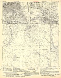
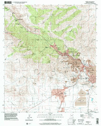
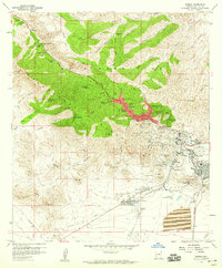 1958 Bisbee1959 Print · USGSThe Bisbee mining district is captured here at a peak of industrial activity, showcasing the massive Lavender Pit and the bustling streets of Bisbee. Genealogists and historians can trace neighborhood developments in Warren or Lowell and locate landmarks like Evergreen Cemetery and the Copper Queen Mine.3 unique versions available
 - 1958 Map of Bisbee, 1959 Print
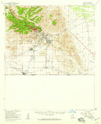 1958 Bisbee1959 Print · USGSThe copper-rich slopes of the Mule Mountains are shown here in the late fifties, just as open-pit mining was reshaping the local landscape. Genealogists and historians can trace the early footprints of the Lavender Pit, the streets of Tintown, and the international border crossing at Naco.2 unique versions available
 - 1958 Map of Bisbee NE, 1959 Print
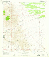 1958 Bisbee NE1959 Print · USGSCochise County mining and ranching culture are preserved here in the late fifties, where the mountains meet the desert floor. Researchers can trace the Old Railroad Grade and locate historic workings like the Easter Sunday Mine and Ivanthoe Mine.3 unique versions available
 - 1959 Map of Douglas, 1968 Print
 1959 Douglas1968 Print · USGSSoutheast Arizona and southwest New Mexico meet at the border in the late fifties, showcasing a high-desert landscape defined by industrial copper mining and ranching. Genealogists and historians can trace the foundations of Bisbee, locate the Lavender Pit, and follow the Southern Pacific line through Douglas.4 unique versions available
 - 1961 Map of Douglas
 1961 Douglas1961 Print · USGSThe Arizona-Mexico borderlands come into focus at mid-century, detailing the vital mining and ranching hubs of Cochise County and southwest New Mexico. Genealogists and historians can trace the Southern Pacific Railroad through Bisbee and Douglas, or locate early sites like the Old Hachita Mine and Rucker School.
 - 1964 Map of Douglas
 1964 Douglas1964 Print · USGSThe Arizona-New Mexico borderlands in the early sixties reveal a landscape of deep-rooted copper mining and high-desert ranching. Genealogists and researchers can trace the legacy of settlements like Pirtleville, the industrial site of the Copper Smelter, and remnants of the Cochise Mines.
 - 1994 Map of Douglas
 1994 Douglas1994 Print · USGSThe copper mining heart of Cochise County and the international border are captured here in the mid-nineties. Researchers can trace the massive Lavender Pit at Bisbee or locate rural landmarks like Paul Spur and the San Bernardino National Wildlife Refuge.2 unique versions available
 - 1996 Map of Bisbee, 2002 Print
 1996 Bisbee2002 Print · USGSBisbee and the Mule Mountains are shown during the late 1990s, revealing the massive scale of open-pit copper mining alongside established residential wards. Genealogists and historians can trace family locations near St Patrick Sch, Evergreen Cem, and the historic Wolverine Mines.
 - 2011 Map of Bisbee NE, 2011 Print
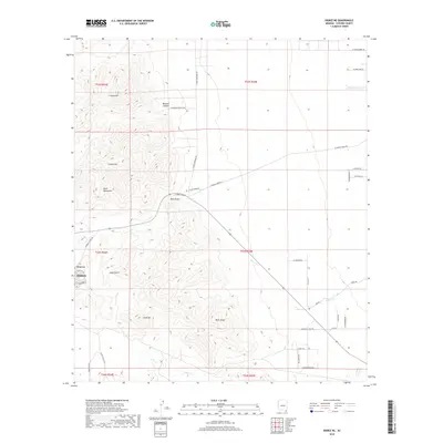
 2011 Bisbee NE2011 Print · USGSCovers Bisbee, including Cochise County, United States, and other nearby areas
 - 2011 Map of Bisbee, 2011 Print
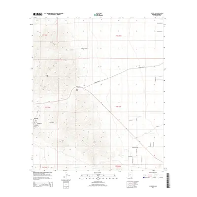
 2011 Bisbee2011 Print · USGSCovers Bisbee, including Neff, Corta Junction, and other nearby areas
 - 2014 Map of Bisbee, 2014 Print
 2014 Bisbee2014 Print · USGSCovers Bisbee, including Neff, Corta Junction, and other nearby areas
 - 2014 Map of Bisbee NE, 2014 Print
 2014 Bisbee NE2014 Print · USGSCovers Bisbee, including Cochise County, United States, and other nearby areas
 - 2018 Map of Bisbee NE, 2018 Print
 2018 Bisbee NE2018 Print · USGSCovers Bisbee, including Cochise County, United States, and other nearby areas
 - 2018 Map of Bisbee, 2018 Print
 2018 Bisbee2018 Print · USGSCovers Bisbee, including Neff, Corta Junction, and other nearby areas
 - 2021 Map of Bisbee NE, 2021 Print
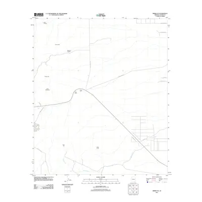
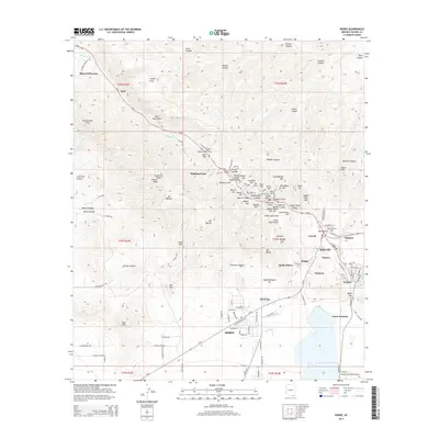
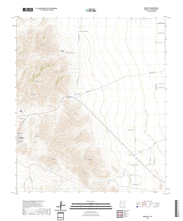 2021 Bisbee NE2021 Print · USGSThe mining district of Bisbee and the planned community of Warren meet the high desert at the edge of the Mule Mountains in this modern survey. Researchers can trace the local drainage of Mule Gulch or locate family-named rural routes such as N Presgrove Ln.
 - 2021 Map of Bisbee, 2021 Print
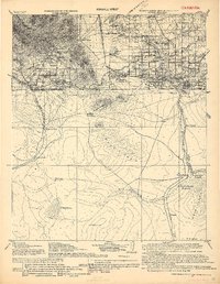
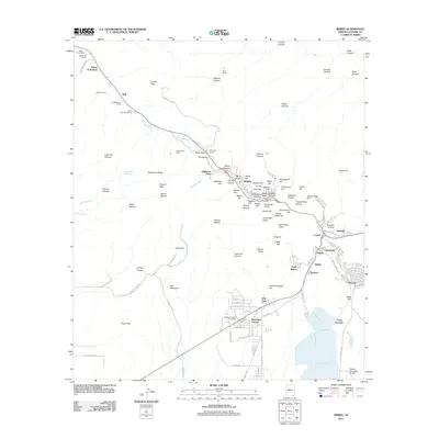
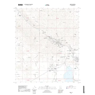
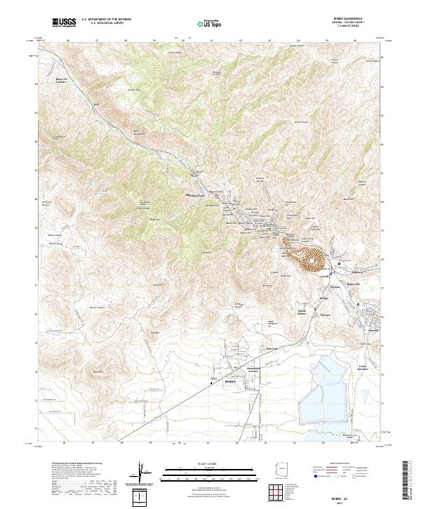 2021 Bisbee2021 Print · USGSThe mining district of southern Arizona remains a dense network of neighborhoods and industrial landmarks in the early twenty-first century. Genealogists and historians can trace the streets of Bisbee, Lowell, and Warren, or locate family sites near Evergreen Cem and the historic Brewery Gulch.
End of results
Showing maps 1-23 of 23
Top cities near Bisbee
Top neighborhoods of Bisbee
- Warren historical maps
- Bakerville historical maps
- Briggs historical maps
- Don Luis historical maps
- Galena historical maps
- Huachuca Terrace historical maps
See more
Frequently asked questions
- What are the different types of historical maps available for Bisbee?
- What is the oldest map of Bisbee?
- Where can I purchase historical maps of Bisbee for my home or office?
- Where can I download high-res historical maps of Bisbee?
- Are there historical topographic maps available for Bisbee?
- Is there historical aerial imagery available for Bisbee?
- Where are historical maps of Bisbee sourced from?