1990s Maps of Palominas, Arizona
Explore 2 historic maps of Palominas from the 1990s. These maps offer a rare glimpse into what life looked like during the 1990s — showing old roads, neighborhoods, homes, and landmarks that have changed or disappeared over time.
Whether you're researching your family's past, planning a metal detecting trip, or studying how Palominas's landscape evolved across the 1990s, these high-resolution maps are a powerful tool for exploring the history of this region.
- Focus on a specific era: All maps on this page are from the 1990s, giving you a focused view of this time period.
- See what’s changed: Compare century-old streets, trails, and buildings to today's modern landscape using overlays and satellite layers.
- Research with precision: Use these maps for genealogy, historical research, land use analysis, or educational projects.
- View, download, or print: Maps are fully viewable online in high resolution, and can be downloaded or printed for your own records.
Start exploring Palominas's history through authentic maps from the 1990s. This is your window into the past.
Palominas, AZ maps
(2)- 1994 Map of Nogales
 1994 Nogales1994 Print · USGSThe Arizona-Sonora borderlands come into focus in the mid-1990s, showcasing the intricate Spanish land grants and mining districts that shaped the region. Genealogists and historians can trace old mining camps like Washington Camp and Duquesne or locate the historic Mowry Mine.2 unique versions available
 - 1996 Map of Hereford, 2002 Print
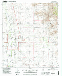 1996 Hereford2002 Print · USGSThe San Pedro River valley in the late twentieth century reveals a landscape defined by deep-rooted ranching and river conservation. Trace family histories at the Hereford Dairy Ranch or Double Mill Ranch, and follow the Old Railroad Grade through the valley.
End of results
Showing maps 1-2 of 2
Top cities near Palominas
Frequently asked questions
- What are the different types of historical maps available for Palominas?
- What is the oldest map of Palominas?
- Where can I purchase historical maps of Palominas for my home or office?
- Where can I download high-res historical maps of Palominas?
- Are there historical topographic maps available for Palominas?
- Is there historical aerial imagery available for Palominas?
- Where are historical maps of Palominas sourced from?