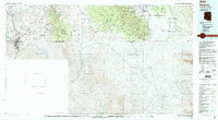
1994 Map of Nogales
USGS Topo · Published 1994About this map
The borderlands of southern Arizona are defined here by a complex geography of Spanish land grants and mining history. Large historic tracts such as the Luis Maria Baca Float No 3 and San Rafael de la Zanja Grant dominate the landscape, reflecting the region's colonial heritage. Between the Patagonia Mountains and the Huachuca Mountains, the map reveals a history of mineral extraction at sites like the Mowry Mine, Santo Nino Mine, and the Morning Glory Mine. The rugged terrain transitions into the high-altitude peaks of the Miller Peak Wilderness and Coronado Peak, while the international boundary with Sonora, Mexico, is clearly marked south of the city of Nogales. The presence of the Fort Huachuca Military Reservation and the Coronado National Memorial underscores the strategic and cultural significance of this high-desert corridor in the mid-1990s.
Find a feature on this map
64 named features on this map. Tap any name to fly to it.
Don’t see what you’re looking for? This feature index may not catch every label — zoom into the map to look around manually.
Map Details
Editions of this 1994 Nogales Map
2 editions found
Other maps of this area

1902 · Bisbee
USGS Topo · 1:62,500

1904 · Patagonia
USGS Topo · 1:125,000

1905 · Patagonia
USGS Topo · 1:125,000

1905 · Nogales
USGS Topo · 1:125,000

1910 · Bisbee
USGS Topo · 1:62,500

1914 · Hereford
USGS Topo · 1:125,000

1915 · Benson
USGS Topo · 1:125,000

1916 · Pearce
USGS Topo · 1:125,000

1916 · Douglas
USGS Topo · 1:125,000

1919 · Douglas
USGS Topo · 1:125,000