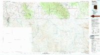
1994 Map of Nogales
USGS Topo · Published 1994About this map
The international border between the United States of America and Mexico anchors this 1994 survey, capturing the binational character of the Arizona-Sonora frontier. The landscape is defined by the high elevations of the Huachuca Mountains and the Patagonia Mountains, where mining history is preserved at sites like Washington Camp, Duquesne, and the Morning Glory Mine. In the valleys, the Santa Cruz River and San Pedro River provide vital corridors for settlement, supporting communities from Nogales to the small border outpost of Lochiel.
Find a feature on this map
82 named features on this map. Tap any name to fly to it.
Don’t see what you’re looking for? This feature index may not catch every label — zoom into the map to look around manually.
Map Details
Editions of this 1994 Nogales Map
2 editions found
Other maps of this area

1902 · Bisbee
USGS Topo · 1:62,500

1904 · Patagonia
USGS Topo · 1:125,000

1905 · Patagonia
USGS Topo · 1:125,000

1905 · Nogales
USGS Topo · 1:125,000

1910 · Bisbee
USGS Topo · 1:62,500

1914 · Hereford
USGS Topo · 1:125,000

1915 · Benson
USGS Topo · 1:125,000

1916 · Pearce
USGS Topo · 1:125,000

1916 · Douglas
USGS Topo · 1:125,000

1919 · Douglas
USGS Topo · 1:125,000