1910s Maps of Portal, Arizona
Explore 2 historic maps of Portal from the 1910s. These maps offer a rare glimpse into what life looked like during the 1910s — showing old roads, neighborhoods, homes, and landmarks that have changed or disappeared over time.
Whether you're researching your family's past, planning a metal detecting trip, or studying how Portal's landscape evolved across the 1910s, these high-resolution maps are a powerful tool for exploring the history of this region.
- Focus on a specific era: All maps on this page are from the 1910s, giving you a focused view of this time period.
- See what’s changed: Compare century-old streets, trails, and buildings to today's modern landscape using overlays and satellite layers.
- Research with precision: Use these maps for genealogy, historical research, land use analysis, or educational projects.
- View, download, or print: Maps are fully viewable online in high resolution, and can be downloaded or printed for your own records.
Start exploring Portal's history through authentic maps from the 1910s. This is your window into the past.
Portal, AZ maps
(2)- 1917 Map of Chiricahua, 1954 Print
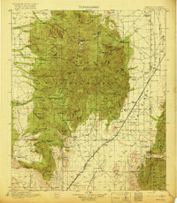
 1917 Chiricahua1954 Print · USGSSoutheastern Arizona and the New Mexico borderlands are shown here during a period of mining expansion and cattle ranching. Genealogists can locate family homesteads like Staffords Ranch or trace remote outposts like Paradise and the Hilltop Mine.
 - 1919 Map of Chiricahua
 1919 Chiricahua1919 Print · USGSSoutheastern Arizona ranching and mining operations are captured here during the late nineteen-teens. Genealogists can trace family homesteads like Staffords Ranch and Hampe Ranch alongside the Hilltop Mine and several rural schoolhouses.3 unique versions available
End of results
Showing maps 1-2 of 2
Top cities near Portal
Frequently asked questions
- What are the different types of historical maps available for Portal?
- What is the oldest map of Portal?
- Where can I purchase historical maps of Portal for my home or office?
- Where can I download high-res historical maps of Portal?
- Are there historical topographic maps available for Portal?
- Is there historical aerial imagery available for Portal?
- Where are historical maps of Portal sourced from?