Old Maps of Tombstone, Arizona for Hiking & Exploration
Hike through history with 14 historic maps of Tombstone. Explore old trails, ghost towns, and forgotten backroads — perfect for outdoor adventurers and local explorers.
- Rediscover forgotten places: Map out old mining camps, roads, and footpaths that no longer exist on modern maps.
- Layer with modern tools: Combine with LiDAR or satellite views to plan hikes through historical terrain.
- Made for exploration: Popular among hikers, overlanders, and local history lovers.
Use these maps to find adventure and explore the hidden past of Tombstone.
Tombstone, AZ maps
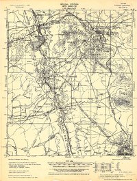
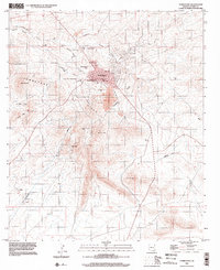
(14)- 1915 Map of Benson
 1915 Benson1915 Print · USGSSouthern Arizona was a landscape of rail junctions and mining claims just before the Great War. Genealogists and historians can trace the reach of Tombstone, find the Panama Mine, and locate vanished rail stops like Fairbank and Boquillas.4 unique versions available
 - 1932 Map of Fairbank
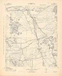
 1932 Fairbank1932 Print · USGSCochise County during the early 1930s remains a critical hub of Arizona mining and ranching along the San Pedro River. Researchers can trace the industrial landscape of Tombstone, locating the Bronco Mine, the Powder Magazine, and old rail junctions like Benson Junction.
 - 1943 Map of Benson
 1943 Benson1943 Print · USGSCochise County during the wartime 1940s reveals a landscape defined by the San Pedro River and the legendary town of Tombstone. Genealogists and historians can trace the foundations of Fort Huachuca and locate rural landmarks like St David, Fairbank, and Huachuca Turner PO.
 - 1952 Map of Tombstone, 1955 Print
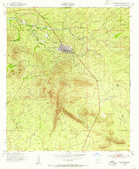 1952 Tombstone1955 Print · USGSTombstone and the surrounding high desert are captured here in the early fifties, showing the legendary town's layout alongside its historic mining and ranching legacy. Researchers can locate the Boothill Cem, the Schieffelin Monument, and family sites like Fox Ranch.3 unique versions available
 - 1952 Map of Tombstone, 1959 Print
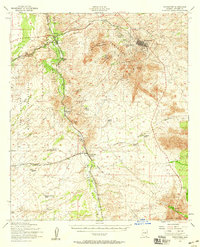 1952 Tombstone1959 Print · USGSCochise County during the early 1950s reveals a landscape defined by ranching, mining, and frontier legacy. Genealogists and historians can trace old homesteads like Bakarich-McCool Ranch or locate the famed Boothill Cem and Fairbank rail junction.2 unique versions available
 - 1956 Map of Nogales, 1963 Print
 1956 Nogales1963 Print · USGSSouthern Arizona in the mid-fifties is captured here from the Papago tribal lands to the San Pedro valley. Genealogists and historians can trace border settlements like Sasabe, the legacy of Tombstone, and old mining sites including the Mary G Mine.4 unique versions available
 - 1958 Map of Nogales
 1958 Nogales1958 Print · USGSSouthern Arizona in the late fifties was a landscape of international borders and high-desert outposts, dominated by the Huachuca Mountains and the Papago Indian Reservation. Local historians can trace old mining camps like Ruby and Greaterville or locate historic military grounds at the Fort Huachuca Military Reservation.
 - 1959 Map of Nogales
 1959 Nogales1959 Print · USGSThe Southern Arizona borderlands appear in the late fifties as a complex landscape of military ranges, tribal lands, and high-desert mining towns. Local historians can trace the Southern Pacific rail lines connecting Tombstone and Benson or locate family ranches such as Canoa Ranch.
 - 1994 Map of Fort Huachuca
 1994 Fort Huachuca1994 Print · USGSSouthern Arizona in the mid-nineties shows a landscape of expansive military reservations, historic land grants, and storied mining districts. Researchers can trace the S P RR through the San Pedro River valley or locate dozens of remote mountain workings like the Montezuma Mine and Eureka Mine.3 unique versions available
 - 1996 Map of Tombstone, 2002 Print
 1996 Tombstone2002 Print · USGSTombstone and the surrounding high desert ranchlands appear in the 1990s as a landscape where frontier history meets modern utility. Local historians can trace the Old Railroad Grade and locate legacy sites like Boothill Cem and the Schieffelin Monument.
 - 2012 Map of Tombstone, 2012 Print
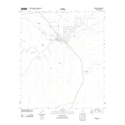 2012 Tombstone2012 Print · USGSCovers Tombstone, including Cochise County, United States, and other nearby areas
 - 2014 Map of Tombstone, 2014 Print
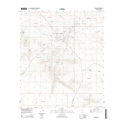 2014 Tombstone2014 Print · USGSCovers Tombstone, including Cochise County, United States, and other nearby areas
 - 2018 Map of Tombstone, 2018 Print
 2018 Tombstone2018 Print · USGSCovers Tombstone, including Cochise County, United States, and other nearby areas
 - 2021 Map of Tombstone, 2021 Print
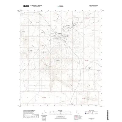
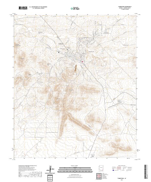 2021 Tombstone2021 Print · USGSTombstone and its surrounding high-desert peaks are captured here in the early twenty-first century. Researchers can trace the town’s grid near the famous Boothill Graveyard and find local landmarks like Comstock Hill and the Tombstone Municipal Airport.
End of results
Showing maps 1-14 of 14
Top cities near Tombstone
Frequently asked questions
- What are the different types of historical maps available for Tombstone?
- What is the oldest map of Tombstone?
- Where can I purchase historical maps of Tombstone for my home or office?
- Where can I download high-res historical maps of Tombstone?
- Are there historical topographic maps available for Tombstone?
- Is there historical aerial imagery available for Tombstone?
- Where are historical maps of Tombstone sourced from?