2020s Maps of Cameron, Arizona
Explore 2 historic maps of Cameron from the 2020s. These maps offer a rare glimpse into what life looked like during the 2020s — showing old roads, neighborhoods, homes, and landmarks that have changed or disappeared over time.
Whether you're researching your family's past, planning a metal detecting trip, or studying how Cameron's landscape evolved across the 2020s, these high-resolution maps are a powerful tool for exploring the history of this region.
- Focus on a specific era: All maps on this page are from the 2020s, giving you a focused view of this time period.
- See what’s changed: Compare century-old streets, trails, and buildings to today's modern landscape using overlays and satellite layers.
- Research with precision: Use these maps for genealogy, historical research, land use analysis, or educational projects.
- View, download, or print: Maps are fully viewable online in high resolution, and can be downloaded or printed for your own records.
Start exploring Cameron's history through authentic maps from the 2020s. This is your window into the past.
Cameron, AZ maps
(2)- 2021 Map of Cameron South, 2021 Print
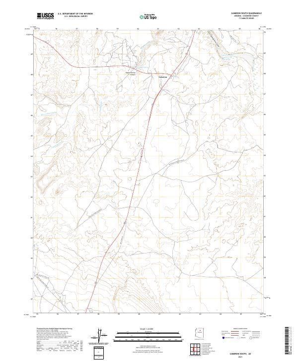 2021 Cameron South2021 Print · USGSCameron and the surrounding Coconino County plateau are captured here in the early 2020s, revealing a landscape shaped by deep river canyons and desert utility routes. Researchers can trace the path of Old US Hwy 89 or locate vital water sources like Tappan Spring and Junius Spring.
 - 2021 Map of Cameron North, 2021 Print
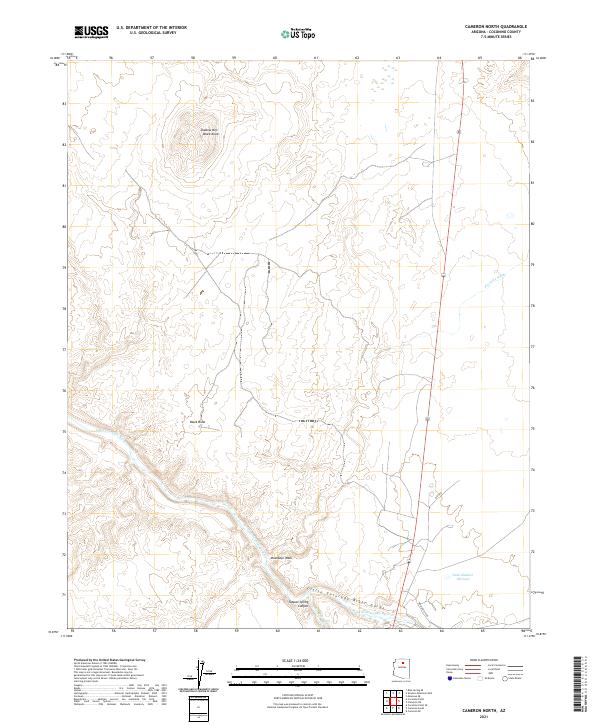 2021 Cameron North2021 Print · USGSCoconino County’s high desert landscape is documented here in the early 2020s, centered on the dramatic Little Colorado River Gorge. Trace the rugged topography of Shadow Mtn and follow the route of Highway 89 across the Moenkopi Wash.
End of results
Showing maps 1-2 of 2
Frequently asked questions
- What are the different types of historical maps available for Cameron?
- What is the oldest map of Cameron?
- Where can I purchase historical maps of Cameron for my home or office?
- Where can I download high-res historical maps of Cameron?
- Are there historical topographic maps available for Cameron?
- Is there historical aerial imagery available for Cameron?
- Where are historical maps of Cameron sourced from?