Old Maps of Fort Valley, Arizona for Academic Research
Study the evolution of Fort Valley with 17 high-resolution historic maps. Whether you're teaching, researching, or modeling changes in land use, these maps provide essential visual documentation of urban, environmental, and geographic change.
- Analyze long-term change: Track patterns in development, transportation, and natural features.
- Ideal for environmental or urban studies: Support academic projects with primary historical map data.
- Use in the classroom or lab: Educators and researchers rely on these maps to bring historical context to life.
These maps are a powerful tool for teaching, research, and visualizing how Fort Valley has changed over the decades.
Fort Valley, AZ maps
(17)- 1886 Map of San Francisco Mtns
 1886 San Francisco Mtns1886 Print · USGSNorthern Arizona's high desert and peaks are documented here just as the rail era transformed the territory. Trace the early path of the Atlantic and Pacific Railroad through Flagstaff and find landmarks like Fort Moroni and Grand Falls.
 - 1891 Map of San Francisco Mtns
 1891 San Francisco Mtns1891 Print · USGSNorthern Arizona's high country during the territorial era is defined by the arrival of the railroad and the growth of mountain settlements. Trace the early layout of Flagstaff and follow the Atlantic and Pacific Railroad past Fort Moroni and through the San Francisco Mountains.
 - 1894 Map of San Francisco Mtns
 1894 San Francisco Mtns1894 Print · USGSNorthern Arizona's high timber and volcanic peaks appear here in the late nineteenth century as the railroad transforms the plateau. Trace early settlements like Flagstaff and Cosnino or locate territorial landmarks like Fort Moroni and Le Roux Spring.5 unique versions available
 - 1899 Map of San Francisco Mtns, 1922 Print
 1899 San Francisco Mtns1922 Print · USGSNorthern Arizona's high timber and desert plateau come alive in this late nineteenth-century survey. You can trace the early growth of Flagstaff, find the outpost at Fort Moroni, and follow the Santa Fe Pacific Railroad to Canyon Diablo.
 - 1908 Map of Flagstaff, 1960 Print
 1908 Flagstaff1960 Print · USGSNorthern Arizona's high country is captured here during the early twentieth century, showing the rail and ranching roots of the Coconino plateau. Genealogists and historians can trace early settlements like Bellemont, scientific landmarks like Lowell Observatory, and the timber works at Greenlaw's Mill.
 - 1912 Map of Flagstaff
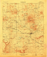 1912 Flagstaff1912 Print · USGSFlagstaff and the surrounding Coconino highlands appear here during a period of steady growth along the railroad. Genealogists and historians can locate early family sites like Darden's Ranch, the Lowell Observatory, and Greenlaw's Mill.5 unique versions available
 - 1947 Map of Flagstaff, 1948 Print
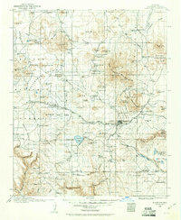
 1947 Flagstaff1948 Print · USGSThe Arizona high country and the Painted Desert converge in this post-war survey. Researchers can trace the ancient mesa villages of Walpi and Oraibi, the early roads of Flagstaff, and landmarks like Sunset Crater National Monument.2 unique versions available
 - 1954 Map of Flagstaff, 1966 Print
 1954 Flagstaff1966 Print · USGSNorthern Arizona in the mid-fifties shows a landscape of volcanic peaks and ancestral mesa villages linked by the iconic U.S. 66. Trace the path of the Atchison Topeka and Santa Fe through Winslow or explore the settlements of Old Oraibi and Kearns Canyon.3 unique versions available
 - 1958 Map of Flagstaff
 1958 Flagstaff1958 Print · USGSNorthern Arizona in the late fifties is captured here during the heyday of Route 66 and the expansion of the high desert rail corridors. Researchers can trace historic mesa settlements like Old Oraibi or follow the path of the Atchison Topeka and Santa Fe through Flagstaff and Winslow.
 - 1960 Map of Flagstaff
 1960 Flagstaff1960 Print · USGSNorthern Arizona at the dawn of the sixties shows a landscape defined by mesa-top Hopi villages and the burgeoning railroad hub of Flagstaff. Trace the path of U.S. 66 past Meteor Crater or locate historic trading posts like Gray Mountain Trading Post.2 unique versions available
 - 1962 Map of Flagstaff
 1962 Flagstaff1962 Print · USGSNorthern Arizona in the early sixties showcases the intersection of Tribal lands, national forests, and the busy Route 66 corridor. Trace historic roadside stops and landmarks like Meteor Crater, the Buck-Rodgers Trading Post, and the ancient village of Old Oraibi.
 - 1966 Map of Humphreys Peak, 1968 Print
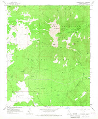 1966 Humphreys Peak1968 Print · USGSThe San Francisco Peaks rose above the Coconino National Forest in the mid-sixties, serving as a hub for both winter sports and timber research. Trace the early trails and water sources that sustained the region, from the Arizona Snow Bowl to Big Leroux Spring and the Fort Valley Experimental Forest Station.5 unique versions available
 - 1982 Map of Flagstaff, 1983 Print
 1982 Flagstaff1983 Print · USGSThe high plateau surrounding Flagstaff is seen here in the early eighties, centered on the intersection of forest, rail, and science. Genealogists and historians can trace the paths of U S 66 and the Atchison Topeka and Santa Fe past landmarks like Two Guns, Bellemont, and Lowell Observatory.2 unique versions available
 - 2011 Map of Humphreys Peak, 2011 Print
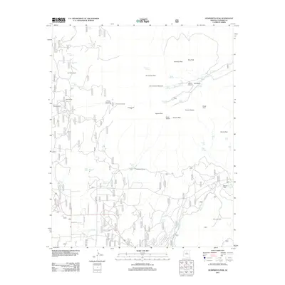 2011 Humphreys Peak2011 Print · USGSCovers Fort Valley, including Coconino County, United States, and other nearby areas
 - 2014 Map of Humphreys Peak, 2014 Print
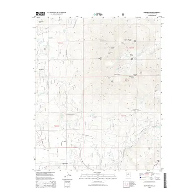 2014 Humphreys Peak2014 Print · USGSCovers Fort Valley, including Coconino County, United States, and other nearby areas
 - 2018 Map of Humphreys Peak, 2018 Print
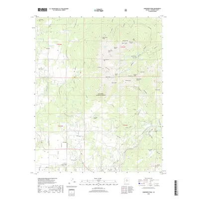 2018 Humphreys Peak2018 Print · USGSCovers Fort Valley, including Coconino County, United States, and other nearby areas
 - 2021 Map of Humphreys Peak, 2021 Print
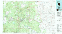
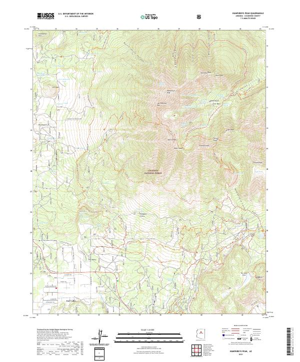 2021 Humphreys Peak2021 Print · USGSCoconino County high country is mapped here in 2021, centered on the heights of the San Francisco Peaks. Outdoor historians and researchers can trace the old water sources and routes like Leroux Spring, the Waterline Trl, and the settlement at Fort Valley.
End of results
Showing maps 1-17 of 17
Top cities near Fort Valley
- Flagstaff historical maps
- Doney Park historical maps
- Kachina Village historical maps
- Timberline-Fernwood historical maps
- Parks historical maps
- Bellemont historical maps
See more
Frequently asked questions
- What are the different types of historical maps available for Fort Valley?
- What is the oldest map of Fort Valley?
- Where can I purchase historical maps of Fort Valley for my home or office?
- Where can I download high-res historical maps of Fort Valley?
- Are there historical topographic maps available for Fort Valley?
- Is there historical aerial imagery available for Fort Valley?
- Where are historical maps of Fort Valley sourced from?