Old Maps of Coolidge Dam, Arizona for Academic Research
Study the evolution of Coolidge Dam with 14 high-resolution historic maps. Whether you're teaching, researching, or modeling changes in land use, these maps provide essential visual documentation of urban, environmental, and geographic change.
- Analyze long-term change: Track patterns in development, transportation, and natural features.
- Ideal for environmental or urban studies: Support academic projects with primary historical map data.
- Use in the classroom or lab: Educators and researchers rely on these maps to bring historical context to life.
These maps are a powerful tool for teaching, research, and visualizing how Coolidge Dam has changed over the decades.
Coolidge Dam, AZ maps
(14)- 1915 Map of Christmas, 1957 Print
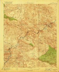
 1915 Christmas1957 Print · USGSThe Gila River canyon and Mescal Mountains are shown here during the peak of early Arizona mining and ranching. Genealogists and historians can trace the foundations of the Christmas settlement, the Arizona Eastern rail line, and remote sites like Mings Ranch or the Lower Coal Field Mine.2 unique versions available
 - 1917 Map of Christmas
 1917 Christmas1917 Print · USGSMining camps and desert ranching take center stage in this Gila County survey conducted just after the turn of the century. Genealogists and historians can trace the early footprint of Christmas and the various mineral works of the region, from the Lee Mine to the Old Mill.3 unique versions available
 - 1954 Map of Mesa, 1968 Print
 1954 Mesa1968 Print · USGSCentral Arizona in the mid-fifties reveals the rapid growth of the Valley of the Sun alongside the deep-rooted mining districts of the eastern mountains. Genealogists and researchers can trace the expansion of Mesa and Chandler or locate legacy operations at Inspiration Mine and the Magma Arizona railroad.4 unique versions available
 - 1957 Map of Mesa
 1957 Mesa1957 Print · USGSCentral Arizona's desert valleys and high-mountain mining districts come alive in the mid-fifties. Researchers can trace the early layout of Mesa and Phoenix or locate remote sites like Inspiration Mine and Arizona State College.
 - 1958 Map of Mesa
 1958 Mesa1958 Print · USGSMid-century Arizona comes alive in this survey of the valley and high desert, where urban growth begins to transform the landscape. Genealogists and researchers can trace the rail-and-mine economy through Inspiration Mine and old stops like Rittenhouse and Magma.
 - 1960 Map of Mesa
 1960 Mesa1960 Print · USGSThe Salt River Valley and Superstition wilderness are captured here during a era of rapid post-war growth. Researchers can trace the mid-century footprints of Williams AF Base and Arizona State College or locate the deep-rock shafts of the Old Dominion Mine and Magma Mine.
 - 1964 Map of Mesa
 1964 Mesa1964 Print · USGSCentral Arizona in the mid-1960s reveals a landscape defined by rapid desert urbanization and a massive copper mining industry. Genealogists and historians can trace the growth of Phoenix or explore the mining camps and operations at Miami Mine and Magma Mine.
 - 1968 Map of Coolidge Dam, 1971 Print
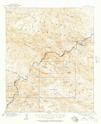
 1968 Coolidge Dam1971 Print · USGSThe Gila River canyon and the San Carlos Indian Reservation are documented here in the late sixties, just as the region's water management infrastructure reached maturity. Researchers can trace remote water sources and cattle industry remnants like Stockton Well, Standing Rock Catchment Basin, and the engineering of the Coolidge Dam.2 unique versions available
 - 1986 Map of Globe
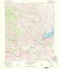
 1986 Globe1986 Print · USGSThe copper districts of Gila County and the lands of the San Carlos Apache are detailed here during the mid-eighties. Researchers can trace the industrial footprint of the Miami Mine, the sprawling San Carlos Reservoir, and small riverside settlements like Bylas and Geronimo.2 unique versions available
 - 2011 Map of Coolidge Dam, 2011 Print
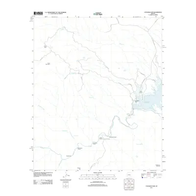 2011 Coolidge Dam2011 Print · USGSCovers Coolidge Dam, including Pinal County, Gila County, and other nearby areas
 - 2014 Map of Coolidge Dam, 2014 Print
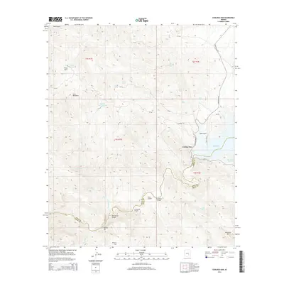 2014 Coolidge Dam2014 Print · USGSCovers Coolidge Dam, including Pinal County, Gila County, and other nearby areas
 - 2018 Map of Coolidge Dam, 2018 Print
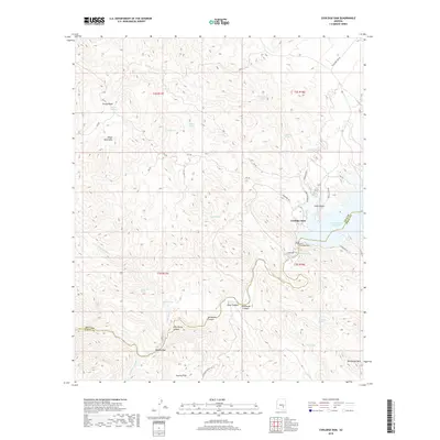 2018 Coolidge Dam2018 Print · USGSCovers Coolidge Dam, including Pinal County, Gila County, and other nearby areas
 - 2021 Map of Coolidge Dam, 2021 Print
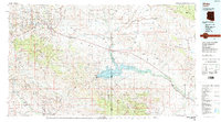
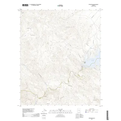
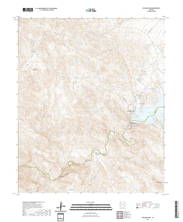 2021 Coolidge Dam2021 Print · USGSThe Gila River basin near the Gila and Pinal county line is defined by the massive engineering of Coolidge Dam and its reservoir. Geologists and local historians can trace the paths of McDougal Wash or explore landmarks like Needles Eye and Poverty Flat.
 - 2026 Map of Coolidge Dam, 2026 Print
 2026 Coolidge Dam2026 Print · USGSCovers Coolidge Dam, including Pinal County, Gila County, and other nearby areas
End of results
Showing maps 1-14 of 14
Top cities near Coolidge Dam
Frequently asked questions
- What are the different types of historical maps available for Coolidge Dam?
- What is the oldest map of Coolidge Dam?
- Where can I purchase historical maps of Coolidge Dam for my home or office?
- Where can I download high-res historical maps of Coolidge Dam?
- Are there historical topographic maps available for Coolidge Dam?
- Is there historical aerial imagery available for Coolidge Dam?
- Where are historical maps of Coolidge Dam sourced from?