2000s (21st Century) Maps of Diamond Point Summer Homes, Arizona
Explore 5 historic maps of Diamond Point Summer Homes from the 2000s (21st Century). These maps offer a rare glimpse into what life looked like during the 2000s — showing old roads, neighborhoods, homes, and landmarks that have changed or disappeared over time.
Whether you're researching your family's past, planning a metal detecting trip, or studying how Diamond Point Summer Homes's landscape evolved across the 2000s, these high-resolution maps are a powerful tool for exploring the history of this region.
- Focus on a specific era: All maps on this page are from the 2000s, giving you a focused view of this time period.
- See what’s changed: Compare century-old streets, trails, and buildings to today's modern landscape using overlays and satellite layers.
- Research with precision: Use these maps for genealogy, historical research, land use analysis, or educational projects.
- View, download, or print: Maps are fully viewable online in high resolution, and can be downloaded or printed for your own records.
Start exploring Diamond Point Summer Homes's history through authentic maps from the 2000s. This is your window into the past.
Diamond Point Summer Homes, AZ maps
(5)- 2004 Map of Diamond Point, 2006 Print
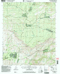 2004 Diamond Point2006 Print · USGSArizona's Mogollon Rim country comes into focus in this early 2000s study of the Tonto National Forest. Genealogists and hikers can trace seasonal settlements like Ellison Creek Summer Homes and historic routes including the Highline National Recreation Trail.
 - 2011 Map of Diamond Point, 2011 Print
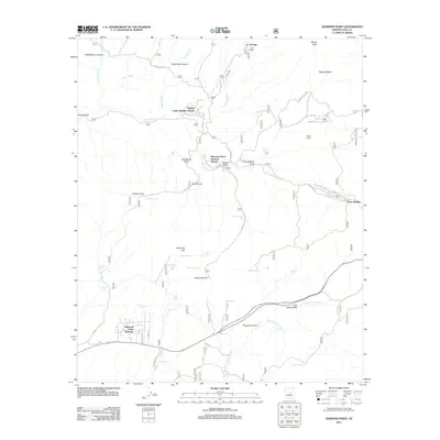 2011 Diamond Point2011 Print · USGSCovers Diamond Point Summer Homes, including Star Valley, Little Green Valley, and other nearby areas
 - 2014 Map of Diamond Point, 2014 Print
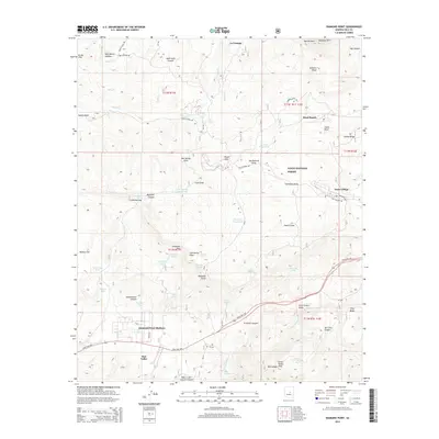 2014 Diamond Point2014 Print · USGSCovers Diamond Point Summer Homes, including Star Valley, Little Green Valley, and other nearby areas
 - 2018 Map of Diamond Point, 2018 Print
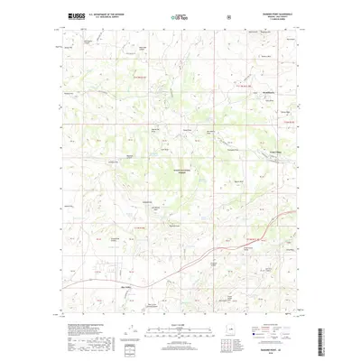 2018 Diamond Point2018 Print · USGSCovers Diamond Point Summer Homes, including Star Valley, Little Green Valley, and other nearby areas
 - 2021 Map of Diamond Point, 2021 Print
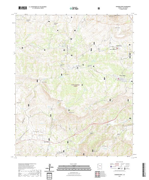 2021 Diamond Point2021 Print · USGSGila County's rugged rim country is documented here in the early 2020s, showing the transition from the high Mogollon Rim to the canyon floor. Local historians can trace the development of Star Valley and Tonto Village or locate remote landmarks like Hells Gate Canyon and the Highline Trail.
End of results
Showing maps 1-5 of 5
Top cities near Diamond Point Summer Homes
Frequently asked questions
- What are the different types of historical maps available for Diamond Point Summer Homes?
- What is the oldest map of Diamond Point Summer Homes?
- Where can I purchase historical maps of Diamond Point Summer Homes for my home or office?
- Where can I download high-res historical maps of Diamond Point Summer Homes?
- Are there historical topographic maps available for Diamond Point Summer Homes?
- Is there historical aerial imagery available for Diamond Point Summer Homes?
- Where are historical maps of Diamond Point Summer Homes sourced from?