2020s Maps of Chandler, Arizona
Explore 4 historic maps of Chandler from the 2020s. These maps offer a rare glimpse into what life looked like during the 2020s — showing old roads, neighborhoods, homes, and landmarks that have changed or disappeared over time.
Whether you're researching your family's past, planning a metal detecting trip, or studying how Chandler's landscape evolved across the 2020s, these high-resolution maps are a powerful tool for exploring the history of this region.
- Focus on a specific era: All maps on this page are from the 2020s, giving you a focused view of this time period.
- See what’s changed: Compare century-old streets, trails, and buildings to today's modern landscape using overlays and satellite layers.
- Research with precision: Use these maps for genealogy, historical research, land use analysis, or educational projects.
- View, download, or print: Maps are fully viewable online in high resolution, and can be downloaded or printed for your own records.
Start exploring Chandler's history through authentic maps from the 2020s. This is your window into the past.
Chandler, AZ maps
(4)- 2021 Map of Gila Butte, 2021 Print
 2021 Gila Butte2021 Print · USGSThe southern periphery of Chandler meets the Gila River Indian Community in the early 2020s, showing a landscape of rapid suburban growth and ancestral lands. Researchers can trace the boundaries of Stotonic Village and Bapchule or locate the Goodyear-Ocotillo Cem near the rising profile of Gila Butte.
 - 2021 Map of Chandler, 2021 Print
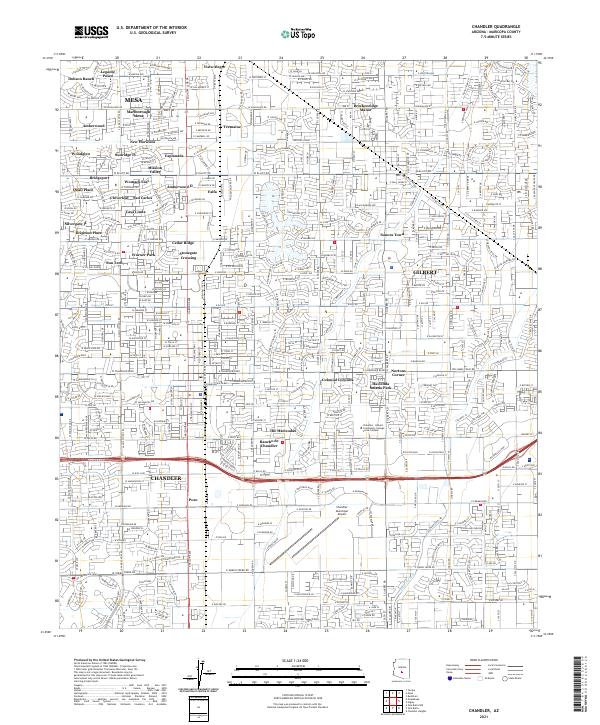 2021 Chandler2021 Print · USGSThe East Valley transitions from its agricultural past to a modern suburban hub in this contemporary survey of Maricopa County. Researchers can trace the layout of Dobson Ranch, the industrial pulse of the Union Pacific RR, and the grounds of Nortons Corner.
 - 2021 Map of Gila Butte NW, 2021 Print
 2021 Gila Butte NW2021 Print · USGSThe Gila River Indian Reservation meets the expanding edge of the East Valley in the early 2020s. Researchers can trace the heritage of Snaketown within the Hohokam Pima National Monument alongside settlements like Sacate Village and Bapchule.
 - 2021 Map of Guadalupe, 2021 Print
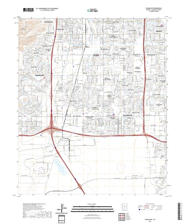 2021 Guadalupe2021 Print · USGSThe East Valley suburbs of Phoenix are shown in high detail during their twenty-first-century expansion. Researchers can trace local landmarks like the Highline Canal, the historic location of Kyrene, and the Village of Gila Springs within the dense urban grid.
End of results
Showing maps 1-4 of 4
Top cities near Chandler
- Phoenix historical maps
- Mesa historical maps
- Scottsdale historical maps
- Gilbert historical maps
- Tempe historical maps
- Maricopa historical maps
See more
Top neighborhoods of Chandler
- West Chandler historical maps
- Serape historical maps
- Sunbird Golf Resort historical maps
- Crestview Chateaux historical maps
- Carrizal historical maps
- Hightown historical maps
See more
Frequently asked questions
- What are the different types of historical maps available for Chandler?
- What is the oldest map of Chandler?
- Where can I purchase historical maps of Chandler for my home or office?
- Where can I download high-res historical maps of Chandler?
- Are there historical topographic maps available for Chandler?
- Is there historical aerial imagery available for Chandler?
- Where are historical maps of Chandler sourced from?