Old Maps of Gilbert, Arizona for Academic Research
Study the evolution of Gilbert with 53 high-resolution historic maps. Whether you're teaching, researching, or modeling changes in land use, these maps provide essential visual documentation of urban, environmental, and geographic change.
- Analyze long-term change: Track patterns in development, transportation, and natural features.
- Ideal for environmental or urban studies: Support academic projects with primary historical map data.
- Use in the classroom or lab: Educators and researchers rely on these maps to bring historical context to life.
These maps are a powerful tool for teaching, research, and visualizing how Gilbert has changed over the decades.
Gilbert, AZ maps
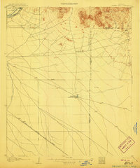
(53)- 1904 Map of Desert Well, 1958 Print
 1904 Desert Well1958 Print · USGSArizona's Salt River Valley comes to life in the early 1900s as a landscape of irrigation canals and desert outposts. Local historians can trace the early footprint of Higley, locate the specific Desert Well, and follow the path of the Santa Fe Prescott and Phoenix RR.
 - 1906 Map of Desert Well
 1906 Desert Well1906 Print · USGSArizona's Salt River valley was transitioning from open range to an irrigated landscape in the years after the turn of the century. Trace the early routes of the Santa Fe Prescott and Phoenix RR and locate pioneer outposts like Buchanan's Ranch and the Desert Well.3 unique versions available
 - 1907 Map of Sacaton
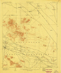 1907 Sacaton1907 Print · USGSThe Gila River Valley comes alive in this survey from the early 1900s, showing the early infrastructure of the Gila River Indian Reservation. Trace the legacy of desert ranching at Andrada's Ranch or find the early site of Blackwater Chapel.4 unique versions available
 - 1913 Map of Mesa, 1955 Print
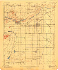
 1913 Mesa1955 Print · USGSMaricopa County's irrigation and early rail networks are meticulously detailed in this pre-war survey of the Salt River Valley. Genealogists can trace family names at local landmarks like Alma School, the settlement of Creamery, and the Kyrene School.
 - 1914 Map of Gila Butte
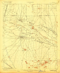
 1914 Gila Butte1914 Print · USGSThe Gila River valley in the early twentieth century shows a landscape defined by desert trading posts and the rise of managed irrigation. Researchers can locate family roots and early commerce at the Sweetwater Store Indian Trading Post, Snaketown, and the Casa Blanca Indian School.
 - 1915 Map of Mesa
 1915 Mesa1915 Print · USGSMaricopa County's agricultural heartland was defined by a complex web of gravity-fed water systems before the era of modern expansion. Genealogists and historians can trace early settlements and school districts like Kyrene School, Falfa, and the Arizona State Normal School.2 unique versions available
 - 1917 Map of Gila Butte
 1917 Gila Butte1917 Print · USGSThe Pinal County desert comes into focus during the early twentieth century as irrigation and rail lines began to reshape the Gila River valley. Genealogists and historians can locate early trading hubs like the North Line Trading Post and tribal landmarks including Snaketown and the Casa Blanca Indian School.2 unique versions available
 - 1952 Map of Chandler, 1957 Print
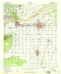
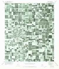
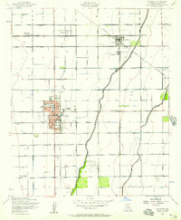 1952 Chandler1957 Print · USGSCentral Arizona's agricultural heartland is captured here in the early fifties as irrigation and rail networks drove the expansion of the Salt River Valley. Researchers can trace the development of Chandler and Gilbert alongside smaller vanished stops like Falfa and the Water Users Camp 10.5 unique versions available
 - 1952 Map of Mesa, 1957 Print
 1952 Mesa1957 Print · USGSMid-century Mesa and the surrounding Salt River Valley are seen here during a period of agricultural productivity and steady growth. Researchers can trace the extensive irrigation network of the Consolidated Canal and locate neighborhood landmarks like the LDS Temple and Taylor Field.5 unique versions available
 - 1952 Map of Gila Butte, 1957 Print
 1952 Gila Butte1957 Print · USGSThe Pinal County desert landscape in the early fifties shows a transition from railway outposts to established reservation communities. Genealogists and historians can trace community roots at St Peters Mission Sch, the Goodyear Cem, and through settlements like Bapchule and Santan.4 unique versions available
 - 1952 Map of Gila Butte, 1960 Print
 1952 Gila Butte1960 Print · USGSCentral Arizona's desert valleys show a distinct transition during the early fifties as irrigation canals reshaped the Gila River basin. Genealogists can trace family footprints at Bapchule, St Peters Mission Sch, and the Goodyear Cemetery.2 unique versions available
 - 1952 Map of Mesa, 1960 Print
 1952 Mesa1960 Print · USGSThe East Valley was a burgeoning network of irrigation canals and growing citrus towns in the early fifties. Genealogists and historians can trace old community centers like Sonora Town, Falfa, and Winfield Scott Sch alongside the early campus of Arizona State College.
 - 1954 Map of Mesa, 1968 Print
 1954 Mesa1968 Print · USGSCentral Arizona in the mid-fifties reveals the rapid growth of the Valley of the Sun alongside the deep-rooted mining districts of the eastern mountains. Genealogists and researchers can trace the expansion of Mesa and Chandler or locate legacy operations at Inspiration Mine and the Magma Arizona railroad.4 unique versions available
 - 1956 Map of Buckhorn, 1959 Print
 1956 Buckhorn1959 Print · USGSMaricopa County during the mid-fifties shows a fascinating mix of aviation history and desert agriculture as the suburban fringe began to take shape. Researchers can trace early landing strips like Oasis Airport and find the site of the Arizona Girls Ranch near the Apache Trail.5 unique versions available
 - 1956 Map of Chandler Heights, 1959 Print
 1956 Chandler Heights1959 Print · USGSThe Pinal and Maricopa County borderlands come into focus in the mid-1950s as agriculture and industry reach into the desert. Genealogists and historians can trace the early development of Chandler Heights and locate remote mining shafts near the Goldmine Mountains.4 unique versions available
 - 1956 Map of Higley, 1959 Print
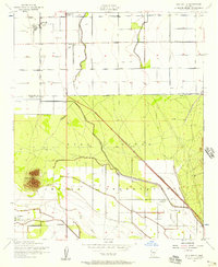
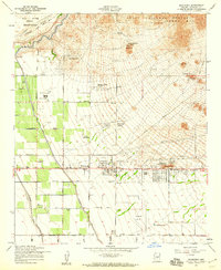
 1956 Higley1959 Print · USGSSoutheastern Maricopa County is captured during its mid-century transition from a desert railroad corridor to a significant military and agricultural hub. Researchers can trace the layout of Williams Air Force Base and the rural origins of Higley and Queen Creek.5 unique versions available
 - 1957 Map of Mesa
 1957 Mesa1957 Print · USGSCentral Arizona's desert valleys and high-mountain mining districts come alive in the mid-fifties. Researchers can trace the early layout of Mesa and Phoenix or locate remote sites like Inspiration Mine and Arizona State College.
 - 1958 Map of Mesa
 1958 Mesa1958 Print · USGSMid-century Arizona comes alive in this survey of the valley and high desert, where urban growth begins to transform the landscape. Genealogists and researchers can trace the rail-and-mine economy through Inspiration Mine and old stops like Rittenhouse and Magma.
 - 1960 Map of Mesa
 1960 Mesa1960 Print · USGSThe Salt River Valley and Superstition wilderness are captured here during a era of rapid post-war growth. Researchers can trace the mid-century footprints of Williams AF Base and Arizona State College or locate the deep-rock shafts of the Old Dominion Mine and Magma Mine.
 - 1964 Map of Mesa
 1964 Mesa1964 Print · USGSCentral Arizona in the mid-1960s reveals a landscape defined by rapid desert urbanization and a massive copper mining industry. Genealogists and historians can trace the growth of Phoenix or explore the mining camps and operations at Miami Mine and Magma Mine.
 - 1971 Map of Gila Butte, 1972 Print
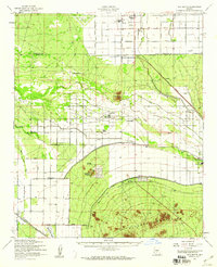
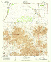
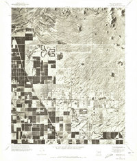
 1971 Gila Butte1972 Print · USGSThe Pinal County desert floor meets irrigated agriculture in the early 1970s, as seen from high-altitude aerial photography. Trace the rural layout of Ocotillo and Bapchule, or locate the prominent landmark of Gila Butte overlooking the Gila River.
 - 1971 Map of Chandler, 1972 Print
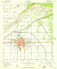
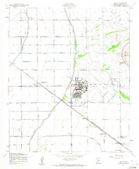
 1971 Chandler1972 Print · USGSMaricopa County is captured during its mid-century agricultural prime before the surge of suburban sprawl. Researchers can trace the early layouts of Chandler and Gilbert alongside vital irrigation routes like the Eastern Canal.
 - 1971 Map of Buckhorn, 1972 Print
 1971 Buckhorn1972 Print · USGSMaricopa County is captured during a period of rapid change in the early 1970s, showing the intersection of desert agriculture and new development. Researchers can trace the path of the Roosevelt Canal and the distinct volcanic landmark of Spook Hill near Buckhorn.
 - 1971 Map of Higley, 1972 Print
 1971 Higley1972 Print · USGSMaricopa County agriculture and military aviation are captured in detail during the early seventies. Genealogists and historians can trace the footprint of Higley and the sprawling layout of Williams Air Force Base at the height of its activity.
 - 1971 Map of Mesa, 1972 Print
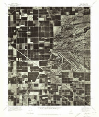
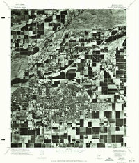 1971 Mesa1972 Print · USGSMesa in the early seventies shows the sharp contrast between its growing street grid and the surrounding agricultural tracts. Local historians can trace the mid-century footprint of Mesa and the natural course of the Salt River during this period of change.2 unique versions available
Showing maps 1-25 of 53
Top cities near Gilbert
- Phoenix historical maps
- Mesa historical maps
- Chandler historical maps
- Scottsdale historical maps
- Tempe historical maps
- San Tan Valley historical maps
See more
Top neighborhoods of Gilbert
- The Bridges at Gilbert historical maps
- Tremaine historical maps
- Gilbert Ranch historical maps
- Estates at Spectrum historical maps
- Ocotillo historical maps
- Allen Ranch historical maps
See more
Frequently asked questions
- What are the different types of historical maps available for Gilbert?
- What is the oldest map of Gilbert?
- Where can I purchase historical maps of Gilbert for my home or office?
- Where can I download high-res historical maps of Gilbert?
- Are there historical topographic maps available for Gilbert?
- Is there historical aerial imagery available for Gilbert?
- Where are historical maps of Gilbert sourced from?