Old Maps of Winslow, Arizona
Explore 20 old maps of Winslow, spanning from 1883 to today. These high-resolution historic maps reveal how streets, neighborhoods, landmarks, and natural features evolved over time — perfect for genealogy, metal detecting, research, and local history exploration.
What you can do with these maps:
- See how Winslow changed over time: Compare historical maps to modern-day views to trace roads, homesites, rail lines & more.
- View detailed metadata: Each map includes creators, publishers, year, scale, and archive source.
- Overlay maps with satellite & LiDAR: Visualize the past alongside modern tools to explore terrain & human change.
- Trusted historical sources: Maps sourced from the USGS, Library of Congress, and other archives.
- Access maps your way: View online, download high-res files, or order prints for personal or research use.
Start exploring old maps of Winslow to uncover forgotten places, hidden landmarks, and the deep history beneath your feet.
Winslow, AZ maps
(20)- 1883 Map of Tusayan, 1896 Print
 1883 Tusayan1896 Print · USGSCovers Winslow, including Chinle Agency, Fort Defiance Agency, and other nearby areas
 - 1886 Map of Tusayan
 1886 Tusayan1886 Print · USGSCovers Winslow, including Chinle Agency, Fort Defiance Agency, and other nearby areas5 unique versions available
 - 1886 Map of Holbrook
 1886 Holbrook1886 Print · USGSCovers Winslow, including Show Low, Snowflake, and other nearby areas
 - 1893 Map of Holbrook
 1893 Holbrook1893 Print · USGSCovers Winslow, including Show Low, Snowflake, and other nearby areas4 unique versions available
 - 1947 Map of Flagstaff, 1948 Print
 1947 Flagstaff1948 Print · USGSCovers Winslow, including Flagstaff, Doney Park, and other nearby areas2 unique versions available
 - 1954 Map of Winslow, 1956 Print
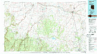
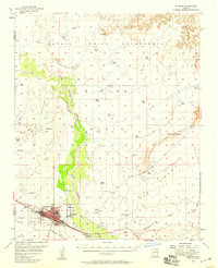 1954 Winslow1956 Print · USGSCovers Winslow, including Fort Defiance Agency, West Winslow, and other nearby areas2 unique versions available
 - 1954 Map of Winslow 4 SW, 1957 Print
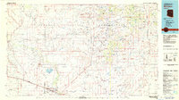
 1954 Winslow 4 SW1957 Print · USGSCovers Winslow, including West Winslow, Winslow West, and other nearby areas
 - 1954 Map of Flagstaff, 1966 Print
 1954 Flagstaff1966 Print · USGSCovers Winslow, including Flagstaff, Doney Park, and other nearby areas3 unique versions available
 - 1954 Map of Holbrook, 1966 Print
 1954 Holbrook1966 Print · USGSCovers Winslow, including Payson, Cottonwood, and other nearby areas3 unique versions available
 - 1957 Map of Holbrook
 1957 Holbrook1957 Print · USGSCovers Winslow, including Payson, Cottonwood, and other nearby areas
 - 1958 Map of Flagstaff
 1958 Flagstaff1958 Print · USGSCovers Winslow, including Flagstaff, Doney Park, and other nearby areas
 - 1958 Map of Holbrook
 1958 Holbrook1958 Print · USGSCovers Winslow, including Payson, Cottonwood, and other nearby areas
 - 1960 Map of Flagstaff
 1960 Flagstaff1960 Print · USGSCovers Winslow, including Flagstaff, Doney Park, and other nearby areas2 unique versions available
 - 1960 Map of Holbrook
 1960 Holbrook1960 Print · USGSCovers Winslow, including Payson, Cottonwood, and other nearby areas
 - 1962 Map of Flagstaff
 1962 Flagstaff1962 Print · USGSCovers Winslow, including Flagstaff, Doney Park, and other nearby areas
 - 1968 Map of Tucker Mesa, 1971 Print
 1968 Tucker Mesa1971 Print · USGSCovers Winslow, including Lechee, Winslow West, and other nearby areas2 unique versions available
 - 1970 Map of Clear Creek Reservoir, 1973 Print
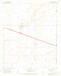
 1970 Clear Creek Reservoir1973 Print · USGSCovers Winslow, including Navajo County, United States, and other nearby areas
 - 1980 Map of Holbrook, 1996 Print
 1980 Holbrook1996 Print · USGSCovers Winslow, including Snowflake, Holbrook, and other nearby areas2 unique versions available
 - 1982 Map of Winslow, 1983 Print
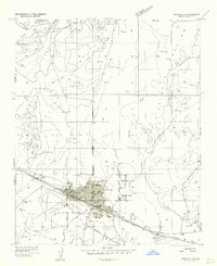
 1982 Winslow1983 Print · USGSCovers Winslow, including Fort Defiance Agency, Leupp, and other nearby areas2 unique versions available
 - 1986 Map of Winslow
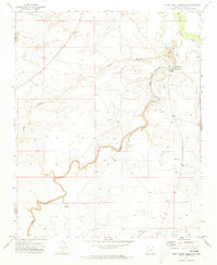
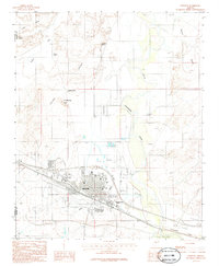 1986 Winslow1986 Print · USGSCovers Winslow, including West Winslow, Winslow West, and other nearby areas
End of results
Showing maps 1-20 of 20
Top cities near Winslow
Top neighborhoods of Winslow
Frequently asked questions
- What are the different types of historical maps available for Winslow?
- What is the oldest map of Winslow?
- Where can I purchase historical maps of Winslow for my home or office?
- Where can I download high-res historical maps of Winslow?
- Are there historical topographic maps available for Winslow?
- Is there historical aerial imagery available for Winslow?
- Where are historical maps of Winslow sourced from?