2020s Maps of Sells, Arizona
Explore 17 historic maps of Sells from the 2020s. These maps offer a rare glimpse into what life looked like during the 2020s — showing old roads, neighborhoods, homes, and landmarks that have changed or disappeared over time.
Whether you're researching your family's past, planning a metal detecting trip, or studying how Sells's landscape evolved across the 2020s, these high-resolution maps are a powerful tool for exploring the history of this region.
- Focus on a specific era: All maps on this page are from the 2020s, giving you a focused view of this time period.
- See what’s changed: Compare century-old streets, trails, and buildings to today's modern landscape using overlays and satellite layers.
- Research with precision: Use these maps for genealogy, historical research, land use analysis, or educational projects.
- View, download, or print: Maps are fully viewable online in high resolution, and can be downloaded or printed for your own records.
Start exploring Sells's history through authentic maps from the 2020s. This is your window into the past.
Sells, AZ maps
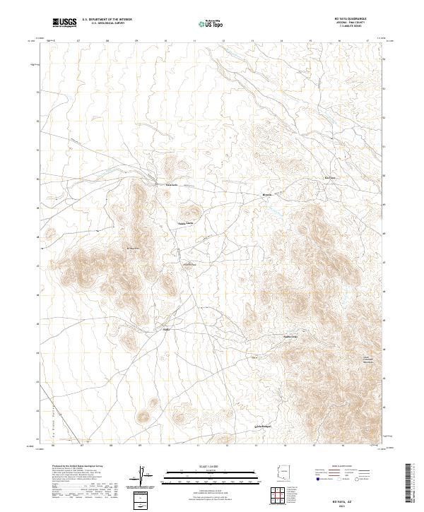
(17)- 2021 Map of Sells West, 2021 Print
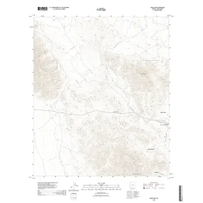
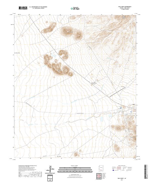 2021 Sells West2021 Print · USGSThe Tohono O'odham Nation in the early 2020s centers on the hub of Sells and its desert surroundings. Trace local infrastructure from Sells Airport to Tohono Oodham Community College - West Campus and the outlier settlement of Etoi Ki.
 - 2021 Map of Chukut Kuk, 2021 Print
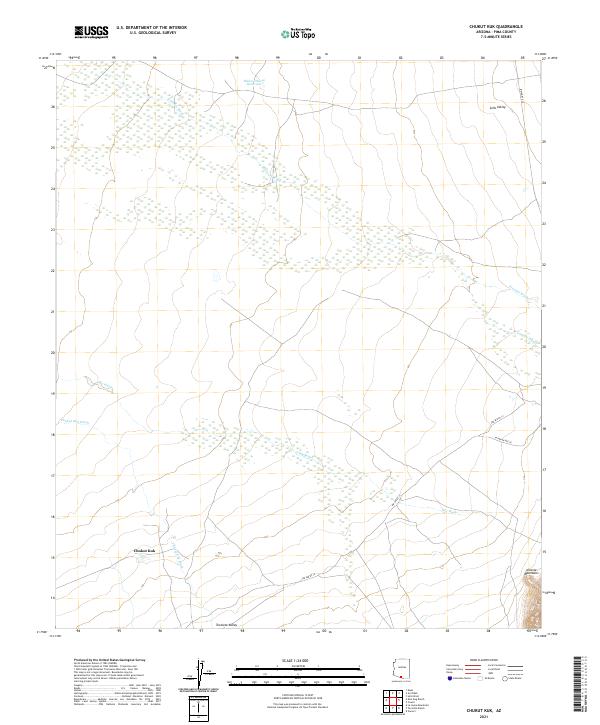 2021 Chukut Kuk2021 Print · USGSSettlement patterns in the Pima County desert are centered around Chukut Kuk in the early 2020s. Researchers can trace seasonal water flow through Big Wash and the rise of the Alvarez Mountains near Indian Rte 20.
 - 2021 Map of Sells East, 2021 Print
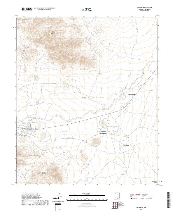 2021 Sells East2021 Print · USGSThe Tohono O'odham Nation territory comes into focus here in the early twenty-first century, showing the desert valley floor between the South Comobabi Mountains and Artesa Mountains. Trace local settlements and educational sites like Ali Chukson and the Tohono Oodham Community College Central Campus.
 - 2021 Map of Cowlic, 2021 Print
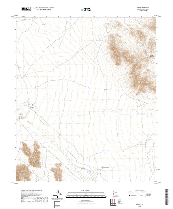 2021 Cowlic2021 Print · USGSHigh desert valleys and mountain ranges define this Pima County landscape in 2021. Researchers can trace the routes of Indian Rte 20 and locate settlements like Cowlic and Vopolo Havoka among the desert washes.
 - 2021 Map of Vamori, 2021 Print
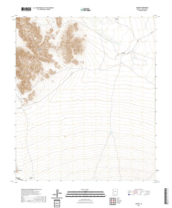 2021 Vamori2021 Print · USGSThe southern Arizona desert near the international border comes into focus in this recent survey. Researchers can trace the paths of Indian Rte 2 to Vamori or locate landmarks like Alvarez Mountains and Vamur Tank.
 - 2021 Map of Topawa, 2021 Print
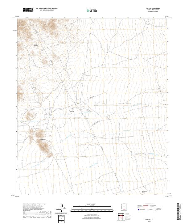 2021 Topawa2021 Print · USGSThe desert community of Topawa is captured here in the early twenty-first century, showing the intersection of local life and the arid landscape. Researchers can trace the paths of Fresnal Wash and Topawa Wash or locate landmarks like Burro Mtn and the Artesa Mountains.
 - 2021 Map of Gu Oidak, 2021 Print
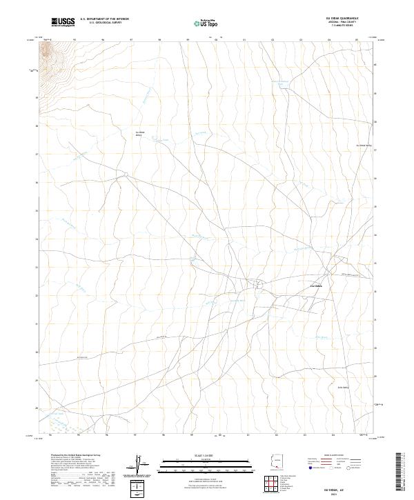 2021 Gu Oidak2021 Print · USGSThe community of Gu Oidak is documented here in the early twenty-first century, showing the intersection of Indian Service Routte 24 and local desert life. Researchers can trace the water-dependent landscape through named features like Gu Oidak Wash, Sells Valley, and Kuke Chehedagi Tank.
 - 2021 Map of Kupk, 2021 Print
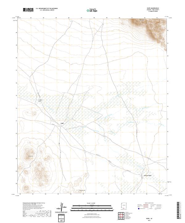 2021 Kupk2021 Print · USGSPima County's desert floor is captured in this recent survey, showing the relationship between seasonal watercourses and local settlements. Genealogists and desert historians can locate rural clusters like Kupk and Chuwut Murk along routes such as Indian Rte 24.
 - 2021 Map of Kots Kug Ranch, 2021 Print
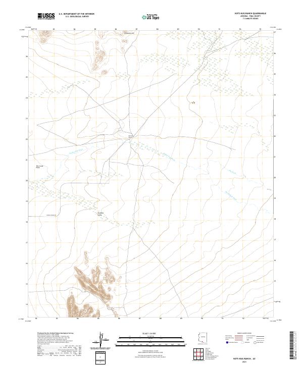 2021 Kots Kug Ranch2021 Print · USGSSouthern Arizona ranching territory and desert basins are detailed in this recent survey. Local researchers can trace the drainages of Chukut Kuk Wash and Big Wash as they meet near Kots Kug Ranch and the southern Tecolote Valley.
 - 2021 Map of Vainom Kug, 2021 Print
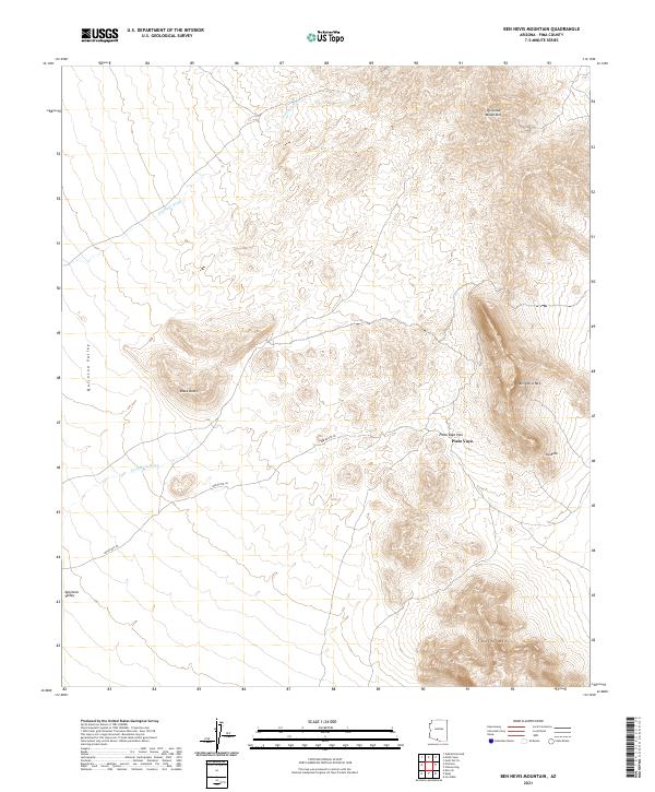
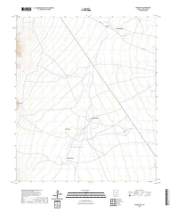 2021 Vainom Kug2021 Print · USGSThe desert settlements of the Tohono O'odham Nation are documented in this recent survey of Pima County. Genealogists and researchers can trace the locations of Vainom Kug, Sikul Himatk, and Kui Tatk alongside landmarks like Ben Nevis Mtn.
 - 2021 Map of Comobabi, 2021 Print
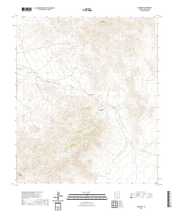 2021 Comobabi2021 Print · USGSThe settlement of Comobabi and its surrounding peaks are documented in this 2021 survey of the Arizona desert. Researchers can trace land divisions and seasonal watercourses like Ko Vaya Wash, Comobabi Wash, and the transit route through Comobabi Pass.
 - 2021 Map of Maish Vaya, 2021 Print
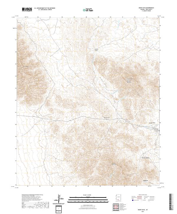 2021 Maish Vaya2021 Print · USGSThe Tohono Oodham Nation lands in Pima County appear here in the early twenty-first century as a landscape of desert washes and high peaks. Genealogists and historians can locate specific sites including Maish Vaya, the Tohono Oodham Reservation Cem, and Quijotoa.
 - 2021 Map of Ko Vaya, 2021 Print
 2021 Ko Vaya2021 Print · USGSThe Tohono O'odham landscape in the early 2020s shows a network of desert communities and traditional washes. Genealogists and historians can locate settlements like Ko Vaya, Nolic, and Santa Lucia near landmarks like Picacho Peak.
 - 2021 Map of Ben Nevis Mountain, 2021 Print
 2021 Ben Nevis Mountain2021 Print · USGSThe Pima County desert at the start of the 2020s shows a landscape of sharp mountain peaks and wide valley floors. Genealogists and researchers can trace the roads near Piato Vaya and find landmarks like Ben Nevis Mtn and the Quijotoa Mountains.
 - 2021 Map of Gurli Put Vo, 2021 Print
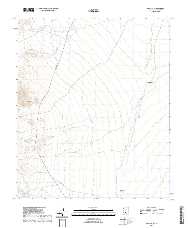 2021 Gurli Put Vo2021 Print · USGSPima County’s desert basin is captured here in the early twenty-first century, showing the intersection of tribal lands and traditional hydrology. Researchers can locate the Tohono Oodham Reservation Cem and trace routes between Gurli Put Vo and the Santa Rosa Valley.
 - 2026 Map of Ben Nevis Mountain, 2026 Print
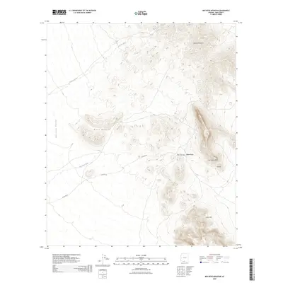 2026 Ben Nevis Mountain2026 Print · USGSCovers Sells, including Piato Vaya, Pisinemo District, and other nearby areas
 - 2026 Map of Maish Vaya, 2026 Print
 2026 Maish Vaya2026 Print · USGSCovers Sells, including Maish Vaya, Pisinemo District, and other nearby areas
End of results
Showing maps 1-17 of 17
Top cities near Sells
Top neighborhoods of Sells
- Vainom Kug historical maps
- Santa Cruz historical maps
- Sells historical maps
- Wickchoupai historical maps
- Artesa historical maps
- Gu Oidak historical maps
See more
Frequently asked questions
- What are the different types of historical maps available for Sells?
- What is the oldest map of Sells?
- Where can I purchase historical maps of Sells for my home or office?
- Where can I download high-res historical maps of Sells?
- Are there historical topographic maps available for Sells?
- Is there historical aerial imagery available for Sells?
- Where are historical maps of Sells sourced from?