Old Maps of Topawa, Arizona
Explore 89 old maps of Topawa, spanning from 1934 to today. These high-resolution historic maps reveal how streets, neighborhoods, landmarks, and natural features evolved over time — perfect for genealogy, metal detecting, research, and local history exploration.
What you can do with these maps:
- See how Topawa changed over time: Compare historical maps to modern-day views to trace roads, homesites, rail lines & more.
- View detailed metadata: Each map includes creators, publishers, year, scale, and archive source.
- Overlay maps with satellite & LiDAR: Visualize the past alongside modern tools to explore terrain & human change.
- Trusted historical sources: Maps sourced from the USGS, Library of Congress, and other archives.
- Access maps your way: View online, download high-res files, or order prints for personal or research use.
Start exploring old maps of Topawa to uncover forgotten places, hidden landmarks, and the deep history beneath your feet.
Topawa, AZ maps
(89)- 1934 Map of Silver Bell
 1934 Silver Bell1934 Print · USGSPima County at the height of the New Deal era reveals a sparse network of desert settlements and remote mines. Genealogists and historians can trace the footprint of the Papago Indian Reservation through its small villages like Santa Cruz and industrial sites like the Roadside Mine.
 - 1937 Map of Comobabi
 1937 Comobabi1937 Print · USGSPima County's high-desert mining and tribal lands are captured in the late 1930s, showing the early infrastructure of the Papago Indian Reservation. Trace the locations of isolated mining operations like the Cobabi Mine and settlements at San Luis and Nolic.4 unique versions available
 - 1941 Map of Presumido Peak
 1941 Presumido Peak1941 Print · USGSThe Arizona borderlands in the early 1940s are defined here by cattle ranching and tribal lands along the international line. Researchers can trace historic properties like Rancho de la Osa and Buenos Aires Ranch or locate the Site of Old Indian Fort near Sasabe.2 unique versions available
 - 1941 Map of Baboquivari Peak, 1955 Print
 1941 Baboquivari Peak1955 Print · USGSArizona's Tohono O'odham lands come alive in this wartime survey, showing the deep connection between ranching families and the desert landscape. Genealogists and historians can trace the locations of the Allison Mine, Fresnal Canyon School, and numerous holdings like Otero Ranch.3 unique versions available
 - 1941 Map of Vamori, 1958 Print
 1941 Vamori1958 Print · USGSTraditional O'odham life in the early 1940s is mapped here across the desert expanses of the Papago Indian Reservation. Genealogists and historians can locate remote settlements and family landmarks including San Miguel, Ak Chut Vaya, and San Agustin Ranch.3 unique versions available
 - 1941 Map of Sells, 1969 Print
 1941 Sells1969 Print · USGSThe Papago Indian Reservation in the early 1940s reveals a desert landscape of ancestral villages and active mining. Trace family roots and desert trails through Sells, Topawa, and the historic San Solano Mission.
 - 1942 Map of Comobabi
 1942 Comobabi1942 Print · USGSThe Papago Indian Reservation comes into focus during the late 1930s, showing a network of remote desert settlements and scattered mountain mines. Genealogists and historians can trace the foundations of Sil Nakya, Ko Vaya, and mining sites like the Picacho Mine.2 unique versions available
 - 1943 Map of Sells
 1943 Sells1943 Print · USGSThe Papago Indian Reservation in the early 1940s reveals a desert landscape of traditional settlements and active mining. Genealogists and historians can trace family roots through the San Solano Mission, Topawa P O, and villages like Artesa or Ali Chuk Son.4 unique versions available
 - 1943 Map of Fresnal
 1943 Fresnal1943 Print · USGSSouthern Arizona’s borderlands and tribal territories are captured here in the 1940s, shortly after the height of early mining efforts. Researchers can trace ancestral connections in villages like Indian Oasis or locate vanished industrial sites like the Golden Age Mine & Mill.
 - 1943 Map of Presumido Peak
 1943 Presumido Peak1943 Print · USGSSouthern Arizona’s borderlands are mapped here in the early 1940s, showing the high ranching country and tribal lands of Pima County. Researchers can trace historic family holdings like Rancho de la Osa and Santa Margarita Ranch or locate the Site of Old Indian Fort.2 unique versions available
 - 1943 Map of Vamori
 1943 Vamori1943 Print · USGSThe Papago Indian Reservation and the international border define this high-desert region during the early 1940s. Genealogists and historians can trace indigenous settlements and ranching outposts like Vamori, San Miguel, and the San Agustin Ranch.2 unique versions available
 - 1944 Map of Baboquivari Peak
 1944 Baboquivari Peak1944 Print · USGSThe Papago Indian Reservation in the early 1940s reveals a landscape of isolated ranches and tribal settlements. Genealogists can trace family holdings like Otero Ranch or locate the Fresnal Canyon Sch and the Allison Mine near the base of Baboquivari Peak.2 unique versions available
 - 1956 Map of Nogales, 1963 Print
 1956 Nogales1963 Print · USGSSouthern Arizona in the mid-fifties is captured here from the Papago tribal lands to the San Pedro valley. Genealogists and historians can trace border settlements like Sasabe, the legacy of Tombstone, and old mining sites including the Mary G Mine.4 unique versions available
 - 1956 Map of Tucson, 1967 Print
 1956 Tucson1967 Print · USGSPost-war Southern Arizona comes into focus as the copper and aviation industries expand around Tucson. Trace family roots in South Tucson or locate early mining sites like the San Manuel Mine and Silver Bell Mine near the Santa Cruz River.3 unique versions available
 - 1958 Map of Nogales
 1958 Nogales1958 Print · USGSSouthern Arizona in the late fifties was a landscape of international borders and high-desert outposts, dominated by the Huachuca Mountains and the Papago Indian Reservation. Local historians can trace old mining camps like Ruby and Greaterville or locate historic military grounds at the Fort Huachuca Military Reservation.
 - 1958 Map of Tucson
 1958 Tucson1958 Print · USGSSouthern Arizona in the late fifties reveals a landscape of desert agriculture and rising military aviation. Trace the rail lines of the Southern Pacific or locate the historic San Xavier Del Bac Mission and the Casa Grande Natl Mon.
 - 1959 Map of Tucson
 1959 Tucson1959 Print · USGSSouthern Arizona in the late fifties shows a landscape of military growth and desert industry. Genealogists and historians can trace the footprint of Davis-Monthan Air Force Base and old mining sites like the San Manuel Mine near Mammoth.2 unique versions available
 - 1959 Map of Nogales
 1959 Nogales1959 Print · USGSThe Southern Arizona borderlands appear in the late fifties as a complex landscape of military ranges, tribal lands, and high-desert mining towns. Local historians can trace the Southern Pacific rail lines connecting Tombstone and Benson or locate family ranches such as Canoa Ranch.
 - 1962 Map of Tucson
 1962 Tucson1962 Print · USGSSouthern Arizona in the early sixties showcases a landscape defined by burgeoning desert cities and massive military installations. Researchers can trace tribal settlements like Schuchk, legacy mining sites at Silver Bell Mine, and the early footprint of Davis-Monthan Air Force Base.
 - 1964 Map of Tucson
 1964 Tucson1964 Print · USGSSouthern Arizona in the mid-1960s shows a landscape of burgeoning desert cities and industrial-scale copper mining. Researchers can trace the development of Tucson and its outlying mining districts, including the Silver Bell Mine and San Manuel Mine.
 - 1978 Map of San Juan Spring, 1979 Print
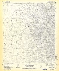 1978 San Juan Spring1979 Print · USGSThe Baboquivari Mountains and the desert plains of the Papago Indian Reservation come to life in the late seventies. Genealogists and historians can trace desert settlements like Gu Chuapo, locate the Pavo Kug (Ruins), and find remote landmarks like San Juan Spring.
 - 1979 Map of Mildred Peak
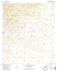 1979 Mildred Peak1979 Print · USGSThe Baboquivari Mountains and the Tohono O'odham lands are captured here in the late seventies. Researchers can trace the ranching and mining history of the region through sites like the Gold Bullion Mine, Santa Margarita Ranch, and Shaffer Camp.3 unique versions available
 - 1979 Map of Sells East
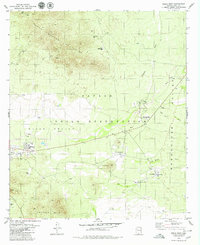 1979 Sells East1979 Print · USGSThe Papago Indian Reservation in the late seventies reveals a desert landscape organized around essential water sources and mountain foothills. Researchers can trace community development from the hub of Sells to Our Lady of Lourdes Mission and find old mining sites like the Jaeger Mine.2 unique versions available
 - 1979 Map of Baboquivari Peak
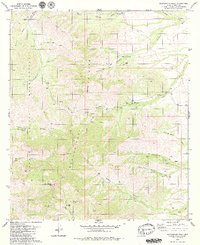 1979 Baboquivari Peak1979 Print · USGSThe Baboquivari Mountains in southern Arizona are documented here during the late 1970s, showcasing the high-desert ranching and reservation lands. Researchers can trace remote sites like Mundo Perdido, historic outposts at Redondo Ranch, and the trails surrounding Baboquivari Peak.3 unique versions available
 - 1979 Map of Topawa
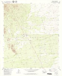 1979 Topawa1979 Print · USGSThe Pima County desert landscape comes into focus during the late seventies, centered on the community of Topawa. Local historians can trace the foundations of the San Solano Mission, the Indian Oasis Sch, and remote infrastructure like the Landing Strip.
Showing maps 1-25 of 89
Top cities near Topawa
Top neighborhoods of Topawa
- Chukson historical maps
- Topawa historical maps
- Choulic historical maps
- Kahachi Miliuk historical maps
- Pitoikam historical maps
- Vopolo Havoka historical maps
See more
Frequently asked questions
- What are the different types of historical maps available for Topawa?
- What is the oldest map of Topawa?
- Where can I purchase historical maps of Topawa for my home or office?
- Where can I download high-res historical maps of Topawa?
- Are there historical topographic maps available for Topawa?
- Is there historical aerial imagery available for Topawa?
- Where are historical maps of Topawa sourced from?