1990s Maps of Topawa, Arizona
Explore 8 historic maps of Topawa from the 1990s. These maps offer a rare glimpse into what life looked like during the 1990s — showing old roads, neighborhoods, homes, and landmarks that have changed or disappeared over time.
Whether you're researching your family's past, planning a metal detecting trip, or studying how Topawa's landscape evolved across the 1990s, these high-resolution maps are a powerful tool for exploring the history of this region.
- Focus on a specific era: All maps on this page are from the 1990s, giving you a focused view of this time period.
- See what’s changed: Compare century-old streets, trails, and buildings to today's modern landscape using overlays and satellite layers.
- Research with precision: Use these maps for genealogy, historical research, land use analysis, or educational projects.
- View, download, or print: Maps are fully viewable online in high resolution, and can be downloaded or printed for your own records.
Start exploring Topawa's history through authentic maps from the 1990s. This is your window into the past.
Topawa, AZ maps
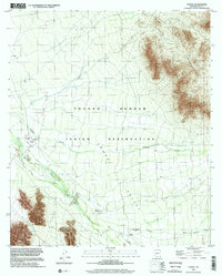
(8)- 1994 Map of Sells
 1994 Sells1994 Print · USGSSouthern Arizona in the mid-nineties shows a landscape of deep cultural history, from the Tohono O'odham Nation to the historic Santa Cruz River valley. Genealogists and historians can trace desert settlements like Pisinimo, explore the border town of Sasabe, and locate the mining operations at Mission Mine.2 unique versions available
 - 1994 Map of Silver Bell Mountains
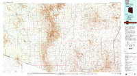
 1994 Silver Bell Mountains1994 Print · USGSSouthern Arizona in the mid-nineties shows a land of transition between desert wilderness, tribal lands, and the growing Tucson suburbs. Genealogists and historians can trace settlements like San Luis and Ko Vaya, or follow the industrial legacy of the Silver Bell Mine.2 unique versions available
 - 1996 Map of Sells East, 2002 Print
 1996 Sells East2002 Print · USGSThe Tohono O'odham nation centers on Sells in the late twentieth century, showing a landscape of desert villages and vital water sources. Researchers can trace the layout of Sells, identify local landmarks like Ali Chukson, and locate the Our Lady of Lourdes Mission.
 - 1996 Map of Comobabi, 2002 Print
 1996 Comobabi2002 Print · USGSThe Tohono O'odham Reservation in the mid-1990s reveals a landscape of desert peaks and O'odham settlements. Trace family roots and land use near Ko Vaya, the Emperor and Duchess Mine, and the village of Comobabi.
 - 1996 Map of Topawa, 2002 Print
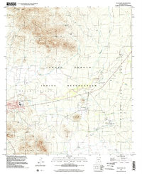
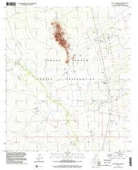
 1996 Topawa2002 Print · USGSThe Tohono O'odham nation in Pima County appears here in the late nineties, centered on the settlement and mission at Topawa. Genealogists and researchers can locate the San Solano Mission, Indian Oasis Sch, and Cem while tracing the seasonal paths of Fresnal Wash.
 - 1996 Map of South Komelik, 2002 Print
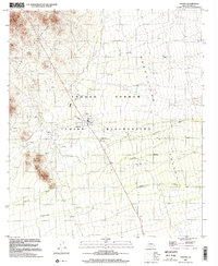
 1996 South Komelik2002 Print · USGSBaboquivari Valley life in the mid-1990s is centered around seasonal washes and small tribal communities near the Mexican border. Researchers can trace the layout of traditional settlements like South Komelik, Choulic, and San Miguel.
 - 1996 Map of Cowlic, 2002 Print
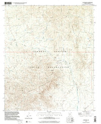
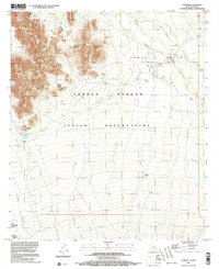
 1996 Cowlic2002 Print · USGSIn the high Sonoran desert of the late twentieth century, this survey tracks the drainage patterns and settlements of the Tohono O'odham Indian Reservation. Genealogists and historians can locate specific sites such as Cowlic, Topawa, and the Vopolo Havoka (Site).
 - 1996 Map of Vamori, 2003 Print
 1996 Vamori2003 Print · USGSThe Tohono O'odham lands along the Arizona-Sonora border are captured here in the mid-1990s as the desert landscape meets the international line. Genealogists and researchers can trace local settlements like Vamori and Itak, and identify landmarks like Wamul Tank or Tecolote Ranch.
End of results
Showing maps 1-8 of 8
Top cities near Topawa
Top neighborhoods of Topawa
- Chukson historical maps
- Topawa historical maps
- Choulic historical maps
- Kahachi Miliuk historical maps
- Pitoikam historical maps
- Vopolo Havoka historical maps
See more
Frequently asked questions
- What are the different types of historical maps available for Topawa?
- What is the oldest map of Topawa?
- Where can I purchase historical maps of Topawa for my home or office?
- Where can I download high-res historical maps of Topawa?
- Are there historical topographic maps available for Topawa?
- Is there historical aerial imagery available for Topawa?
- Where are historical maps of Topawa sourced from?