1900s (20th Century) Maps of Los Portales, Casa Grande
Explore 11 historic maps of Los Portales from the 1900s (20th Century). These maps offer a rare glimpse into what life looked like during the 1900s — showing old roads, neighborhoods, homes, and landmarks that have changed or disappeared over time.
Whether you're researching your family's past, planning a metal detecting trip, or studying how Los Portales's landscape evolved across the 1900s, these high-resolution maps are a powerful tool for exploring the history of this region.
- Focus on a specific era: All maps on this page are from the 1900s, giving you a focused view of this time period.
- See what’s changed: Compare century-old streets, trails, and buildings to today's modern landscape using overlays and satellite layers.
- Research with precision: Use these maps for genealogy, historical research, land use analysis, or educational projects.
- View, download, or print: Maps are fully viewable online in high resolution, and can be downloaded or printed for your own records.
Start exploring Los Portales's history through authentic maps from the 1900s. This is your window into the past.
Los Portales, Casa Grande maps
(11)- 1922 Map of Casa Grande, 1956 Print
 1922 Casa Grande1956 Print · USGSPinal County in the early twenties shows a landscape shaped by tribal lands and the railroad. Genealogists and historians can trace the early layout of Casa Grande, the rail siding at Nunez, and the village of Chuichu.2 unique versions available
 - 1924 Map of Casa Grande
 1924 Casa Grande1924 Print · USGSThe Santa Cruz River valley in the early 1920s shows the convergence of rail travel and early desert irrigation. Genealogists and historians can trace the rail sidings of Bon and Nunez or locate the village of Chiu Chuischu within the Papago Indian Reservation.
 - 1956 Map of Tucson, 1967 Print
 1956 Tucson1967 Print · USGSPost-war Southern Arizona comes into focus as the copper and aviation industries expand around Tucson. Trace family roots in South Tucson or locate early mining sites like the San Manuel Mine and Silver Bell Mine near the Santa Cruz River.3 unique versions available
 - 1958 Map of Tucson
 1958 Tucson1958 Print · USGSSouthern Arizona in the late fifties reveals a landscape of desert agriculture and rising military aviation. Trace the rail lines of the Southern Pacific or locate the historic San Xavier Del Bac Mission and the Casa Grande Natl Mon.
 - 1959 Map of Tucson
 1959 Tucson1959 Print · USGSSouthern Arizona in the late fifties shows a landscape of military growth and desert industry. Genealogists and historians can trace the footprint of Davis-Monthan Air Force Base and old mining sites like the San Manuel Mine near Mammoth.2 unique versions available
 - 1962 Map of Tucson
 1962 Tucson1962 Print · USGSSouthern Arizona in the early sixties showcases a landscape defined by burgeoning desert cities and massive military installations. Researchers can trace tribal settlements like Schuchk, legacy mining sites at Silver Bell Mine, and the early footprint of Davis-Monthan Air Force Base.
 - 1964 Map of Tucson
 1964 Tucson1964 Print · USGSSouthern Arizona in the mid-1960s shows a landscape of burgeoning desert cities and industrial-scale copper mining. Researchers can trace the development of Tucson and its outlying mining districts, including the Silver Bell Mine and San Manuel Mine.
 - 1965 Map of Casa Grande West, 1967 Print
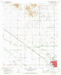 1965 Casa Grande West1967 Print · USGSArizona's desert valley comes into focus during the mid-sixties as Casa Grande expands along the Southern Pacific tracks. Researchers can trace land development through the Casa Grande Canal and sites like the Mormon Battalion Historical Monument.2 unique versions available
 - 1971 Map of Casa Grande West, 1972 Print
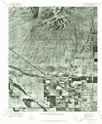 1971 Casa Grande West1972 Print · USGSArizona's desert landscape meets organized agriculture in the early seventies as the desert begins to yield to development. Trace the intersection of the Sacaton Mountains and the expanding irrigation networks near Casa Grande and the Santa Cruz Wash.
 - 1992 Map of Casa Grande West
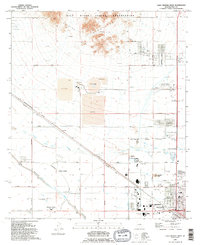 1992 Casa Grande West1992 Print · USGSCasa Grande is shown in the early nineties during a period of transition between its mining roots and modern expansion. Researchers can trace the extensive Open Pit Mine works or locate local landmarks like Saguaro Sch and the Mormon Battalion Historical Monument.
 - 1994 Map of Casa Grande
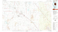 1994 Casa Grande1994 Print · USGSPinal County in the early nineties shows a desert landscape shaped by massive irrigation projects and ancient heritage. Trace the path of the Southern Pacific past Casa Grande National Monument Ruins and the Silver Reef Mine.3 unique versions available
End of results
Showing maps 1-11 of 11
Frequently asked questions
- What are the different types of historical maps available for Los Portales?
- What is the oldest map of Los Portales?
- Where can I purchase historical maps of Los Portales for my home or office?
- Where can I download high-res historical maps of Los Portales?
- Are there historical topographic maps available for Los Portales?
- Is there historical aerial imagery available for Los Portales?
- Where are historical maps of Los Portales sourced from?