Loading...
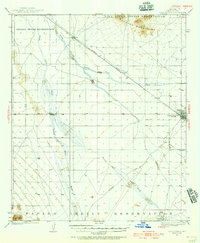
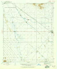
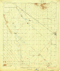
Loading map...1922 Map of Casa Grande
USGS Topo · Published 1956About this map
The Papago Indian Reservation and Gila River Indian Reservation encompass large portions of this 1920s desert landscape, reflecting the tribal territories that define the region south of the Gila River. The Southern Pacific railroad cuts a diagonal line across the arid flats, serving small sidings and outposts such as Bon and Nunez. Water management is central to the area's development, evidenced by the Casa Grande Florence Canal and the natural drainage patterns of the Santa Cruz River, Santa Rosa Wash, and Greens Wash.
Find a feature on this map
16 named features on this map. Tap any name to fly to it.
Don’t see what you’re looking for? This feature index may not catch every label — zoom into the map to look around manually.
Map Details
Date Portrayed1922
Date Published1956
PublisherU.S. Geological Survey
Map TypeTopographic
Scale1:62,500
Physical Dimensions16.9 x 20.6 inches
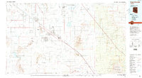
Editions of this 1922 Casa Grande Map
2 editions found
Historical Maps of Maricopa Through Time
3 maps found
Featured Locations
Source Details
SourceU.S. Geological Survey
CopyrightPublic Domain