Old Maps of Coolidge, Arizona for Metal Detecting
Plan your next treasure hunt with 44 historic maps of Coolidge. Find old homesites, ghost towns, trails, and gathering spots that may be lost to time — perfect for identifying promising metal detecting locations.
- Locate forgotten sites: Uncover places like long-lost settlements, abandoned rail lines, or gathering spots.
- Plan better hunts: Use map overlays combined with LiDAR or satellite views to narrow in on historically rich areas.
- Made for detectorists: Thousands of hobbyists use these maps to discover relics, coins, and hidden history.
Use these historic maps to boost your research and find new opportunities beneath the surface of Coolidge.
Coolidge, AZ maps
(44)- 1900 Map of Florence, 1956 Print
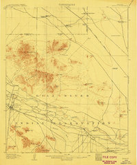
 1900 Florence1956 Print · USGSArizona's mining and ranching frontiers are mapped here at the dawn of the century as the Gila River valley begins its growth. Researchers can trace historic family holdings like Arnett Ranch and early industrial camps at Silver King or the Silver Bell Mine.
 - 1902 Map of Florence
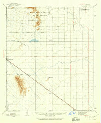
 1902 Florence1902 Print · USGSFlorence and the Gila River valley are captured here at the turn of the century during the peak of early Arizona mining and ranching. Researchers can locate vanished settlements and family sites like Silver King, Adamsville, and the Silver Bell Mine.5 unique versions available
 - 1907 Map of Sacaton
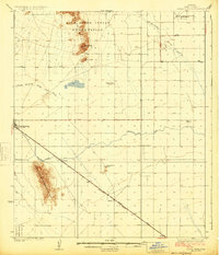
 1907 Sacaton1907 Print · USGSThe Gila River Valley comes alive in this survey from the early 1900s, showing the early infrastructure of the Gila River Indian Reservation. Trace the legacy of desert ranching at Andrada's Ranch or find the early site of Blackwater Chapel.4 unique versions available
 - 1922 Map of Red Rock No 2
 1922 Red Rock No 21922 Print · USGSPinal County at the dawn of statehood reveals a desert landscape being transformed by irrigation and early highways. Researchers can trace the development of the Picacho Reservoir and early rural landmarks like the Kenilworth School.
 - 1922 Map of Signal Peak, 1959 Print
 1922 Signal Peak1959 Print · USGSPinal County's desert corridor is captured in the early 1920s as the railroad and new canals began to transform the arid landscape. Genealogists and historians can trace the early footprints of Casa Grande, Arizola, and the American Boy Mine.2 unique versions available
 - 1924 Map of Signal Peak
 1924 Signal Peak1924 Print · USGSPinal County in the early twenties shows a landscape of desert peaks and growing rail hubs along the Southern Pacific Railroad. Trace the early development of Casa Grande and Eloy near the American Boy Mine and rural Selma School.3 unique versions available
 - 1934 Map of Newman Peak
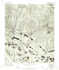
 1934 Newman Peak1934 Print · USGSThe Pinal and Pima County line area is captured here in the mid-1930s, showing a desert landscape shaped by mining and the railroad. Researchers can trace the Southern Pacific line through Redrock or locate the Sasco Mine and 96 Ranch.
 - 1954 Map of Mesa, 1968 Print
 1954 Mesa1968 Print · USGSCentral Arizona in the mid-fifties reveals the rapid growth of the Valley of the Sun alongside the deep-rooted mining districts of the eastern mountains. Genealogists and researchers can trace the expansion of Mesa and Chandler or locate legacy operations at Inspiration Mine and the Magma Arizona railroad.4 unique versions available
 - 1956 Map of Tucson, 1967 Print
 1956 Tucson1967 Print · USGSPost-war Southern Arizona comes into focus as the copper and aviation industries expand around Tucson. Trace family roots in South Tucson or locate early mining sites like the San Manuel Mine and Silver Bell Mine near the Santa Cruz River.3 unique versions available
 - 1957 Map of Mesa
 1957 Mesa1957 Print · USGSCentral Arizona's desert valleys and high-mountain mining districts come alive in the mid-fifties. Researchers can trace the early layout of Mesa and Phoenix or locate remote sites like Inspiration Mine and Arizona State College.
 - 1958 Map of Mesa
 1958 Mesa1958 Print · USGSMid-century Arizona comes alive in this survey of the valley and high desert, where urban growth begins to transform the landscape. Genealogists and researchers can trace the rail-and-mine economy through Inspiration Mine and old stops like Rittenhouse and Magma.
 - 1958 Map of Tucson
 1958 Tucson1958 Print · USGSSouthern Arizona in the late fifties reveals a landscape of desert agriculture and rising military aviation. Trace the rail lines of the Southern Pacific or locate the historic San Xavier Del Bac Mission and the Casa Grande Natl Mon.
 - 1959 Map of Tucson
 1959 Tucson1959 Print · USGSSouthern Arizona in the late fifties shows a landscape of military growth and desert industry. Genealogists and historians can trace the footprint of Davis-Monthan Air Force Base and old mining sites like the San Manuel Mine near Mammoth.2 unique versions available
 - 1960 Map of Mesa
 1960 Mesa1960 Print · USGSThe Salt River Valley and Superstition wilderness are captured here during a era of rapid post-war growth. Researchers can trace the mid-century footprints of Williams AF Base and Arizona State College or locate the deep-rock shafts of the Old Dominion Mine and Magma Mine.
 - 1962 Map of Tucson
 1962 Tucson1962 Print · USGSSouthern Arizona in the early sixties showcases a landscape defined by burgeoning desert cities and massive military installations. Researchers can trace tribal settlements like Schuchk, legacy mining sites at Silver Bell Mine, and the early footprint of Davis-Monthan Air Force Base.
 - 1964 Map of Tucson
 1964 Tucson1964 Print · USGSSouthern Arizona in the mid-1960s shows a landscape of burgeoning desert cities and industrial-scale copper mining. Researchers can trace the development of Tucson and its outlying mining districts, including the Silver Bell Mine and San Manuel Mine.
 - 1964 Map of Mesa
 1964 Mesa1964 Print · USGSCentral Arizona in the mid-1960s reveals a landscape defined by rapid desert urbanization and a massive copper mining industry. Genealogists and historians can trace the growth of Phoenix or explore the mining camps and operations at Miami Mine and Magma Mine.
 - 1964 Map of Valley Farms, 1965 Print
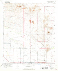
 1964 Valley Farms1965 Print · USGSArizona's desert agriculture is on full display in the 1960s as irrigation canals and rural schools shaped Pinal County. Trace the development of Valley Farms through its local landmarks, including the Kenilworth Sch, Casa Grande Canal, and Sarita Airport.2 unique versions available
 - 1965 Map of Coolidge, 1966 Print
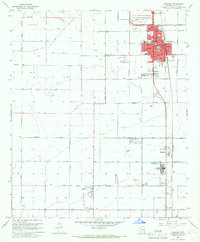 1965 Coolidge1966 Print · USGSMid-century Coolidge is depicted here as a thriving agricultural and rail hub just as the region's desert irrigation systems were fully matured. Researchers can locate specific street layouts in Coolidge, trace the Southern Pacific line, and find landmarks like Casa Grande Ruins National Monument and Randolph.3 unique versions available
 - 1965 Map of Florence, 1967 Print
 1965 Florence1967 Print · USGSThe Pinal County seat and its surrounding irrigation network are captured here in the mid-1960s, showing a desert landscape shaped by water and institutions. Genealogists and historians can locate the State Prison, Florence Cemetery, and the site of Adamsville.3 unique versions available
 - 1966 Map of Blackwater, 1970 Print
 1966 Blackwater1970 Print · USGSPinal County in the mid-1960s reveals a desert landscape shaped by the Gila River and Indigenous lands. Genealogists and researchers can trace the roads around Blackwater, identify a local Cem, and locate landmarks like Walker Butte or the Southern Pacific line.2 unique versions available
 - 1971 Map of Blackwater, 1972 Print
 1971 Blackwater1972 Print · USGSBlackwater and the surrounding Gila River Indian Community are captured here in the early seventies during a period of expanding desert agriculture. Researchers can trace the path of the Gila River and the settlement of Blackwater against the backdrop of Twin Buttes.
 - 1971 Map of Coolidge, 1972 Print
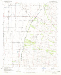
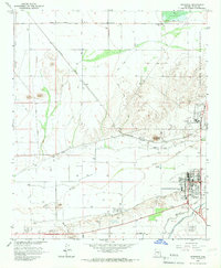
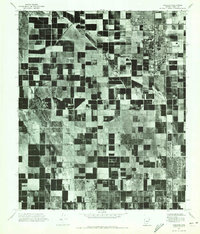 1971 Coolidge1972 Print · USGSPinal County's agricultural heartland is documented in the early 1970s through this aerial-based survey. Local researchers can trace the development of the irrigation grid and the historic footprints of Coolidge, Randolph, and Eleven Mile Corner.
 - 1992 Map of Coolidge, 1995 Print
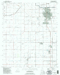 1992 Coolidge1995 Print · USGSCoolidge and the surrounding Gila River valley are captured in the early 1990s, showcasing a landscape of ancient ruins and modern irrigation. Genealogists and historians can trace the development of Randolph, locate the Mary T O'Brien Sch, and explore the grounds of the Casa Grande National Monument.
 - 1992 Map of Valley Farms, 1995 Print
 1992 Valley Farms1995 Print · USGSArizona's Pinal County shows a landscape of complex irrigation and aviation infrastructure in the early 1990s. Researchers can trace the massive Salt Gila Aqueduct, find the Kenilworth Sch, or locate the Coolidge Municipal Airport.
Showing maps 1-25 of 44
Top cities near Coolidge
- San Tan Valley historical maps
- Queen Creek historical maps
- Casa Grande historical maps
- Florence historical maps
- Eloy historical maps
- Arizona City historical maps
Top neighborhoods of Coolidge
- Cross Creek Ranch historical maps
- Heartland historical maps
- Picacho Crossings historical maps
- McClellan Meadows historical maps
Frequently asked questions
- What are the different types of historical maps available for Coolidge?
- What is the oldest map of Coolidge?
- Where can I purchase historical maps of Coolidge for my home or office?
- Where can I download high-res historical maps of Coolidge?
- Are there historical topographic maps available for Coolidge?
- Is there historical aerial imagery available for Coolidge?
- Where are historical maps of Coolidge sourced from?