Old Maps of Eloy, Arizona for Academic Research
Study the evolution of Eloy with 36 high-resolution historic maps. Whether you're teaching, researching, or modeling changes in land use, these maps provide essential visual documentation of urban, environmental, and geographic change.
- Analyze long-term change: Track patterns in development, transportation, and natural features.
- Ideal for environmental or urban studies: Support academic projects with primary historical map data.
- Use in the classroom or lab: Educators and researchers rely on these maps to bring historical context to life.
These maps are a powerful tool for teaching, research, and visualizing how Eloy has changed over the decades.
Eloy, AZ maps
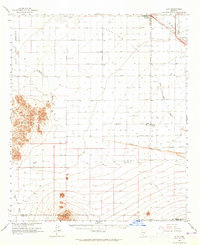
(36)- 1922 Map of Signal Peak, 1959 Print
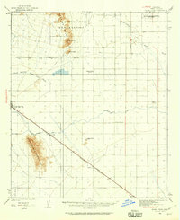 1922 Signal Peak1959 Print · USGSPinal County's desert corridor is captured in the early 1920s as the railroad and new canals began to transform the arid landscape. Genealogists and historians can trace the early footprints of Casa Grande, Arizola, and the American Boy Mine.2 unique versions available
 - 1924 Map of Signal Peak
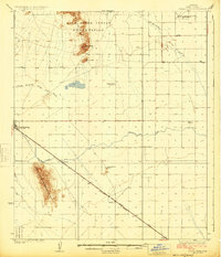 1924 Signal Peak1924 Print · USGSPinal County in the early twenties shows a landscape of desert peaks and growing rail hubs along the Southern Pacific Railroad. Trace the early development of Casa Grande and Eloy near the American Boy Mine and rural Selma School.3 unique versions available
 - 1947 Map of Eloy, 1959 Print
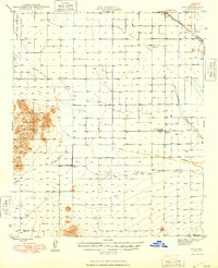
 1947 Eloy1959 Print · USGSThe Pinal County desert just after the war shows a landscape of rail transit and early agricultural irrigation. Trace the development of Eloy and Picacho along the Southern Pacific Railroad or locate the Sawtooth Sch and Friendly Corners.2 unique versions available
 - 1948 Map of Eloy
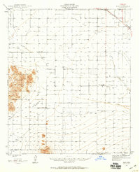
 1948 Eloy1948 Print · USGSMid-century Pinal County comes into focus as a developing agricultural and rail hub centered on the Southern Pacific line. You can trace early irrigation works and rural landmarks like the Sawtooth Sch, the Friendly Corners settlement, and the U S Dept of Agric Farm Labor Camp.
 - 1956 Map of Tucson, 1967 Print
 1956 Tucson1967 Print · USGSPost-war Southern Arizona comes into focus as the copper and aviation industries expand around Tucson. Trace family roots in South Tucson or locate early mining sites like the San Manuel Mine and Silver Bell Mine near the Santa Cruz River.3 unique versions available
 - 1958 Map of Tucson
 1958 Tucson1958 Print · USGSSouthern Arizona in the late fifties reveals a landscape of desert agriculture and rising military aviation. Trace the rail lines of the Southern Pacific or locate the historic San Xavier Del Bac Mission and the Casa Grande Natl Mon.
 - 1959 Map of Tucson
 1959 Tucson1959 Print · USGSSouthern Arizona in the late fifties shows a landscape of military growth and desert industry. Genealogists and historians can trace the footprint of Davis-Monthan Air Force Base and old mining sites like the San Manuel Mine near Mammoth.2 unique versions available
 - 1962 Map of Tucson
 1962 Tucson1962 Print · USGSSouthern Arizona in the early sixties showcases a landscape defined by burgeoning desert cities and massive military installations. Researchers can trace tribal settlements like Schuchk, legacy mining sites at Silver Bell Mine, and the early footprint of Davis-Monthan Air Force Base.
 - 1963 Map of Eloy, 1965 Print
 1963 Eloy1965 Print · USGSThe Santa Cruz Flats are captured here in the early 1960s, showing a landscape of desert irrigation and rail-side growth. Trace the development of Arizona City, the Southern Pacific rail line, and remote outposts like Friendly Corners.2 unique versions available
 - 1964 Map of Tucson
 1964 Tucson1964 Print · USGSSouthern Arizona in the mid-1960s shows a landscape of burgeoning desert cities and industrial-scale copper mining. Researchers can trace the development of Tucson and its outlying mining districts, including the Silver Bell Mine and San Manuel Mine.
 - 1965 Map of Casa Grande Mts, 1966 Print
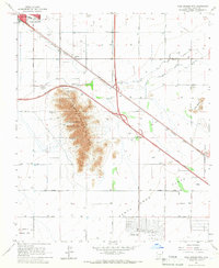 1965 Casa Grande Mts1966 Print · USGSMid-century Pinal County comes alive in this survey of the desert floor, where the Casa Grande Mts rise above developing agricultural lands. Researchers can locate the Mtn View Cem, trace the Southern Pacific line, and see the early layout of Arizona City.3 unique versions available
 - 1965 Map of Eloy North, 1966 Print
 1965 Eloy North1966 Print · USGSThe Pinal County desert transitions toward intensive agriculture in the mid-1960s, framed by the expanding irrigation of the Santa Cruz Flats. Genealogists and local historians can trace early neighborhood plats in Eloy, the rural Toltec Sch, and the industrial sidings along the Southern Pacific railroad.2 unique versions available
 - 1981 Map of Eloy NW
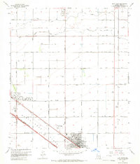
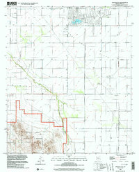
 1981 Eloy NW1981 Print · USGSArizona City and the surrounding Pinal County desert are captured in the early eighties as residential growth met the agricultural basin. Genealogists and historians can trace family-named routes like Alsdorf Road or locate landmarks like Curry Camp and the Lake Towers reservoir.2 unique versions available
 - 1981 Map of Eloy South
 1981 Eloy South1981 Print · USGSThe agricultural heart of Pinal County is captured here in the early eighties as irrigation transformed the high desert. Genealogists and historians can trace the Southern Pacific rail line, find Eloy Memorial Park (Cem), and locate family-named routes like Pretzer Road and Harmon Road.2 unique versions available
 - 1992 Map of Eloy North, 1995 Print
 1992 Eloy North1995 Print · USGSNorth of Eloy in the early nineties, the desert floor was transformed by massive irrigation projects and expanding desert communities. Genealogists and local historians can locate early schools like Toltec Sch and Ceriel Sch, or trace the paths of the Casa Grande Canal and Santa Rosa Canal.
 - 1992 Map of Casa Grande Mountains, 1995 Print
 1992 Casa Grande Mountains1995 Print · USGSPinal County at the start of the nineties shows a desert landscape transformed by irrigation and rail, from the city of Casa Grande to the Santa Cruz Flats. Researchers can trace early settlements like Arizola and historic sites such as Weaver Pioneer Cemetery and St Anthony Sch.
 - 1994 Map of Casa Grande
 1994 Casa Grande1994 Print · USGSPinal County in the early nineties shows a desert landscape shaped by massive irrigation projects and ancient heritage. Trace the path of the Southern Pacific past Casa Grande National Monument Ruins and the Silver Reef Mine.3 unique versions available
 - 1996 Map of Eloy South, 2001 Print
 1996 Eloy South2001 Print · USGSThe Pinal County desert comes into focus in the mid-nineties, showing a landscape defined by industrial agriculture and the Southern Pacific rail line. Trace local history through landmarks like Picacho, the Eloy Memorial Park (Cem), and the Main Canal.
 - 1996 Map of Arizona City, 2003 Print
 1996 Arizona City2003 Print · USGSArizona City and the Santa Cruz Flats are seen in the mid-1990s as a desert landscape of planned residential growth and protected wilderness. Researchers can find old infrastructure like the Landing Strip, isolated sites such as Curry Camp, and the boundaries of the Ironwood Forest National Monument.
 - 2011 Map of Arizona City, 2011 Print
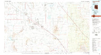
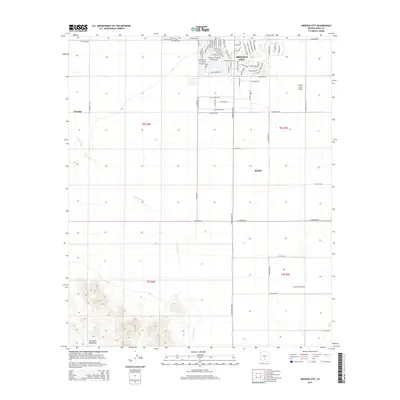
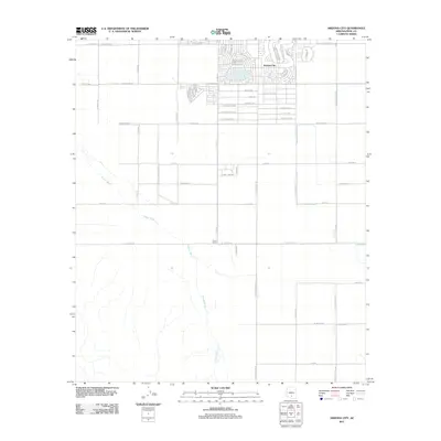 2011 Arizona City2011 Print · USGSCovers Eloy, including Sif Oidak District, San Lucy District, and other nearby areas
 - 2011 Map of Casa Grande Mountains, 2011 Print
 2011 Casa Grande Mountains2011 Print · USGSCovers Eloy, including Casa Grande, Arizona City, and other nearby areas
 - 2011 Map of Eloy South, 2011 Print
 2011 Eloy South2011 Print · USGSCovers Eloy, including Pinal County, United States, and other nearby areas
 - 2011 Map of Eloy North, 2011 Print
 2011 Eloy North2011 Print · USGSCovers Eloy, including Toltec, Pinal County, and other nearby areas
 - 2014 Map of Arizona City, 2014 Print
 2014 Arizona City2014 Print · USGSCovers Eloy, including Sif Oidak District, San Lucy District, and other nearby areas
 - 2014 Map of Eloy South, 2014 Print
 2014 Eloy South2014 Print · USGSCovers Eloy, including Pinal County, United States, and other nearby areas
Showing maps 1-25 of 36
Top cities near Eloy
- Casa Grande historical maps
- Coolidge historical maps
- Arizona City historical maps
- Picacho historical maps
- Chuichu historical maps
Top neighborhoods of Eloy
Frequently asked questions
- What are the different types of historical maps available for Eloy?
- What is the oldest map of Eloy?
- Where can I purchase historical maps of Eloy for my home or office?
- Where can I download high-res historical maps of Eloy?
- Are there historical topographic maps available for Eloy?
- Is there historical aerial imagery available for Eloy?
- Where are historical maps of Eloy sourced from?