Old Maps of Lochiel, Arizona for Metal Detecting
Plan your next treasure hunt with 15 historic maps of Lochiel. Find old homesites, ghost towns, trails, and gathering spots that may be lost to time — perfect for identifying promising metal detecting locations.
- Locate forgotten sites: Uncover places like long-lost settlements, abandoned rail lines, or gathering spots.
- Plan better hunts: Use map overlays combined with LiDAR or satellite views to narrow in on historically rich areas.
- Made for detectorists: Thousands of hobbyists use these maps to discover relics, coins, and hidden history.
Use these historic maps to boost your research and find new opportunities beneath the surface of Lochiel.
Lochiel, AZ maps
(15)- 1905 Map of Nogales
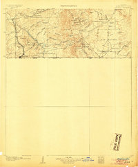 1905 Nogales1905 Print · USGSThe Arizona-Mexico borderlands are captured here at the height of the mining boom and the expansion of the Southern Pacific RR. Genealogists and historians can trace family landholdings from Calabasas to Lochiel or locate remote sites like The Mowry Mine and Fuller's Ranch.4 unique versions available
 - 1932 Map of Lochiel
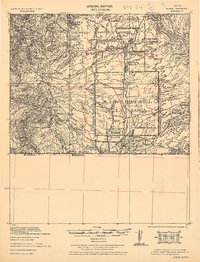 1932 Lochiel1932 Print · USGSThe Arizona-Mexico borderlands come alive in this early 1930s survey of the high desert and San Rafael Valley. Researchers can trace family ranching legacies at Stevensons Ranch or explore the mining history of The Mowry Mine and Harshaw.2 unique versions available
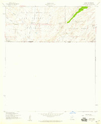
 - 1948 Map of Lochiel SE, 1953 Print
 1948 Lochiel SE1953 Print · USGSSettled along the international boundary in the late 1940s, this area of Santa Cruz County highlights the lonely border outpost of Lochiel. Researchers can locate the U. S. Custom House, the Santa Cruz River, and the Jones Ranch cattle operations.
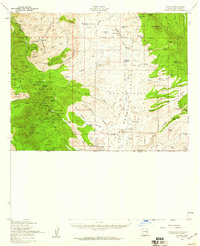
 - 1948 Map of Lochiel, 1958 Print
 1948 Lochiel1958 Print · USGSThe Arizona-Mexico borderlands in the late 1940s reveal a landscape of remote mining camps and sprawling cattle ranches. Researchers can trace the legacy of early mining at Washington Camp and Duquesne, or locate the Custom House at the international crossing in Lochiel.
 - 1956 Map of Nogales, 1963 Print
 1956 Nogales1963 Print · USGSSouthern Arizona in the mid-fifties is captured here from the Papago tribal lands to the San Pedro valley. Genealogists and historians can trace border settlements like Sasabe, the legacy of Tombstone, and old mining sites including the Mary G Mine.4 unique versions available
 - 1958 Map of Nogales
 1958 Nogales1958 Print · USGSSouthern Arizona in the late fifties was a landscape of international borders and high-desert outposts, dominated by the Huachuca Mountains and the Papago Indian Reservation. Local historians can trace old mining camps like Ruby and Greaterville or locate historic military grounds at the Fort Huachuca Military Reservation.
 - 1958 Map of Lochiel, 1959 Print
 1958 Lochiel1959 Print · USGSThe high grasslands of the San Rafael Valley meet the Mexican border in the late fifties, during a time of active ranching and border commerce. Genealogists and historians can locate the US Customhouse at Lochiel, the Parker Canyon School, and family landmarks like Greene Ranch.4 unique versions available
 - 1958 Map of Lochiel, 1959 Print
 1958 Lochiel1959 Print · USGSSouthern Arizona’s mining and ranching frontier is captured here during the mid-century, stretching from the Patagonia Mountains to the San Rafael Valley. Researchers can locate dozens of individual mine shafts and settlements like Duquesne, Washington Camp, and the border outpost of Lochiel.2 unique versions available
 - 1959 Map of Nogales
 1959 Nogales1959 Print · USGSThe Southern Arizona borderlands appear in the late fifties as a complex landscape of military ranges, tribal lands, and high-desert mining towns. Local historians can trace the Southern Pacific rail lines connecting Tombstone and Benson or locate family ranches such as Canoa Ranch.
 - 1994 Map of Nogales
 1994 Nogales1994 Print · USGSThe Arizona-Sonora borderlands come into focus in the mid-1990s, showcasing the intricate Spanish land grants and mining districts that shaped the region. Genealogists and historians can trace old mining camps like Washington Camp and Duquesne or locate the historic Mowry Mine.2 unique versions available
 - 2004 Map of Lochiel, 2007 Print
 2004 Lochiel2007 Print · USGSThe international borderlands of the San Rafael Valley come alive in this map from the turn of the millennium. Genealogists and historians can trace old outposts like Lochiel and San Fernando, alongside several vanished sites including La Escondida (Abandonada).
 - 2012 Map of Lochiel, 2012 Print
 2012 Lochiel2012 Print · USGSCovers Lochiel, including Santa Cruz County, Santa Cruz, and other nearby areas
 - 2014 Map of Lochiel, 2014 Print
 2014 Lochiel2014 Print · USGSCovers Lochiel, including Santa Cruz County, Santa Cruz, and other nearby areas
 - 2018 Map of Lochiel, 2018 Print
 2018 Lochiel2018 Print · USGSCovers Lochiel, including Santa Cruz County, Santa Cruz, and other nearby areas
 - 2021 Map of Lochiel, 2021 Print
 2021 Lochiel2021 Print · USGSThe borderlands of Santa Cruz County are mapped here in the modern era, showing the remote settlement of Lochiel at the international boundary. Genealogists and ranchers can trace the vital water sources of the San Rafael Valley, including Sheehy Spring and Arlene Tank.
End of results
Showing maps 1-15 of 15
Top cities near Lochiel
Frequently asked questions
- What are the different types of historical maps available for Lochiel?
- What is the oldest map of Lochiel?
- Where can I purchase historical maps of Lochiel for my home or office?
- Where can I download high-res historical maps of Lochiel?
- Are there historical topographic maps available for Lochiel?
- Is there historical aerial imagery available for Lochiel?
- Where are historical maps of Lochiel sourced from?