Old Maps of Bagdad, Arizona for Genealogy
Trace your family roots with 16 historic maps of Bagdad. These high-res maps reveal old neighborhoods, homesites, landmarks, and streets — helping you uncover where your ancestors lived and how the area evolved over time.
- Explore historic neighborhoods: Identify where your relatives may have lived in the 1800s or 1900s.
- Compare maps over time: Trace the changes in streets, buildings, and landmarks for multi-generational research.
- Perfect for genealogy & ancestry research: Used by family historians and researchers to map out lineage and migration.
These maps are an incredible resource for exploring your personal connection to Bagdad's past.
Bagdad, AZ maps
(16)- 1923 Map of Signal
 1923 Signal1923 Print · USGSWestern Arizona in the early twenties was a landscape of isolated mining camps and vital desert springs. Genealogists and historians can trace the footprint of early settlements like Signal and Swansea or locate remote outposts such as Owen and Butler well.
 - 1942 Map of Signal
 1942 Signal1942 Print · USGSNorthwestern Arizona was a rugged network of mining camps and river crossings during the early years of the war. Researchers can trace the isolated roads connecting Signal, the mines at Bagdad, and the remote desert outposts of Swansea and Alamo.
 - 1945 Map of Bagdad, 1964 Print
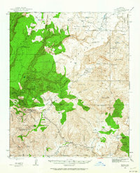 1945 Bagdad1964 Print · USGSThe copper district of Yavapai County is captured here in the mid-1940s, showing the early industrial footprint of Bagdad. Researchers can trace the era's mining landscape through the Black Pearl Mine, Old Dick Mine, and the remote Bozarth Ranch.3 unique versions available
 - 1948 Map of Bagdad
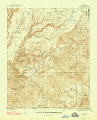 1948 Bagdad1948 Print · USGSArizona's copper and gold mining landscape is captured here in the late 1940s, centered on the growing town of Bagdad. Genealogists and industrial historians can trace early claims and cattle operations through labels like Hillside Mine, Bozarth Ranch, and the Cowboy Mine.2 unique versions available
 - 1950 Map of Prescott, 1951 Print
 1950 Prescott1951 Print · USGSArizona's mining and ranching frontiers were in full operation during the early fifties, from the vertical streets of Jerome to the remote western desert. Genealogists and researchers can trace rural life via the Bland School, the United Verde Mine, and stops along the Atchison Topeka and Santa Fe Railway.
 - 1954 Map of Prescott, 1963 Print
 1954 Prescott1963 Print · USGSYavapai County mining and ranching districts are shown in high detail during the mid-twentieth century. Researchers can trace the legacy of remote camps and transport hubs like Swansea, Octave, and the Bagdad Mine along the desert rail lines.4 unique versions available
 - 1958 Map of Prescott
 1958 Prescott1958 Print · USGSCentral Arizona's rugged mining and ranching corridors come alive in the late fifties. Genealogists and historians can trace the remote Trout Creek School, the mining operations at Jerome, and the rail stops at Skull Valley and Kirkland.
 - 1959 Map of Prescott
 1959 Prescott1959 Print · USGSYavapai County and the central Arizona highlands come alive in the late fifties, showcasing a landscape of mountain mining towns and forest outposts. Researchers can trace the industrial footprints of the United Verde Mine, follow the Atchison Topeka and Santa Fe rails, and locate remote settlements like Swansea or Skull Valley.2 unique versions available
 - 1960 Map of Prescott
 1960 Prescott1960 Print · USGSYavapai County and the surrounding high-desert mining districts are captured here during a period of steady industrial and rail activity. Researchers can trace the routes of the Atchison Topeka and Santa Fe Railway and locate historic sites like the United Verde Mine and Bland School.2 unique versions available
 - 1965 Map of Prescott
 1965 Prescott1965 Print · USGSArizona's mining heartland is captured during the mid-sixties, from the copper mines of Jerome to the cattle country of Williamson Valley Wash. Genealogists and historians can trace old mining camps at Octave and Stanton or the historic Whipple Military Reservation.
 - 1979 Map of Bagdad, 1997 Print
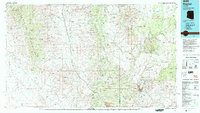 1979 Bagdad1997 Print · USGSArizona's copper and graphite mining districts are captured here in the late seventies, showing the industrial footprint at Bagdad. Researchers can trace old mineral claims like the Boriana Mines and Diamond Joe Mine alongside historic water sources like Coors Well.2 unique versions available
 - 1986 Map of Bagdad
 1986 Bagdad1986 Print · USGSThe mining community of Bagdad is captured in the mid-1980s, showcasing the massive industrial footprint of the Yavapai County highlands. Genealogists and researchers can locate remote Mine Shafts, family-named peaks like Lucy Peak, and infrastructure including the local Airport.2 unique versions available
 - 2011 Map of Bagdad, 2011 Print
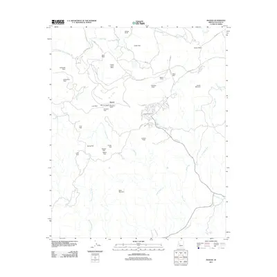 2011 Bagdad2011 Print · USGSCovers Bagdad, including Yavapai County, United States, and other nearby areas
 - 2014 Map of Bagdad, 2014 Print
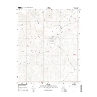 2014 Bagdad2014 Print · USGSCovers Bagdad, including Yavapai County, United States, and other nearby areas
 - 2018 Map of Bagdad, 2018 Print
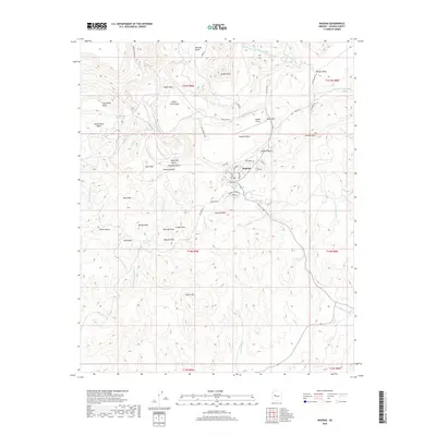 2018 Bagdad2018 Print · USGSCovers Bagdad, including Yavapai County, United States, and other nearby areas
 - 2021 Map of Bagdad, 2021 Print
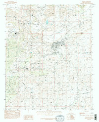
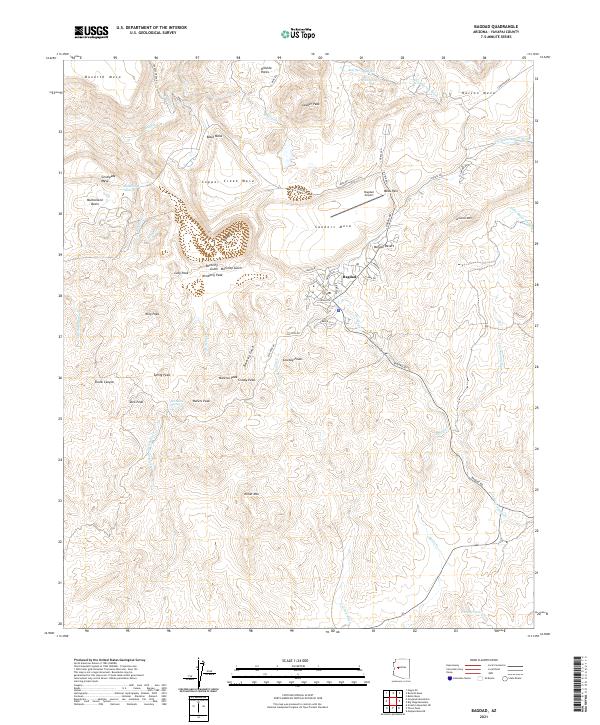 2021 Bagdad2021 Print · USGSThe mining community of Bagdad and its surrounding Yavapai County highlands are captured here in high detail during the early 2020s. Researchers can trace the town's modern footprint from the Bagdad School to the Bagdad Airport, alongside landmarks like Mesa Pass and Miller Mtn.
End of results
Showing maps 1-16 of 16
Frequently asked questions
- What are the different types of historical maps available for Bagdad?
- What is the oldest map of Bagdad?
- Where can I purchase historical maps of Bagdad for my home or office?
- Where can I download high-res historical maps of Bagdad?
- Are there historical topographic maps available for Bagdad?
- Is there historical aerial imagery available for Bagdad?
- Where are historical maps of Bagdad sourced from?