Old Maps of Cottonwood, Arizona for Metal Detecting
Plan your next treasure hunt with 45 historic maps of Cottonwood. Find old homesites, ghost towns, trails, and gathering spots that may be lost to time — perfect for identifying promising metal detecting locations.
- Locate forgotten sites: Uncover places like long-lost settlements, abandoned rail lines, or gathering spots.
- Plan better hunts: Use map overlays combined with LiDAR or satellite views to narrow in on historically rich areas.
- Made for detectorists: Thousands of hobbyists use these maps to discover relics, coins, and hidden history.
Use these historic maps to boost your research and find new opportunities beneath the surface of Cottonwood.
Cottonwood, AZ maps
(45)- 1887 Map of Verde
 1887 Verde1887 Print · USGSCentral Arizona at the height of the territorial era is defined by the military presence at Fort Verde and the ranching settlements below the Mogollon Mesa. Genealogists and researchers can trace the early foundations of Payson, Pine, and Strawberry or locate landmarks like Montezuma Well and Natural Bridge.
 - 1887 Map of Prescott
 1887 Prescott1887 Print · USGSThe central Arizona highlands appear in the territorial era, showing the early development of mining and military outposts. Genealogists can trace family-named sites and vanished camps like Big Bug, Stanton, and the original site of Walnut Grove.
 - 1892 Map of Verde
 1892 Verde1892 Print · USGSArizona's territorial frontier is captured in the late nineteenth century as the first ranching and military outposts emerged. Trace the earliest layouts of Payson, Fort Verde, and Strawberry alongside landmarks like Montezuma Well and Natural Bridge.5 unique versions available
 - 1892 Map of Prescott, 1898 Print
 1892 Prescott1898 Print · USGSCentral Arizona in the late nineteenth century was a territory defined by remote mining camps and military outposts. Genealogists and historians can trace early routes between Prescott and Jerome, locating vanished names like Meersville and Bumble-bee.5 unique versions available
 - 1905 Map of Jerome
 1905 Jerome1905 Print · USGSArizona's copper mining and ranching frontiers come to life in this early century survey of the Verde Valley. Trace the narrow-gauge United Verde and Pacific RR as it climbs toward Jerome, or locate family-named sites like Carter's Ranch and Perkins Ranch.2 unique versions available
 - 1923 Map of Camp Verde
 1923 Camp Verde1923 Print · USGSCentral Arizona's river valleys and high plateaus appear here during the early twenties, showing the region's shift toward tourism and settlement. Trace the routes to Montezuma Castle Nat Monument or locate early sites like Cornville and Aultman.
 - 1932 Map of Camp Verde, 1959 Print
 1932 Camp Verde1959 Print · USGSThe Verde Valley and the Mogollon Rim are documented here in the early 1930s, showing a landscape of remote cattle ranches and historic ruins. Researchers can trace early schools and homesteads like Red Rock Sch, Middle Verde, and Indian Gardens alongside Montezuma Well.2 unique versions available
 - 1936 Map of Camp Verde
 1936 Camp Verde1936 Print · USGSThe Verde Valley and Red Rock country are captured in the mid-1930s, showing a landscape of pioneer ranches and ancient ruins. Researchers can locate the early footprints of Sedona and Camp Verde, alongside remote landmarks like Montezuma Castle National Monument and the Stoneman Lake area.3 unique versions available
 - 1944 Map of Clarkdale
 1944 Clarkdale1944 Print · USGSThe Verde Valley during the mid-1940s shows a complex network of mining infrastructure and ancient history. Local historians can trace the industrial footprint of the Smelter in Clarkdale and the archaeological site at Tuzigoot Nat Mon.5 unique versions available
 - 1944 Map of Mingus Mountain, 1947 Print
 1944 Mingus Mountain1947 Print · USGSYavapai County during the mid-forties reveals a landscape defined by industrial mining and the early infrastructure of the Verde Valley. Genealogists and historians can trace old claims like the Leghorn Mine and early community hubs like Smelter City or the Yarber Sch.4 unique versions available
 - 1947 Map of Mingus Mtn
 1947 Mingus Mtn1947 Print · USGSYavapai County mining and ranching culture are deeply etched into this late-1940s landscape, centered on the high peaks of the Black Hills. Genealogists and historians can trace the foundations of local industry and education through the Iron King Mine, the settlement of Cherry, and the Yarber Sch.
 - 1948 Map of Clarkdale
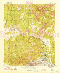 1948 Clarkdale1948 Print · USGSThe mining and smelting centers of the Verde Valley are at their mid-century peak in this survey. Genealogists and industrial historians can trace the United Verde Mine, the neighborhoods of Clarkdale, and remote outposts like Perkinsville along the river rail line.
 - 1950 Map of Prescott, 1951 Print
 1950 Prescott1951 Print · USGSArizona's mining and ranching frontiers were in full operation during the early fifties, from the vertical streets of Jerome to the remote western desert. Genealogists and researchers can trace rural life via the Bland School, the United Verde Mine, and stops along the Atchison Topeka and Santa Fe Railway.
 - 1954 Map of Prescott, 1963 Print
 1954 Prescott1963 Print · USGSYavapai County mining and ranching districts are shown in high detail during the mid-twentieth century. Researchers can trace the legacy of remote camps and transport hubs like Swansea, Octave, and the Bagdad Mine along the desert rail lines.4 unique versions available
 - 1954 Map of Holbrook, 1966 Print
 1954 Holbrook1966 Print · USGSNorth-central Arizona is seen here during the mid-fifties, from the high plateau of the Mogollon Rim to the Verde Valley. Researchers can trace the early growth of Holbrook, locate remote camps like Happy Jack, and explore the roads around Montezuma Castle National Monument.3 unique versions available
 - 1957 Map of Holbrook
 1957 Holbrook1957 Print · USGSNorthern Arizona in the mid-fifties is defined by the high-plateau timberlands and the bustling rail corridor of the Little Colorado River valley. Genealogists and historians can trace the route of U.S. 66 through Holbrook or locate more remote outposts like Zeniff and Aripine.
 - 1958 Map of Holbrook
 1958 Holbrook1958 Print · USGSNortheastern Arizona's high country is captured here during the mid-fifties, showing the growth of mountain towns and timber lands. Researchers can trace the Atchison Topeka & Santa Fe RR through Holbrook or find vanished spots like Zeniff.
 - 1958 Map of Prescott
 1958 Prescott1958 Print · USGSCentral Arizona's rugged mining and ranching corridors come alive in the late fifties. Genealogists and historians can trace the remote Trout Creek School, the mining operations at Jerome, and the rail stops at Skull Valley and Kirkland.
 - 1959 Map of Prescott
 1959 Prescott1959 Print · USGSYavapai County and the central Arizona highlands come alive in the late fifties, showcasing a landscape of mountain mining towns and forest outposts. Researchers can trace the industrial footprints of the United Verde Mine, follow the Atchison Topeka and Santa Fe rails, and locate remote settlements like Swansea or Skull Valley.2 unique versions available
 - 1960 Map of Prescott
 1960 Prescott1960 Print · USGSYavapai County and the surrounding high-desert mining districts are captured here during a period of steady industrial and rail activity. Researchers can trace the routes of the Atchison Topeka and Santa Fe Railway and locate historic sites like the United Verde Mine and Bland School.2 unique versions available
 - 1960 Map of Holbrook
 1960 Holbrook1960 Print · USGSNorthern Arizona is captured here just as modern highways began to reshape the cattle and timber country of the Colorado Plateau. Genealogists and historians can trace the early footprints of Snowflake, Sedona, and Payson, alongside the Atchison Topeka & Santa Fe RR rail line.
 - 1965 Map of Prescott
 1965 Prescott1965 Print · USGSArizona's mining heartland is captured during the mid-sixties, from the copper mines of Jerome to the cattle country of Williamson Valley Wash. Genealogists and historians can trace old mining camps at Octave and Stanton or the historic Whipple Military Reservation.
 - 1968 Map of Cornville, 1971 Print
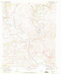 1968 Cornville1971 Print · USGSThe Verde Valley during the late sixties shows the convergence of Oak Creek and the Verde River amidst sprawling cattle and farm lands. Genealogists and historians can locate the Middle Verde Cem and landmarks like the Oak Creek Sch and Cloverleaf Ranch.2 unique versions available
 - 1969 Map of Page Springs, 1971 Print
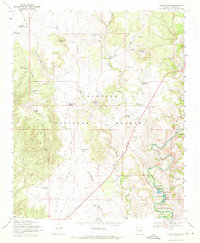 1969 Page Springs1971 Print · USGSYavapai County ranching and conservation efforts are captured here in the late sixties along the well-watered corridor of Oak Creek. Local historians can trace the foundations of Page Springs, the Christian Indian Sch, and the Page Springs State Fish Cultural Station.4 unique versions available
 - 1973 Map of Cottonwood, 1977 Print
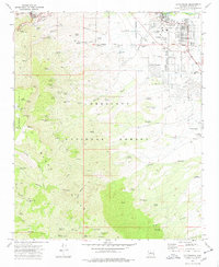 1973 Cottonwood1977 Print · USGSThe Verde Valley and the Black Hills collide in the early seventies, showcasing the mining history of Jerome alongside the growth of Cottonwood. Genealogists and historians can trace deep-level shafts like the Gadsden Shaft or locate the site of the Mingus Union High Sch.3 unique versions available
Showing maps 1-25 of 45
Top cities near Cottonwood
- Prescott Valley historical maps
- Camp Verde historical maps
- Sedona historical maps
- Dewey-Humboldt historical maps
- Clarkdale historical maps
- Jerome historical maps
Top neighborhoods of Cottonwood
Frequently asked questions
- What are the different types of historical maps available for Cottonwood?
- What is the oldest map of Cottonwood?
- Where can I purchase historical maps of Cottonwood for my home or office?
- Where can I download high-res historical maps of Cottonwood?
- Are there historical topographic maps available for Cottonwood?
- Is there historical aerial imagery available for Cottonwood?
- Where are historical maps of Cottonwood sourced from?