1960s Maps of Cottonwood, Arizona
Explore 5 historic maps of Cottonwood from the 1960s. These maps offer a rare glimpse into what life looked like during the 1960s — showing old roads, neighborhoods, homes, and landmarks that have changed or disappeared over time.
Whether you're researching your family's past, planning a metal detecting trip, or studying how Cottonwood's landscape evolved across the 1960s, these high-resolution maps are a powerful tool for exploring the history of this region.
- Focus on a specific era: All maps on this page are from the 1960s, giving you a focused view of this time period.
- See what’s changed: Compare century-old streets, trails, and buildings to today's modern landscape using overlays and satellite layers.
- Research with precision: Use these maps for genealogy, historical research, land use analysis, or educational projects.
- View, download, or print: Maps are fully viewable online in high resolution, and can be downloaded or printed for your own records.
Start exploring Cottonwood's history through authentic maps from the 1960s. This is your window into the past.
Cottonwood, AZ maps
(5)- 1960 Map of Prescott
 1960 Prescott1960 Print · USGSYavapai County and the surrounding high-desert mining districts are captured here during a period of steady industrial and rail activity. Researchers can trace the routes of the Atchison Topeka and Santa Fe Railway and locate historic sites like the United Verde Mine and Bland School.2 unique versions available
 - 1960 Map of Holbrook
 1960 Holbrook1960 Print · USGSNorthern Arizona is captured here just as modern highways began to reshape the cattle and timber country of the Colorado Plateau. Genealogists and historians can trace the early footprints of Snowflake, Sedona, and Payson, alongside the Atchison Topeka & Santa Fe RR rail line.
 - 1965 Map of Prescott
 1965 Prescott1965 Print · USGSArizona's mining heartland is captured during the mid-sixties, from the copper mines of Jerome to the cattle country of Williamson Valley Wash. Genealogists and historians can trace old mining camps at Octave and Stanton or the historic Whipple Military Reservation.
 - 1968 Map of Cornville, 1971 Print
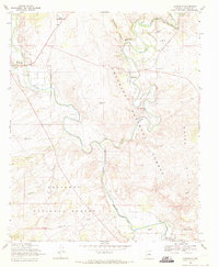 1968 Cornville1971 Print · USGSThe Verde Valley during the late sixties shows the convergence of Oak Creek and the Verde River amidst sprawling cattle and farm lands. Genealogists and historians can locate the Middle Verde Cem and landmarks like the Oak Creek Sch and Cloverleaf Ranch.2 unique versions available
 - 1969 Map of Page Springs, 1971 Print
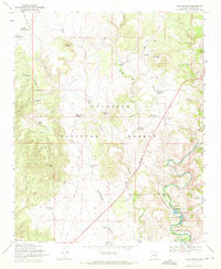 1969 Page Springs1971 Print · USGSYavapai County ranching and conservation efforts are captured here in the late sixties along the well-watered corridor of Oak Creek. Local historians can trace the foundations of Page Springs, the Christian Indian Sch, and the Page Springs State Fish Cultural Station.4 unique versions available
End of results
Showing maps 1-5 of 5
Top cities near Cottonwood
- Prescott Valley historical maps
- Camp Verde historical maps
- Sedona historical maps
- Dewey-Humboldt historical maps
- Clarkdale historical maps
- Jerome historical maps
Top neighborhoods of Cottonwood
Frequently asked questions
- What are the different types of historical maps available for Cottonwood?
- What is the oldest map of Cottonwood?
- Where can I purchase historical maps of Cottonwood for my home or office?
- Where can I download high-res historical maps of Cottonwood?
- Are there historical topographic maps available for Cottonwood?
- Is there historical aerial imagery available for Cottonwood?
- Where are historical maps of Cottonwood sourced from?