2020s Maps of Dewey-Humboldt, Arizona
Explore 6 historic maps of Dewey-Humboldt from the 2020s. These maps offer a rare glimpse into what life looked like during the 2020s — showing old roads, neighborhoods, homes, and landmarks that have changed or disappeared over time.
Whether you're researching your family's past, planning a metal detecting trip, or studying how Dewey-Humboldt's landscape evolved across the 2020s, these high-resolution maps are a powerful tool for exploring the history of this region.
- Focus on a specific era: All maps on this page are from the 2020s, giving you a focused view of this time period.
- See what’s changed: Compare century-old streets, trails, and buildings to today's modern landscape using overlays and satellite layers.
- Research with precision: Use these maps for genealogy, historical research, land use analysis, or educational projects.
- View, download, or print: Maps are fully viewable online in high resolution, and can be downloaded or printed for your own records.
Start exploring Dewey-Humboldt's history through authentic maps from the 2020s. This is your window into the past.
Dewey-Humboldt, AZ maps
(6)- 2021 Map of Mayer, 2021 Print
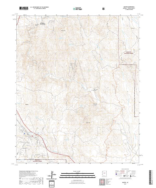 2021 Mayer2021 Print · USGSThe high-desert landscapes of Yavapai County are captured here at the dawn of the 2020s. Genealogists and historians can trace the local development of Mayer and Dewey-Humboldt, or locate family sites near Mayer Cem and the Agua Fria River.
 - 2021 Map of Poland Junction, 2021 Print
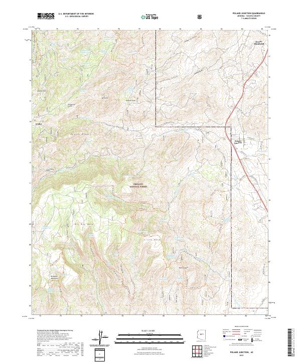 2021 Poland Junction2021 Print · USGSYavapai County mining and mountain life are captured here during the early twenty-first century. Genealogists and historians can trace the paths between Poland Junction and Walker, locating the Bannie Mine and the Poland-Walker Tunnel.
 - 2021 Map of Prescott Valley South, 2021 Print
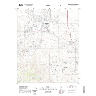 2021 Prescott Valley South2021 Print · USGSCovers Dewey-Humboldt, including Prescott Valley, Blue Hills Farms, and other nearby areas
 - 2021 Map of Humboldt, 2021 Print
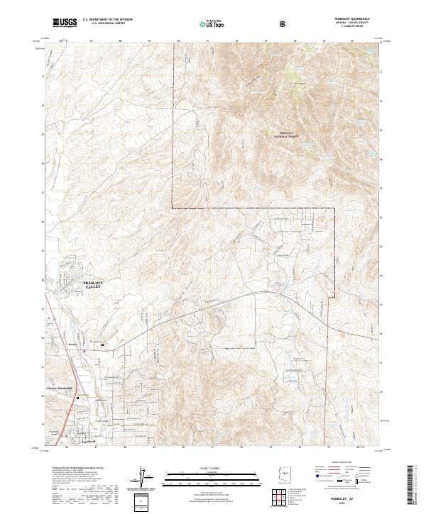 2021 Humboldt2021 Print · USGSThe Agua Fria River valley in Yavapai County shows its modern evolution from a mining and ranching hub into a growing residential region. Researchers can locate family landmarks such as Humboldt Cem or trace the early settlement footprints of Dewey and Humboldt.
 - 2023 Map of Prescott Valley South, 2023 Print
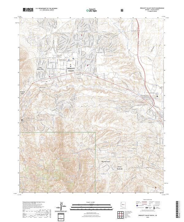 2023 Prescott Valley South2023 Print · USGSYavapai County's high desert communities and the edge of the national forest are mapped in extensive detail during a period of modern growth. Genealogists and hikers can locate the Angeline Hoagland Gravesite, trace the Agua Fria River, or explore the drainages of Charcoal Gulch.
 - 2026 Map of Humboldt, 2026 Print
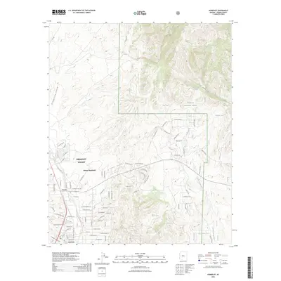 2026 Humboldt2026 Print · USGSCovers Dewey-Humboldt, including Prescott Valley, Dewey, and other nearby areas
End of results
Showing maps 1-6 of 6
Top cities near Dewey-Humboldt
- Prescott historical maps
- Prescott Valley historical maps
- Cottonwood historical maps
- Clarkdale historical maps
- Cordes Lakes historical maps
- Spring Valley historical maps
See more
Top neighborhoods of Dewey-Humboldt
Frequently asked questions
- What are the different types of historical maps available for Dewey-Humboldt?
- What is the oldest map of Dewey-Humboldt?
- Where can I purchase historical maps of Dewey-Humboldt for my home or office?
- Where can I download high-res historical maps of Dewey-Humboldt?
- Are there historical topographic maps available for Dewey-Humboldt?
- Is there historical aerial imagery available for Dewey-Humboldt?
- Where are historical maps of Dewey-Humboldt sourced from?