1940s Maps of Fort Yuma Riviera, Arizona
Explore 4 historic maps of Fort Yuma Riviera from the 1940s. These maps offer a rare glimpse into what life looked like during the 1940s — showing old roads, neighborhoods, homes, and landmarks that have changed or disappeared over time.
Whether you're researching your family's past, planning a metal detecting trip, or studying how Fort Yuma Riviera's landscape evolved across the 1940s, these high-resolution maps are a powerful tool for exploring the history of this region.
- Focus on a specific era: All maps on this page are from the 1940s, giving you a focused view of this time period.
- See what’s changed: Compare century-old streets, trails, and buildings to today's modern landscape using overlays and satellite layers.
- Research with precision: Use these maps for genealogy, historical research, land use analysis, or educational projects.
- View, download, or print: Maps are fully viewable online in high resolution, and can be downloaded or printed for your own records.
Start exploring Fort Yuma Riviera's history through authentic maps from the 1940s. This is your window into the past.
Fort Yuma Riviera, AZ maps
(4)- 1940 Map of Yuma, 1956 Print
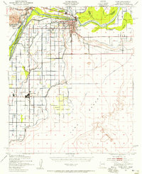 1940 Yuma1956 Print · USGSYuma and the surrounding desert irrigation districts are captured here at the start of the 1940s as the river economy matured. Genealogists and local historians can trace the foundations of Somerton, the Indian Sch, and family-named schools like Crane Sch.3 unique versions available
 - 1942 Map of Yuma
 1942 Yuma1942 Print · USGSThe desert frontier near Yuma underwent a massive transformation during the early war years as irrigation and military infrastructure expanded. Researchers can trace the development of the All American Canal Project and locate numerous historic workings like the Fortuna Mine and Old Senator Mine.
 - 1945 Map of Picacho Peak
 1945 Picacho Peak1945 Print · USGSThe Colorado River borderlands in the mid-1940s reveal a landscape defined by massive irrigation projects and desert mining. Researchers can trace the development of the Yuma Indian Reservation and locate early landmarks like Picacho Mine, Bard, and Laguna Sch.
 - 1945 Map of Yuma
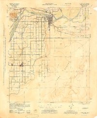 1945 Yuma1945 Print · USGSThe desert crossroads at Yuma come alive in this wartime-era survey, revealing the complex irrigation and rail networks that fueled the border economy. Genealogists and historians can locate early landmarks like Indian School Watertank, Crane Sch, and Yuma Cem.
End of results
Showing maps 1-4 of 4
Top cities near Fort Yuma Riviera
- Yuma historical maps
- Fortuna Foothills historical maps
- Somerton historical maps
- Avenue B & C historical maps
- Donovan Estates historical maps
- Martinez Lake historical maps
See more
Frequently asked questions
- What are the different types of historical maps available for Fort Yuma Riviera?
- What is the oldest map of Fort Yuma Riviera?
- Where can I purchase historical maps of Fort Yuma Riviera for my home or office?
- Where can I download high-res historical maps of Fort Yuma Riviera?
- Are there historical topographic maps available for Fort Yuma Riviera?
- Is there historical aerial imagery available for Fort Yuma Riviera?
- Where are historical maps of Fort Yuma Riviera sourced from?