Old Maps of Big Flat, Arkansas
Explore 30 old maps of Big Flat, spanning from 1890 to today. These high-resolution historic maps reveal how streets, neighborhoods, landmarks, and natural features evolved over time — perfect for genealogy, metal detecting, research, and local history exploration.
What you can do with these maps:
- See how Big Flat changed over time: Compare historical maps to modern-day views to trace roads, homesites, rail lines & more.
- View detailed metadata: Each map includes creators, publishers, year, scale, and archive source.
- Overlay maps with satellite & LiDAR: Visualize the past alongside modern tools to explore terrain & human change.
- Trusted historical sources: Maps sourced from the USGS, Library of Congress, and other archives.
- Access maps your way: View online, download high-res files, or order prints for personal or research use.
Start exploring old maps of Big Flat to uncover forgotten places, hidden landmarks, and the deep history beneath your feet.
Big Flat, AR maps
(30)- 1890 Map of Mountain Home, 1954 Print
 1890 Mountain Home1954 Print · USGSThe Ozark plateau in the late nineteenth century remains a rugged landscape of winding river valleys and isolated hilltop settlements. Genealogists can trace family footprints across Mountain Home, Buffalo City, and Calico Rock before modern dams reshaped the White River.
 - 1891 Map of Mountain Home
 1891 Mountain Home1891 Print · USGSThe Ozark wilderness around Mountain Home is shown here in the late nineteenth century, dominated by a wild river system. Researchers can trace the network of old river crossings like Traceys F'y and Nelsons F'y alongside early towns such as Buffalo City.
 - 1892 Map of Mountain View
 1892 Mountain View1892 Print · USGSThe Arkansas Ozarks are mapped here in the late nineteenth century, a time when river ferries and fords were the primary connections between isolated mountain towns. Trace the early streets of Mountain View and Clinton, or locate old crossings at Upper Fy. and Wilsons Fd.
 - 1894 Map of Mountain View
 1894 Mountain View1894 Print · USGSThe Arkansas Ozark foothills and river valleys are shown in the 1890s as a network of isolated homesteads and river landings. Genealogists can trace early families near Mountain View, Clinton, and river crossings like Upper Fy. or Goffs Cove.5 unique versions available
 - 1894 Map of Mountain Home
 1894 Mountain Home1894 Print · USGSNorthern Arkansas in the 1890s was a rugged territory defined by the winding White and Buffalo rivers. Genealogists and local historians can trace early river crossings and settlements like Traceys Fy & Fd, Ships Fy, Buffalo City, and Henderson.6 unique versions available
 - 1945 Map of Harrison
 1945 Harrison1945 Print · USGSThe Ozark and Boston Mountains straddle the Missouri-Arkansas border during the mid-forties, showing a landscape of forest ridges and river valleys. Genealogists and historians can trace rail-connected towns like Monett and West Plains or early lake developments at Bull Shoals Res and Norfork Lake.
 - 1949 Map of Harrison
 1949 Harrison1949 Print · USGSThe Ozark highlands of northern Arkansas and southern Missouri are shown just after the war, when the White River still followed its original course. Genealogists and historians can trace rail lines like the Missouri & Arkansas RR and locate rural hubs like Harrison, Eureka Springs, and Mountain Home.
 - 1954 Map of Harrison
 1954 Harrison1954 Print · USGSThe Ozarks and Boston Mountains meet during a period of massive river engineering in the mid-fifties. Researchers can trace the early shorelines of Bull Shoals Lake and Table Rock Reservoir or locate inland towns like Berryville and Harrison.
 - 1956 Map of Russellville
 1956 Russellville1956 Print · USGSThe Arkansas River valley and the surrounding Boston Mountains are captured here in the mid-fifties, showing a landscape of small timber towns and new reservoirs. Genealogists can trace family roots through upland settlements like Pelsor and Witts Springs or locate the campus of Arkansas Polytechnic College.2 unique versions available
 - 1958 Map of Harrison, 1973 Print
 1958 Harrison1973 Print · USGSThe Ozark and Boston Mountains appear in this mid-century survey as the great White River impoundments were reshaping the region. Researchers can trace the rail lines of the St Louis-San Francisco Ry and locate early settlements like Berryville and Gainesville.
 - 1964 Map of Russellville
 1964 Russellville1964 Print · USGSMid-century Central Arkansas is defined here by the river-valley towns and the surrounding mountain ranges before the full expansion of the interstate system. Genealogists and historians can trace rail-town development along the Missouri Pacific Railroad and locate landmarks like Arkansas Polytechnic College or Petit Jean State Park.
 - 1964 Map of Harrison
 1964 Harrison1964 Print · USGSThe Ozark and Boston Mountains of Arkansas and Missouri are captured here in the mid-sixties, showing the rugged highlands before extensive modern development. Genealogists and historians can trace family-named peaks like Gaither Mountain and follow the St Louis-San Francisco RR through Monett and Purdy.
 - 1966 Map of Big Flat, 1967 Print
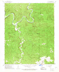 1966 Big Flat1967 Print · USGSThe Buffalo River highlands in the mid-sixties show a landscape of deep hollows and isolated mountain knobs. Genealogists and local historians can trace the roads around Big Flat, locate the local Cem, and explore the terrain near Suggs Mountain and Almus Knob.3 unique versions available
 - 1972 Map of Landis, 1973 Print
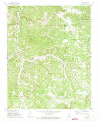 1972 Landis1973 Print · USGSThe Ozark highlands of northern Arkansas are captured here in the early seventies, showcasing a network of remote hollows and mountain ridges. Genealogists can locate several family burial sites and country churches including Landis Cem, Scribner Cem, and Bluff Springs Ch.2 unique versions available
 - 1977 Map of Russellville
 1977 Russellville1977 Print · USGSThe Arkansas River Valley and surrounding Ozark Mountains are documented here during a period of significant postwar growth and infrastructure development. Genealogists and researchers can locate family landmarks such as Mount Carmel Cem, St Josephs Church, and several remote Coal Mine sites along the Missouri Pacific RR line.
 - 1983 Map of Mountain View
 1983 Mountain View1983 Print · USGSNorth-central Arkansas comes into sharp focus during the early eighties, showing the transition from traditional Ozark mountain settlements to a landscape shaped by major reservoirs. Genealogists and historians can trace family roots through mountain hamlets like Snowball, Witts Springs, and Timbo, or locate landmarks such as Zion Hill Church and the Missouri Pacific Railroad.
 - 1984 Map of Russellville
 1984 Russellville1984 Print · USGSThe Arkansas River valley was undergoing significant change in the 1950s as transportation and water management reshaped the region from Russellville to Conway. Researchers can trace the era's rail networks like the Missouri Pacific RR and explore landmarks like Magazine Mountain and Petit Jean State Park.
 - 1985 Map of Bull Shoals Lake
 1985 Bull Shoals Lake1985 Print · USGSThe mid-1980s Ozark Plateau is captured here during a era of significant growth around the sprawling shorelines of Bull Shoals Lake and Norfork Lake. Genealogists and historians can trace the rail-and-river economy through Buffalo City and the Missouri Pacific RR line.
 - 1985 Map of Harrison
 1985 Harrison1985 Print · USGSThe Ozark highlands and the White River valley are seen here in the mid-1980s, showcasing a region defined by its massive reservoirs and protected wilderness. You can trace the rugged corridors of the Missouri & North Arkansas RR or locate historic settlements like Eureka Springs and Jasper.
 - 1992 Map of Russellville, 1993 Print
 1992 Russellville1993 Print · USGSCentral Arkansas in the early nineties shows a landscape defined by the Arkansas River valley and the surrounding national forests. Trace the development of river towns like Russellville and Dardanelle alongside landmarks such as Lake Dardanelle and Magazine Mtn.
 - 2011 Map of Landis, 2011 Print
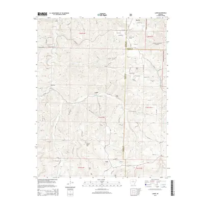
 2011 Landis2011 Print · USGSCovers Big Flat, including Fairview, Thola, and other nearby areas
 - 2011 Map of Big Flat, 2011 Print
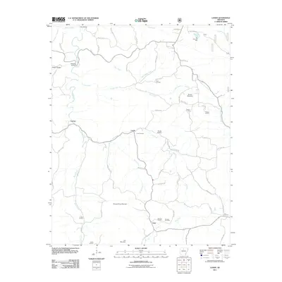
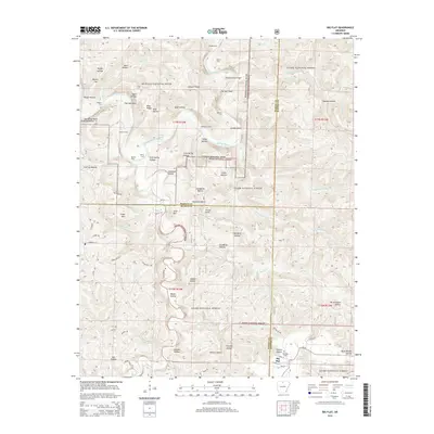
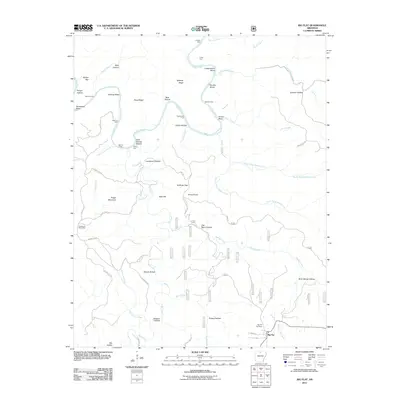 2011 Big Flat2011 Print · USGSCovers Big Flat, including Baxter County, Marion County, and other nearby areas
 - 2014 Map of Landis, 2014 Print
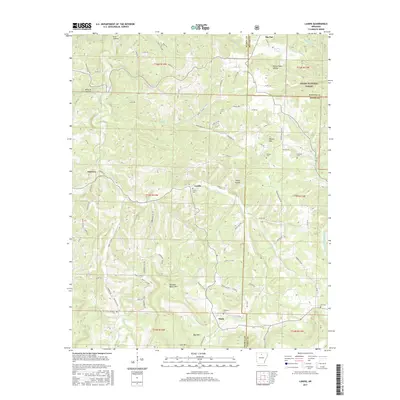
 2014 Landis2014 Print · USGSCovers Big Flat, including Fairview, Thola, and other nearby areas
 - 2014 Map of Big Flat, 2014 Print
 2014 Big Flat2014 Print · USGSCovers Big Flat, including Baxter County, Marion County, and other nearby areas
 - 2017 Map of Landis, 2017 Print
 2017 Landis2017 Print · USGSCovers Big Flat, including Fairview, Thola, and other nearby areas
Showing maps 1-25 of 30
Top cities near Big Flat
- Marshall historical maps
- Norfork historical maps
- Salesville historical maps
- Leslie historical maps
- Fifty-Six historical maps
Frequently asked questions
- What are the different types of historical maps available for Big Flat?
- What is the oldest map of Big Flat?
- Where can I purchase historical maps of Big Flat for my home or office?
- Where can I download high-res historical maps of Big Flat?
- Are there historical topographic maps available for Big Flat?
- Is there historical aerial imagery available for Big Flat?
- Where are historical maps of Big Flat sourced from?