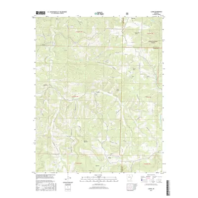
2017 Map of Landis
USGS Topo · Published 2017About this map
Ozark National Forest lands dominate the northeastern corner of this landscape, where the rugged topography of the Boston Mountains meets a network of small settlements. The community of Big Flat sits near the northern boundary, characterized by its proximity to Big Flat Lake and the headwaters of Roasting Ear Cr. To the south and west, the terrain is defined by deep drainages like Wildcat Hollow and Elm Hollow, as well as significant elevations such as Buzzard Roost Mtn and Blue Mtn. Smaller hamlets like Landis and Thola serve as local hubs, connected by a winding network of county roads including Searcy 73 Hwy and Round Mountain Rd. Genealogists will find a high density of burial sites across the ridges, from the Treat Cem in the north to the Passmore Cem and Scribner Cem farther south.
Find a feature on this map
97 named features on this map. Tap any name to fly to it.
Don’t see what you’re looking for? This feature index may not catch every label — zoom into the map to look around manually.
Map Details
Editions of this 2017 Landis Map
This is the sole edition of this map. No revisions or reprints were ever made.
Other maps of this area

1890 · Mountain Home
USGS Topo · 1:125,000

1891 · Mountain Home
USGS Topo · 1:125,000

1892 · Marshall
USGS Topo · 1:125,000

1892 · Mountain View
USGS Topo · 1:125,000

1893 · Yellville
USGS Topo · 1:125,000

1894 · Mountain View
USGS Topo · 1:125,000

1894 · Mountain Home
USGS Topo · 1:125,000

1894 · Marshall
USGS Topo · 1:125,000

1901 · Marshall
USGS Topo · 1:125,000

1903 · Yellville
USGS Topo · 1:125,000