Old Maps of Lower Boydsville, Arkansas for Genealogy
Trace your family roots with 13 historic maps of Lower Boydsville. These high-res maps reveal old neighborhoods, homesites, landmarks, and streets — helping you uncover where your ancestors lived and how the area evolved over time.
- Explore historic neighborhoods: Identify where your relatives may have lived in the 1800s or 1900s.
- Compare maps over time: Trace the changes in streets, buildings, and landmarks for multi-generational research.
- Perfect for genealogy & ancestry research: Used by family historians and researchers to map out lineage and migration.
These maps are an incredible resource for exploring your personal connection to Lower Boydsville's past.
Lower Boydsville, AR maps
(13)- 1935 Map of Rector, 1936 Print
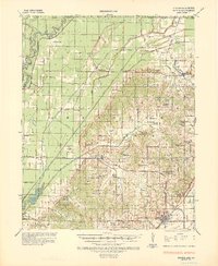 1935 Rector1936 Print · USGSClay County at the height of the 1930s drainage era shows a landscape being reshaped by massive flood control projects and rail expansion. Genealogists can locate family landmarks like Boydsville, the Trovillon Cem, and rural schoolhouses such as Turtle Knob Sch.3 unique versions available
 - 1957 Map of Poplar Bluff, 1968 Print
 1957 Poplar Bluff1968 Print · USGSThe Missouri-Arkansas border region is captured here as the timber and rail industries shaped the Ozark foothills. Genealogists and historians can trace the Missouri Pacific Railroad through river towns like Pocahontas, Greenville, and Van Buren.3 unique versions available
 - 1958 Map of Rector, 1962 Print
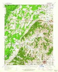 1958 Rector1962 Print · USGSClay County at the edge of the Missouri Bootheel was a landscape of ridge-top settlements and engineered bottomlands in the late fifties. Genealogists can trace family footprints across dozens of local landmarks like Knob Sch, Boydsville, and the Crockett Cem.2 unique versions available
 - 1959 Map of Poplar Bluff
 1959 Poplar Bluff1959 Print · USGSThe Missouri Ozarks and Arkansas borderlands meet in this late 1950s study of the region's diverse terrain and rail-fed towns. Researchers can trace the path of the Missouri Pacific Railroad through Poplar Bluff or locate smaller settlements like Birch Tree and Myrtle.
 - 1960 Map of Rector
 1960 Rector1960 Print · USGSClay County at the end of the fifties reveals a landscape shaped by the rise of Crowleys Ridge and an intricate network of drainage ditches. Local historians can trace the foundations of Rector and Boydsville or locate rural landmarks like the Knob Sch and Purcell Mill.
 - 1960 Map of Poplar Bluff
 1960 Poplar Bluff1960 Print · USGSSoutheast Missouri and Northeast Arkansas are captured here during the post-war era, showing the transition from the Ozark highlands to the Delta. Genealogists and historians can trace rail corridors like the St. Louis Southwestern RR and remote settlements such as Birch Tree and Warm Springs.
 - 1984 Map of Paragould
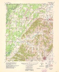
 1984 Paragould1984 Print · USGSNortheast Arkansas and the Missouri Bootheel appear here in the mid-1980s as a landscape of ridge-top towns and engineered delta drainage. Genealogists and historians can locate rural landmarks like Oak Grove Church, trace the St Louis San Francisco RR, or explore the limits of Crowleys Ridge State Park.2 unique versions available
 - 1984 Map of Boydsville
 1984 Boydsville1984 Print · USGSClay County's landscape in the early eighties is defined by the rise of Crowleys Ridge over the engineered lowlands of the Cache River. Genealogists and local historians can trace family locations near Boydsville, Tipperary, and the settlement at Knob.2 unique versions available
 - 2011 Map of Boydsville, 2011 Print
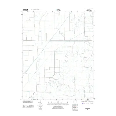 2011 Boydsville2011 Print · USGSCovers Lower Boydsville, including Knob, Boydsville, and other nearby areas
 - 2014 Map of Boydsville, 2014 Print
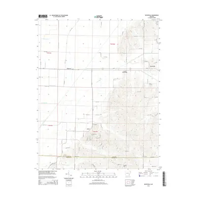 2014 Boydsville2014 Print · USGSCovers Lower Boydsville, including Knob, Boydsville, and other nearby areas
 - 2017 Map of Boydsville, 2017 Print
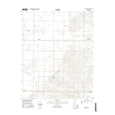 2017 Boydsville2017 Print · USGSCovers Lower Boydsville, including Knob, Boydsville, and other nearby areas
 - 2020 Map of Boydsville, 2020 Print
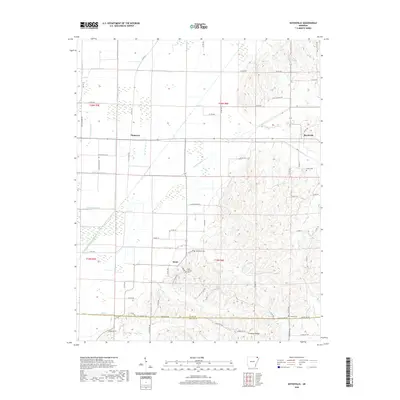 2020 Boydsville2020 Print · USGSCovers Lower Boydsville, including Knob, Boydsville, and other nearby areas
 - 2024 Map of Boydsville, 2024 Print
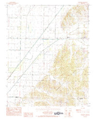
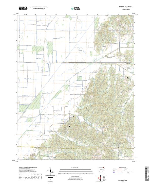 2024 Boydsville2024 Print · USGSClay County history is defined by the rise of Crowleys Ridge out of the delta flats. Local researchers can trace old settlements like Boydsville and Knob, alongside historic sites such as Salem Cem and Rock Springs Cem.
End of results
Showing maps 1-13 of 13
Top cities near Lower Boydsville
- Piggott historical maps
- Corning historical maps
- Rector historical maps
- Marmaduke historical maps
- Oak Grove Heights historical maps
- Neelyville historical maps
See more
Frequently asked questions
- What are the different types of historical maps available for Lower Boydsville?
- What is the oldest map of Lower Boydsville?
- Where can I purchase historical maps of Lower Boydsville for my home or office?
- Where can I download high-res historical maps of Lower Boydsville?
- Are there historical topographic maps available for Lower Boydsville?
- Is there historical aerial imagery available for Lower Boydsville?
- Where are historical maps of Lower Boydsville sourced from?