1980s Maps of Piggott, Arkansas
Explore 3 historic maps of Piggott from the 1980s. These maps offer a rare glimpse into what life looked like during the 1980s — showing old roads, neighborhoods, homes, and landmarks that have changed or disappeared over time.
Whether you're researching your family's past, planning a metal detecting trip, or studying how Piggott's landscape evolved across the 1980s, these high-resolution maps are a powerful tool for exploring the history of this region.
- Focus on a specific era: All maps on this page are from the 1980s, giving you a focused view of this time period.
- See what’s changed: Compare century-old streets, trails, and buildings to today's modern landscape using overlays and satellite layers.
- Research with precision: Use these maps for genealogy, historical research, land use analysis, or educational projects.
- View, download, or print: Maps are fully viewable online in high resolution, and can be downloaded or printed for your own records.
Start exploring Piggott's history through authentic maps from the 1980s. This is your window into the past.
Piggott, AR maps
(3)- 1984 Map of Greenway
 1984 Greenway1984 Print · USGSClay County at the start of the eighties shows a landscape shaped by the ridge and the rail. Trace family roots and local history through the Holly Island Community, Hargrave Corner, and the path of the St Louis Southwestern railroad.2 unique versions available
 - 1984 Map of Piggott
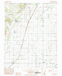
 1984 Piggott1984 Print · USGSClay County, Arkansas, was a landscape of river-bend borders and rail lines in the early 1980s. Genealogists and historians can trace the paths of the St Louis Southwestern railroad and locate old river features like Bass Island and Chalk Bluff.
 - 1984 Map of Paragould
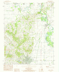
 1984 Paragould1984 Print · USGSNortheast Arkansas and the Missouri Bootheel appear here in the mid-1980s as a landscape of ridge-top towns and engineered delta drainage. Genealogists and historians can locate rural landmarks like Oak Grove Church, trace the St Louis San Francisco RR, or explore the limits of Crowleys Ridge State Park.2 unique versions available
End of results
Showing maps 1-3 of 3
Top cities near Piggott
- Kennett historical maps
- Malden historical maps
- Rector historical maps
- Campbell historical maps
- Clarkton historical maps
- Marmaduke historical maps
See more
Frequently asked questions
- What are the different types of historical maps available for Piggott?
- What is the oldest map of Piggott?
- Where can I purchase historical maps of Piggott for my home or office?
- Where can I download high-res historical maps of Piggott?
- Are there historical topographic maps available for Piggott?
- Is there historical aerial imagery available for Piggott?
- Where are historical maps of Piggott sourced from?