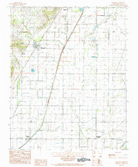
1984 Map of Greenway
USGS Topo · Published 1984About this map
Crowley S Ridge dominates the western landscape of this Clay County survey, providing a distinct topographic contrast to the low-lying agricultural lands to the east. The St Louis Southwestern railroad serves as the primary spine for settlement, connecting the communities of Mitchell, Greenway, and the southern edge of Piggott. This rail corridor influenced the distribution of homesteads and businesses during the mid-20th century, as seen in the clusterings around these established stops.
Find a feature on this map
17 named features on this map. Tap any name to fly to it.
Don’t see what you’re looking for? This feature index may not catch every label — zoom into the map to look around manually.
Map Details
Editions of this 1984 Greenway Map
2 editions found
Other maps of this area

1934 · Kennett
USGS Topo · 1:62,500

1935 · Rector
USGS Topo · 1:62,500

1940 · Marmaduke
USGS Topo · 1:62,500

1940 · Kennett
USGS Topo · 1:62,500

1940 · Piggott
USGS Topo · 1:62,500

1956 · Kennett
USGS Topo · 1:62,500

1956 · Piggott
USGS Topo · 1:62,500

1957 · Poplar Bluff
USGS Topo · 1:250,000

1958 · Marmaduke
USGS Topo · 1:62,500

1958 · Rector
USGS Topo · 1:62,500