
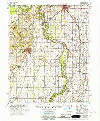
1956 Map of Piggott
USGS Topo · Published 1956About this map
The St Francis River forms a winding corridor through this section of the Mississippi Embayment, serving as the natural boundary between Clay County, Arkansas, and Dunklin County, Missouri. The landscape is defined by the complex hydrology of the river’s former courses and flood control measures, including Raft Slough and Hampton Slough. Large islands such as Bass Island and Shipley Island are caught within the river's loops, while the 1847 Meander Line illustrates the shifting nature of the state border over time.
Find a feature on this map
79 named features on this map. Tap any name to fly to it.
Don’t see what you’re looking for? This feature index may not catch every label — zoom into the map to look around manually.
Map Details
Editions of this 1956 Piggott Map
2 editions found
Other maps of this area

1934 · Kennett
USGS Topo · 1:62,500

1935 · Rector
USGS Topo · 1:62,500

1935 · Harviell
USGS Topo · 1:62,500

1940 · Malden
USGS Topo · 1:62,500

1940 · Pascola
USGS Topo · 1:62,500

1940 · Marmaduke
USGS Topo · 1:62,500

1940 · Valley Ridge
USGS Topo · 1:62,500

1940 · Kennett
USGS Topo · 1:62,500

1940 · Hayti
USGS Topo · 1:62,500

1940 · Piggott
USGS Topo · 1:62,500