Old Maps of Winfrey, Arkansas for Genealogy
Trace your family roots with 14 historic maps of Winfrey. These high-res maps reveal old neighborhoods, homesites, landmarks, and streets — helping you uncover where your ancestors lived and how the area evolved over time.
- Explore historic neighborhoods: Identify where your relatives may have lived in the 1800s or 1900s.
- Compare maps over time: Trace the changes in streets, buildings, and landmarks for multi-generational research.
- Perfect for genealogy & ancestry research: Used by family historians and researchers to map out lineage and migration.
These maps are an incredible resource for exploring your personal connection to Winfrey's past.
Winfrey, AR maps
(14)- 1898 Map of Winslow #4
 1898 Winslow #41898 Print · USGSCrawford County, Arkansas, appears here during the late nineteenth century as a network of ridge-top settlements and winding creek beds. Researchers can trace the early footprints of Lancaster, Graphic, and Pleasant Hill along the banks of Mulberry Creek.
 - 1898 Map of Winslow, 1954 Print
 1898 Winslow1954 Print · USGSNorthwest Arkansas and the adjacent Indian Territory are captured here in the late nineteenth century as the railroad began to transform the high Ozarks. Genealogists can trace early homesteads and transport routes like the Quesenbury Road, Rheas Mill, and the mountain town of Winslow.
 - 1901 Map of Winslow
 1901 Winslow1901 Print · USGSThe Boston Mountains and the Arkansas border are captured here at the close of the nineteenth century, documenting the critical rail passage through the Ozarks. Genealogists and historians can trace the Frisco Line, the historic Old Wire Road, and early settlements like Cove City and Cane Hill.5 unique versions available
 - 1946 Map of Fort Smith
 1946 Fort Smith1946 Print · USGSThe Arkansas-Oklahoma borderlands appear here in the mid-forties, as new reservoirs began to transform the river valleys. Genealogists and historians can trace rail-served towns from Muskogee to Fort Smith and locate landmarks like Camp Chaffee.
 - 1965 Map of Fort Smith
 1965 Fort Smith1965 Print · USGSEastern Oklahoma and Western Arkansas are captured here during a period of massive post-war change as new reservoirs reshaped the river valleys. Genealogists and historians can trace the rail networks of the Midland Valley RR and find established communities like Stilwell, Sallisaw, and Stigler.
 - 1967 Map of Fort Smith
 1967 Fort Smith1967 Print · USGSThe Arkansas River valley and the foothills of the Ozarks are captured here during a period of significant military and industrial activity. Researchers can trace the sprawling bounds of Camp Chaffee and Camp Gruber or locate vanished rail stops along the Midland Valley RR.
 - 1969 Map of Fern, 1971 Print
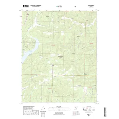
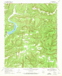 1969 Fern1971 Print · USGSCrawford and Franklin counties are shown here in the late sixties as the Ozark interior balanced rural life with forest management. Genealogists can locate family landmarks like Locke Cemetery, the settlement of Fern, and the Faith Church near the Mulberry River.3 unique versions available
 - 1978 Map of Fort Smith, 1979 Print
 1978 Fort Smith1979 Print · USGSThe Arkansas-Oklahoma borderlands in the late seventies show a landscape shaped by massive river reservoirs and sprawling military reservations. Trace the historic rail lines of the Missouri Pacific RR and locate regional landmarks like Fort Gibson, Tenkiller Ferry Lake, and Barling.2 unique versions available
 - 1978 Map of Stilwell, 1979 Print
 1978 Stilwell1979 Print · USGSThe Oklahoma-Arkansas borderlands come alive in the late seventies, showing the transition from the Cherokee Nation hills to the Arkansas Ozarks. Researchers can trace the Kansas City Southern rail line through Stilwell, find Wrights Chapel, or locate the Northeastern State College campus in Tahlequah.
 - 2011 Map of Fern, 2011 Print
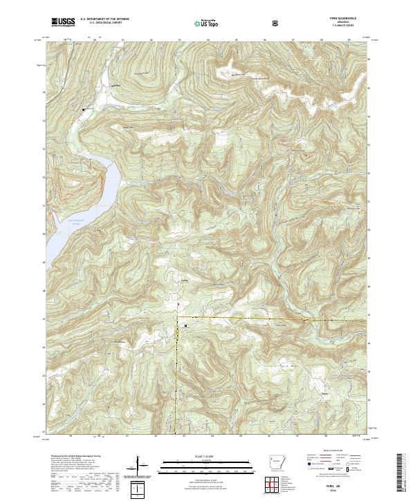
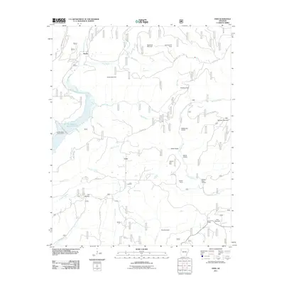 2011 Fern2011 Print · USGSCovers Winfrey, including Fern, Locke, and other nearby areas
 - 2014 Map of Fern, 2014 Print
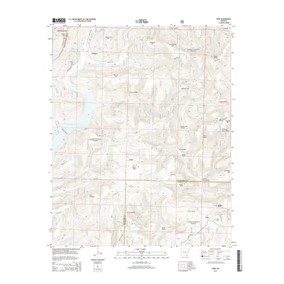 2014 Fern2014 Print · USGSCovers Winfrey, including Fern, Locke, and other nearby areas
 - 2017 Map of Fern, 2017 Print
 2017 Fern2017 Print · USGSCovers Winfrey, including Fern, Locke, and other nearby areas
 - 2020 Map of Fern, 2020 Print
 2020 Fern2020 Print · USGSCovers Winfrey, including Fern, Locke, and other nearby areas
 - 2024 Map of Fern, 2024 Print
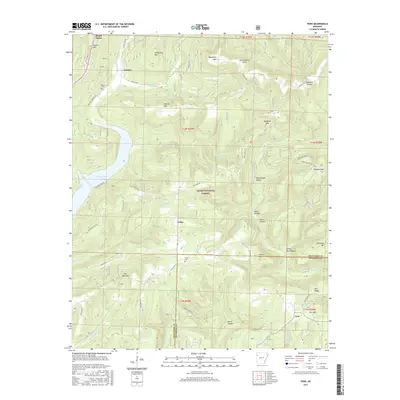
 2024 Fern2024 Print · USGSThe northern Arkansas mountains near the Crawford and Franklin County line are captured in this recent survey. Researchers can locate family sites at Locke Cem and trace the paths of Frog Bayou or the Ozark Highlands Trl.
End of results
Showing maps 1-14 of 14
Top cities near Winfrey
- Alma historical maps
- Ozark historical maps
- West Fork historical maps
- Mulberry historical maps
- Cedarville historical maps
- Dyer historical maps
See more
Frequently asked questions
- What are the different types of historical maps available for Winfrey?
- What is the oldest map of Winfrey?
- Where can I purchase historical maps of Winfrey for my home or office?
- Where can I download high-res historical maps of Winfrey?
- Are there historical topographic maps available for Winfrey?
- Is there historical aerial imagery available for Winfrey?
- Where are historical maps of Winfrey sourced from?