1970s Maps of Grassy Lake Bottom, Arkansas
Explore 2 historic maps of Grassy Lake Bottom from the 1970s. These maps offer a rare glimpse into what life looked like during the 1970s — showing old roads, neighborhoods, homes, and landmarks that have changed or disappeared over time.
Whether you're researching your family's past, planning a metal detecting trip, or studying how Grassy Lake Bottom's landscape evolved across the 1970s, these high-resolution maps are a powerful tool for exploring the history of this region.
- Focus on a specific era: All maps on this page are from the 1970s, giving you a focused view of this time period.
- See what’s changed: Compare century-old streets, trails, and buildings to today's modern landscape using overlays and satellite layers.
- Research with precision: Use these maps for genealogy, historical research, land use analysis, or educational projects.
- View, download, or print: Maps are fully viewable online in high resolution, and can be downloaded or printed for your own records.
Start exploring Grassy Lake Bottom's history through authentic maps from the 1970s. This is your window into the past.
Grassy Lake Bottom, AR maps
(2)- 1974 Map of Earle
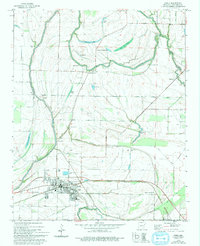 1974 Earle1974 Print · USGSCrittenden County's agricultural heartland is captured here in the mid-1970s, centered on the railroad hub of Earle. Researchers can trace family history through numerous landmarks like Dunbar High Sch, Barton Chapel, and the Gibson Bayou Church.2 unique versions available
 - 1977 Map of Deckerville
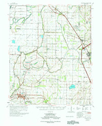 1977 Deckerville1977 Print · USGSCrittenden and Poinsett counties are shown in the mid-seventies, an era when extensive drainage ditch networks supported a thriving agricultural delta. Genealogists can trace family names through sites like New Bethlehem Cem, Philadelphia Ch, and the settlement at Shannonville.
End of results
Showing maps 1-2 of 2
Top cities near Grassy Lake Bottom
- Memphis historical maps
- West Memphis historical maps
- Marion historical maps
- Earle historical maps
- Parkin historical maps
- Tyronza historical maps
See more
Frequently asked questions
- What are the different types of historical maps available for Grassy Lake Bottom?
- What is the oldest map of Grassy Lake Bottom?
- Where can I purchase historical maps of Grassy Lake Bottom for my home or office?
- Where can I download high-res historical maps of Grassy Lake Bottom?
- Are there historical topographic maps available for Grassy Lake Bottom?
- Is there historical aerial imagery available for Grassy Lake Bottom?
- Where are historical maps of Grassy Lake Bottom sourced from?