Old Maps of Lucca Landing, Arkansas for Academic Research
Study the evolution of Lucca Landing with 13 high-resolution historic maps. Whether you're teaching, researching, or modeling changes in land use, these maps provide essential visual documentation of urban, environmental, and geographic change.
- Analyze long-term change: Track patterns in development, transportation, and natural features.
- Ideal for environmental or urban studies: Support academic projects with primary historical map data.
- Use in the classroom or lab: Educators and researchers rely on these maps to bring historical context to life.
These maps are a powerful tool for teaching, research, and visualizing how Lucca Landing has changed over the decades.
Lucca Landing, AR maps
(13)- 1933 Map of Lamont
 1933 Lamont1933 Print · USGSThe Mississippi River delta in the early 1930s is captured here just after the historic floods of the previous decade. Genealogists and historians can trace the foundations of Arkansas City, locate rural sites like Eutaw Store, and follow the tracks of the Mo Pac RR.
 - 1939 Map of Lamont, 1961 Print
 1939 Lamont1961 Print · USGSThe Mississippi Delta in the late thirties reveals a landscape in transition as engineering cut-offs reshaped the river's path. Researchers can locate vanished landings like Monterey Ldg, trace the Yazoo and Mississippi Valley rail line, and find rural centers like Morning Star Ch & Sch.3 unique versions available
 - 1953 Map of Greenwood, 1966 Print
 1953 Greenwood1966 Print · USGSThe Mississippi Delta in the mid-fifties is captured here as a thriving network of river towns, railroads, and oxbow lakes. Researchers can trace the legacy of the Illinois Central Railroad and locate landmarks like the State Penal Farm and Greenville Air Force Base.5 unique versions available
 - 1956 Map of Greenwood
 1956 Greenwood1956 Print · USGSThe Mississippi Delta in the mid-fifties is captured here during a period of significant military and agricultural activity. Researchers can trace the rail lines of the Illinois Central RR, find the Greenville Air Force Base, or locate the State Penal Farm.
 - 1972 Map of Catfish Point, 1974 Print
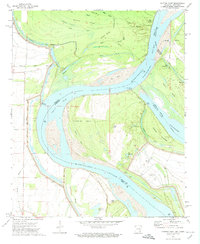 1972 Catfish Point1974 Print · USGSThe Mississippi River borderlands in the early 1970s reveal a landscape shaped by historical engineering and river navigation. Researchers can trace riverside locations like Lucca Landing and Eutaw Cem alongside the significant Caulk Cut-off.
 - 1977 Map of Lamont
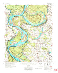 1977 Lamont1977 Print · USGSThe Mississippi Delta's shifting riverbanks and rural settlements are captured here in the late seventies. Genealogists and historians can trace community landmarks like Williams Chapel, the Nugent Center Sch, and the winding Lake Whittington oxbow.2 unique versions available
 - 1986 Map of Dumas
 1986 Dumas1986 Print · USGSSoutheast Arkansas in the mid-eighties shows a landscape defined by the winding Mississippi River and the Missouri Pacific Railroad corridor. Genealogists can trace family roots through river towns like Arkansas City and the rail-junction history of McGehee.2 unique versions available
 - 2011 Map of Catfish Point, 2011 Print
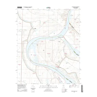
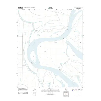 2011 Catfish Point2011 Print · USGSCovers Lucca Landing, including Eutaw, Catfish Point Landing, and other nearby areas
 - 2012 Map of Catfish Point, 2012 Print
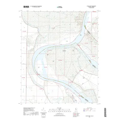
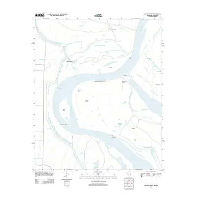 2012 Catfish Point2012 Print · USGSCovers Lucca Landing, including Eutaw, Catfish Point Landing, and other nearby areas
 - 2015 Map of Catfish Point, 2015 Print
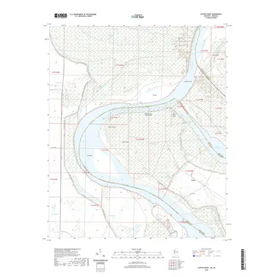
 2015 Catfish Point2015 Print · USGSCovers Lucca Landing, including Eutaw, Catfish Point Landing, and other nearby areas
 - 2018 Map of Catfish Point, 2018 Print
 2018 Catfish Point2018 Print · USGSCovers Lucca Landing, including Eutaw, Catfish Point Landing, and other nearby areas
 - 2020 Map of Catfish Point, 2020 Print
 2020 Catfish Point2020 Print · USGSCovers Lucca Landing, including Eutaw, Catfish Point Landing, and other nearby areas
 - 2024 Map of Catfish Point, 2024 Print
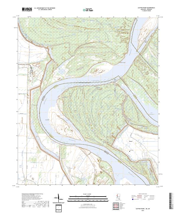 2024 Catfish Point2024 Print · USGSThe Mississippi River borderlands between Arkansas and Mississippi are captured here as they appeared in 2024. Genealogists and river historians can trace the Eutaw Cem and follow the complex water history of Lake Whittington and Caulk Cut-off.
End of results
Showing maps 1-13 of 13
Top cities near Lucca Landing
- McGehee historical maps
- Dermott historical maps
- Rosedale historical maps
- Benoit historical maps
- Arkansas City historical maps
- Watson historical maps
Frequently asked questions
- What are the different types of historical maps available for Lucca Landing?
- What is the oldest map of Lucca Landing?
- Where can I purchase historical maps of Lucca Landing for my home or office?
- Where can I download high-res historical maps of Lucca Landing?
- Are there historical topographic maps available for Lucca Landing?
- Is there historical aerial imagery available for Lucca Landing?
- Where are historical maps of Lucca Landing sourced from?